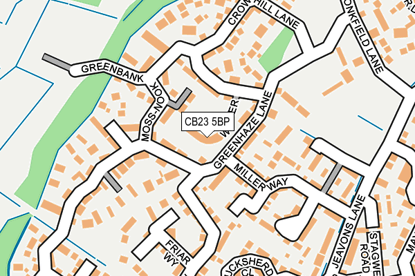
CB23 5BP lies on Foster Way in Great Cambourne, Cambridge. CB23 5BP is located in the Cambourne electoral ward, within the local authority district of South Cambridgeshire and the English Parliamentary constituency of South Cambridgeshire. The Sub Integrated Care Board (ICB) Location is NHS Cambridgeshire and Peterborough ICB - 06H and the police force is Cambridgeshire. This postcode has been in use since September 2006.


GetTheData
Source: OS OpenMap – Local (Ordnance Survey)
Source: OS VectorMap District (Ordnance Survey)
Licence: Open Government Licence (requires attribution)
| Easting | 531814 |
| Northing | 259071 |
| Latitude | 52.214095 |
| Longitude | -0.072096 |
GetTheData
Source: Open Postcode Geo
Licence: Open Government Licence
| Street | Foster Way |
| Locality | Great Cambourne |
| Town/City | Cambridge |
| Country | England |
| Postcode District | CB23 |
➜ See where CB23 is on a map ➜ Where is Cambourne? | |
GetTheData
Source: Land Registry Price Paid Data
Licence: Open Government Licence
Elevation or altitude of CB23 5BP as distance above sea level:
| Metres | Feet | |
|---|---|---|
| Elevation | 70m | 230ft |
Elevation is measured from the approximate centre of the postcode, to the nearest point on an OS contour line from OS Terrain 50, which has contour spacing of ten vertical metres.
➜ How high above sea level am I? Find the elevation of your current position using your device's GPS.
GetTheData
Source: Open Postcode Elevation
Licence: Open Government Licence
| Ward | Cambourne |
| Constituency | South Cambridgeshire |
GetTheData
Source: ONS Postcode Database
Licence: Open Government Licence
| The Tennis Courts (Monkfield Lane) | Great Cambourne | 288m |
| Monkfield Park Primary School (School Lane) | Cambourne | 355m |
| Monkfield Park Primary School (School Lane) | Cambourne | 387m |
| Oaks Wood (School Lane) | Cambourne | 412m |
| Elm Tree Close (Jeavons Lane) | Great Cambourne | 425m |
GetTheData
Source: NaPTAN
Licence: Open Government Licence
| Percentage of properties with Next Generation Access | 100.0% |
| Percentage of properties with Superfast Broadband | 100.0% |
| Percentage of properties with Ultrafast Broadband | 100.0% |
| Percentage of properties with Full Fibre Broadband | 100.0% |
Superfast Broadband is between 30Mbps and 300Mbps
Ultrafast Broadband is > 300Mbps
| Median download speed | 100.0Mbps |
| Average download speed | 111.1Mbps |
| Maximum download speed | 200.00Mbps |
Ofcom does not currently provide upload speed data for CB23 5BP. This is because there are less than four broadband connections in this postcode.
| Percentage of properties unable to receive 2Mbps | 0.0% |
| Percentage of properties unable to receive 5Mbps | 0.0% |
| Percentage of properties unable to receive 10Mbps | 0.0% |
| Percentage of properties unable to receive 30Mbps | 0.0% |
GetTheData
Source: Ofcom
Licence: Ofcom Terms of Use (requires attribution)
Estimated total energy consumption in CB23 5BP by fuel type, 2015.
| Consumption (kWh) | 234,959 |
|---|---|
| Meter count | 13 |
| Mean (kWh/meter) | 18,074 |
| Median (kWh/meter) | 16,282 |
| Consumption (kWh) | 53,684 |
|---|---|
| Meter count | 13 |
| Mean (kWh/meter) | 4,130 |
| Median (kWh/meter) | 4,169 |
GetTheData
Source: Postcode level gas estimates: 2015 (experimental)
Source: Postcode level electricity estimates: 2015 (experimental)
Licence: Open Government Licence
GetTheData
Source: ONS Postcode Database
Licence: Open Government Licence


➜ Get more ratings from the Food Standards Agency
GetTheData
Source: Food Standards Agency
Licence: FSA terms & conditions
| Last Collection | |||
|---|---|---|---|
| Location | Mon-Fri | Sat | Distance |
| Monkfield Lane | 17:00 | 10:30 | 265m |
| School Lane | 16:45 | 10:30 | 532m |
| Monks Drive | 17:30 | 11:00 | 1,314m |
GetTheData
Source: Dracos
Licence: Creative Commons Attribution-ShareAlike
The below table lists the International Territorial Level (ITL) codes (formerly Nomenclature of Territorial Units for Statistics (NUTS) codes) and Local Administrative Units (LAU) codes for CB23 5BP:
| ITL 1 Code | Name |
|---|---|
| TLH | East |
| ITL 2 Code | Name |
| TLH1 | East Anglia |
| ITL 3 Code | Name |
| TLH12 | Cambridgeshire CC |
| LAU 1 Code | Name |
| E07000012 | South Cambridgeshire |
GetTheData
Source: ONS Postcode Directory
Licence: Open Government Licence
The below table lists the Census Output Area (OA), Lower Layer Super Output Area (LSOA), and Middle Layer Super Output Area (MSOA) for CB23 5BP:
| Code | Name | |
|---|---|---|
| OA | E00170802 | |
| LSOA | E01033115 | South Cambridgeshire 020C |
| MSOA | E02006873 | South Cambridgeshire 020 |
GetTheData
Source: ONS Postcode Directory
Licence: Open Government Licence
| CB23 5JR | Moss Nook | 67m |
| CB23 5EF | Greenhaze Lane | 128m |
| CB23 5FS | Salgasson Walk | 131m |
| CB23 5FJ | Miller Way | 133m |
| CB23 5FL | Millhouse Walk | 144m |
| CB23 5AP | Crow Hill Lane | 148m |
| CB23 5JQ | Greenbank | 152m |
| CB23 5JT | Friar Way | 154m |
| CB23 5BH | Greenhaze Lane | 155m |
| CB23 5FR | The Maltings | 160m |
GetTheData
Source: Open Postcode Geo; Land Registry Price Paid Data
Licence: Open Government Licence