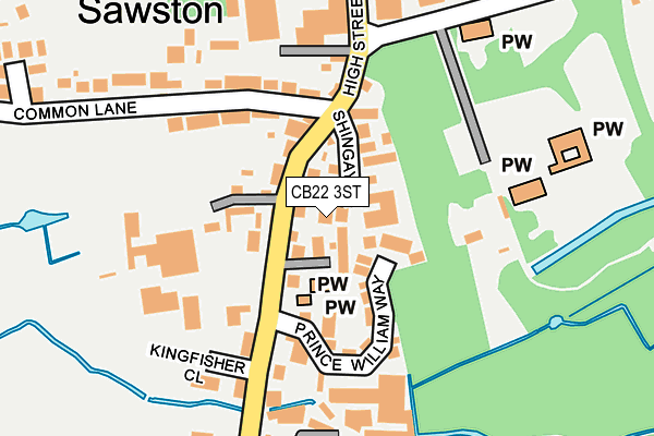
CB22 3ST lies on Burnands Place in Sawston, Cambridge. CB22 3ST is located in the Sawston electoral ward, within the local authority district of South Cambridgeshire and the English Parliamentary constituency of South Cambridgeshire. The Sub Integrated Care Board (ICB) Location is NHS Cambridgeshire and Peterborough ICB - 06H and the police force is Cambridgeshire. This postcode has been in use since September 2006.


GetTheData
Source: OS OpenMap – Local (Ordnance Survey)
Source: OS VectorMap District (Ordnance Survey)
Licence: Open Government Licence (requires attribution)
| Easting | 548623 |
| Northing | 249065 |
| Latitude | 52.119928 |
| Longitude | 0.169375 |
GetTheData
Source: Open Postcode Geo
Licence: Open Government Licence
| Street | Burnands Place |
| Locality | Sawston |
| Town/City | Cambridge |
| Country | England |
| Postcode District | CB22 |
➜ See where CB22 is on a map ➜ Where is Sawston? | |
GetTheData
Source: Land Registry Price Paid Data
Licence: Open Government Licence
Elevation or altitude of CB22 3ST as distance above sea level:
| Metres | Feet | |
|---|---|---|
| Elevation | 20m | 66ft |
Elevation is measured from the approximate centre of the postcode, to the nearest point on an OS contour line from OS Terrain 50, which has contour spacing of ten vertical metres.
➜ How high above sea level am I? Find the elevation of your current position using your device's GPS.
GetTheData
Source: Open Postcode Elevation
Licence: Open Government Licence
| Ward | Sawston |
| Constituency | South Cambridgeshire |
GetTheData
Source: ONS Postcode Database
Licence: Open Government Licence
2018 3 JAN £450,000 |
2008 30 MAY £245,000 |
1999 16 JUL £127,500 |
GetTheData
Source: HM Land Registry Price Paid Data
Licence: Contains HM Land Registry data © Crown copyright and database right 2025. This data is licensed under the Open Government Licence v3.0.
| Church Lane (High Street) | Sawston | 145m |
| Church Lane (High Street) | Sawston | 221m |
| Tannery Road (High Street) | Sawston | 278m |
| Butlers Way (Mill Lane) | Sawston | 318m |
| Tannery Road (High Street) | Sawston | 363m |
| Whittlesford Parkway Station | 1.8km |
| Shelford (Cambs) Station | 3.8km |
GetTheData
Source: NaPTAN
Licence: Open Government Licence
| Percentage of properties with Next Generation Access | 100.0% |
| Percentage of properties with Superfast Broadband | 100.0% |
| Percentage of properties with Ultrafast Broadband | 0.0% |
| Percentage of properties with Full Fibre Broadband | 0.0% |
Superfast Broadband is between 30Mbps and 300Mbps
Ultrafast Broadband is > 300Mbps
| Percentage of properties unable to receive 2Mbps | 0.0% |
| Percentage of properties unable to receive 5Mbps | 0.0% |
| Percentage of properties unable to receive 10Mbps | 0.0% |
| Percentage of properties unable to receive 30Mbps | 0.0% |
GetTheData
Source: Ofcom
Licence: Ofcom Terms of Use (requires attribution)
GetTheData
Source: ONS Postcode Database
Licence: Open Government Licence


➜ Get more ratings from the Food Standards Agency
GetTheData
Source: Food Standards Agency
Licence: FSA terms & conditions
| Last Collection | |||
|---|---|---|---|
| Location | Mon-Fri | Sat | Distance |
| Sawston Post Office | 17:00 | 11:30 | 301m |
| London Road | 16:00 | 11:00 | 326m |
| Glover Close | 16:00 | 11:00 | 346m |
GetTheData
Source: Dracos
Licence: Creative Commons Attribution-ShareAlike
The below table lists the International Territorial Level (ITL) codes (formerly Nomenclature of Territorial Units for Statistics (NUTS) codes) and Local Administrative Units (LAU) codes for CB22 3ST:
| ITL 1 Code | Name |
|---|---|
| TLH | East |
| ITL 2 Code | Name |
| TLH1 | East Anglia |
| ITL 3 Code | Name |
| TLH12 | Cambridgeshire CC |
| LAU 1 Code | Name |
| E07000012 | South Cambridgeshire |
GetTheData
Source: ONS Postcode Directory
Licence: Open Government Licence
The below table lists the Census Output Area (OA), Lower Layer Super Output Area (LSOA), and Middle Layer Super Output Area (MSOA) for CB22 3ST:
| Code | Name | |
|---|---|---|
| OA | E00092205 | |
| LSOA | E01018279 | South Cambridgeshire 015A |
| MSOA | E02003789 | South Cambridgeshire 015 |
GetTheData
Source: ONS Postcode Directory
Licence: Open Government Licence
| CB22 3SS | Shingay Lane | 36m |
| CB22 3HJ | High Street | 40m |
| CB22 3HP | Camping Close | 73m |
| CB22 3SZ | Prince William Way | 96m |
| CB22 3GT | Common Lane | 117m |
| CB22 3JQ | Kingfisher Close | 185m |
| CB22 3BE | Orchard Road | 282m |
| CB22 3HW | Common Lane | 287m |
| CB22 3UP | Glover Close | 303m |
| CB22 3LL | Hurrys Close | 330m |
GetTheData
Source: Open Postcode Geo; Land Registry Price Paid Data
Licence: Open Government Licence