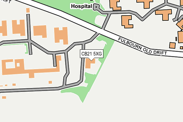
CB21 5XG is located in the Fen Ditton & Fulbourn electoral ward, within the local authority district of South Cambridgeshire and the English Parliamentary constituency of South East Cambridgeshire. The Sub Integrated Care Board (ICB) Location is NHS Cambridgeshire and Peterborough ICB - 06H and the police force is Cambridgeshire. This postcode has been in use since September 2006.


GetTheData
Source: OS OpenMap – Local (Ordnance Survey)
Source: OS VectorMap District (Ordnance Survey)
Licence: Open Government Licence (requires attribution)
| Easting | 550210 |
| Northing | 256354 |
| Latitude | 52.184983 |
| Longitude | 0.195756 |
GetTheData
Source: Open Postcode Geo
Licence: Open Government Licence
| Country | England |
| Postcode District | CB21 |
➜ See where CB21 is on a map ➜ Where is Fulbourn? | |
GetTheData
Source: Land Registry Price Paid Data
Licence: Open Government Licence
Elevation or altitude of CB21 5XG as distance above sea level:
| Metres | Feet | |
|---|---|---|
| Elevation | 20m | 66ft |
Elevation is measured from the approximate centre of the postcode, to the nearest point on an OS contour line from OS Terrain 50, which has contour spacing of ten vertical metres.
➜ How high above sea level am I? Find the elevation of your current position using your device's GPS.
GetTheData
Source: Open Postcode Elevation
Licence: Open Government Licence
| Ward | Fen Ditton & Fulbourn |
| Constituency | South East Cambridgeshire |
GetTheData
Source: ONS Postcode Database
Licence: Open Government Licence
| Rising Bollards (Fulbourn Old Drift) | Fulbourn | 114m |
| Rising Bollards (Fulbourn Old Drift) | Fulbourn | 122m |
| Victoria House (Capital Park) | Fulbourn | 260m |
| Victoria House (Capital Park) | Fulbourn | 289m |
| Ida Darwin Hospital (Fulbourn Old Drift) | Fulbourn | 345m |
| Cambridge Station | 4.1km |
| Shelford (Cambs) Station | 5.5km |
GetTheData
Source: NaPTAN
Licence: Open Government Licence
GetTheData
Source: ONS Postcode Database
Licence: Open Government Licence


➜ Get more ratings from the Food Standards Agency
GetTheData
Source: Food Standards Agency
Licence: FSA terms & conditions
| Last Collection | |||
|---|---|---|---|
| Location | Mon-Fri | Sat | Distance |
| Tamarin Gardens | 18:15 | 12:00 | 805m |
| Teasel Way | 18:15 | 12:30 | 852m |
| Eland Way | 18:00 | 12:00 | 1,033m |
GetTheData
Source: Dracos
Licence: Creative Commons Attribution-ShareAlike
The below table lists the International Territorial Level (ITL) codes (formerly Nomenclature of Territorial Units for Statistics (NUTS) codes) and Local Administrative Units (LAU) codes for CB21 5XG:
| ITL 1 Code | Name |
|---|---|
| TLH | East |
| ITL 2 Code | Name |
| TLH1 | East Anglia |
| ITL 3 Code | Name |
| TLH12 | Cambridgeshire CC |
| LAU 1 Code | Name |
| E07000012 | South Cambridgeshire |
GetTheData
Source: ONS Postcode Directory
Licence: Open Government Licence
The below table lists the Census Output Area (OA), Lower Layer Super Output Area (LSOA), and Middle Layer Super Output Area (MSOA) for CB21 5XG:
| Code | Name | |
|---|---|---|
| OA | E00092020 | |
| LSOA | E01018243 | South Cambridgeshire 011B |
| MSOA | E02003785 | South Cambridgeshire 011 |
GetTheData
Source: ONS Postcode Directory
Licence: Open Government Licence
| CB1 9LT | Fulbourn Old Drift | 470m |
| CB1 9LR | Fulbourn Old Drift | 735m |
| CB21 5AA | Roberts Way | 737m |
| CB1 9YP | Valerian Court | 782m |
| CB1 9LJ | James Nurse Close | 792m |
| CB1 9YJ | Comfrey Court | 793m |
| CB1 9YN | Clover Court | 796m |
| CB1 9YZ | Speedwell Close | 812m |
| CB21 5XN | Brunswick Court | 814m |
| CB21 5EH | Cherry Orchard | 823m |
GetTheData
Source: Open Postcode Geo; Land Registry Price Paid Data
Licence: Open Government Licence