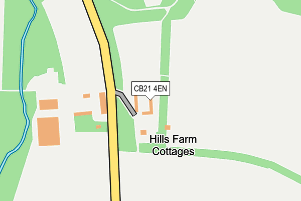
CB21 4EN is located in the Linton electoral ward, within the local authority district of South Cambridgeshire and the English Parliamentary constituency of South East Cambridgeshire. The Sub Integrated Care Board (ICB) Location is NHS Cambridgeshire and Peterborough ICB - 06H and the police force is Cambridgeshire. This postcode has been in use since September 2006.


GetTheData
Source: OS OpenMap – Local (Ordnance Survey)
Source: OS VectorMap District (Ordnance Survey)
Licence: Open Government Licence (requires attribution)
| Easting | 558623 |
| Northing | 244642 |
| Latitude | 52.077419 |
| Longitude | 0.313253 |
GetTheData
Source: Open Postcode Geo
Licence: Open Government Licence
| Country | England |
| Postcode District | CB21 |
➜ See where CB21 is on a map | |
GetTheData
Source: Land Registry Price Paid Data
Licence: Open Government Licence
Elevation or altitude of CB21 4EN as distance above sea level:
| Metres | Feet | |
|---|---|---|
| Elevation | 60m | 197ft |
Elevation is measured from the approximate centre of the postcode, to the nearest point on an OS contour line from OS Terrain 50, which has contour spacing of ten vertical metres.
➜ How high above sea level am I? Find the elevation of your current position using your device's GPS.
GetTheData
Source: Open Postcode Elevation
Licence: Open Government Licence
| Ward | Linton |
| Constituency | South East Cambridgeshire |
GetTheData
Source: ONS Postcode Database
Licence: Open Government Licence
| Station Road | Bartlow | 514m |
| Station Road | Bartlow | 526m |
| Little Barham Hall (Camps Road) | Bartlow | 661m |
| Little Barham Hall (Camps Road) | Bartlow | 669m |
GetTheData
Source: NaPTAN
Licence: Open Government Licence

➜ Get more ratings from the Food Standards Agency
GetTheData
Source: Food Standards Agency
Licence: FSA terms & conditions
| Last Collection | |||
|---|---|---|---|
| Location | Mon-Fri | Sat | Distance |
| Bartlow Village | 16:00 | 11:00 | 430m |
| Steventon End | 16:45 | 10:00 | 2,165m |
| Ashdon Post Office | 17:00 | 10:00 | 2,540m |
GetTheData
Source: Dracos
Licence: Creative Commons Attribution-ShareAlike
The below table lists the International Territorial Level (ITL) codes (formerly Nomenclature of Territorial Units for Statistics (NUTS) codes) and Local Administrative Units (LAU) codes for CB21 4EN:
| ITL 1 Code | Name |
|---|---|
| TLH | East |
| ITL 2 Code | Name |
| TLH1 | East Anglia |
| ITL 3 Code | Name |
| TLH12 | Cambridgeshire CC |
| LAU 1 Code | Name |
| E07000012 | South Cambridgeshire |
GetTheData
Source: ONS Postcode Directory
Licence: Open Government Licence
The below table lists the Census Output Area (OA), Lower Layer Super Output Area (LSOA), and Middle Layer Super Output Area (MSOA) for CB21 4EN:
| Code | Name | |
|---|---|---|
| OA | E00092125 | |
| LSOA | E01018265 | South Cambridgeshire 016F |
| MSOA | E02003790 | South Cambridgeshire 016 |
GetTheData
Source: ONS Postcode Directory
Licence: Open Government Licence
| CB21 4PW | 473m | |
| CB21 4PY | Bartlow Barns | 565m |
| CB21 4PL | Church Lane | 574m |
| CB21 4PP | Camps Road | 583m |
| CB10 2HY | Bartlow Road | 983m |
| CB10 2HU | 2020m | |
| CB10 2JQ | Camps Road | 2054m |
| CB10 2HR | Bartlow Road | 2074m |
| CB10 2JE | Steventon End | 2077m |
| CB10 2JL | Tredgets | 2171m |
GetTheData
Source: Open Postcode Geo; Land Registry Price Paid Data
Licence: Open Government Licence