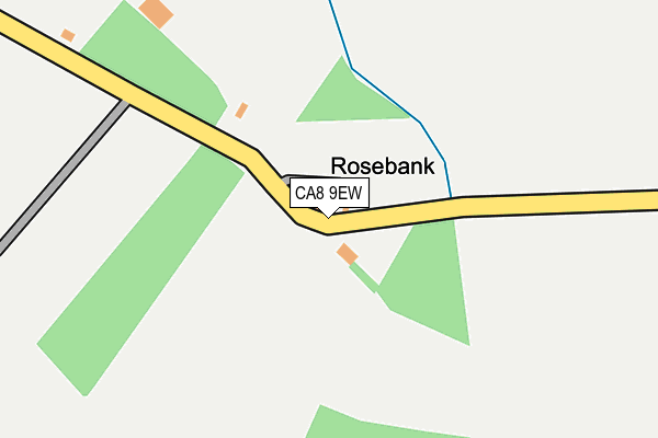
CA8 9EW lies on Rosebank in Heads Nook, Brampton. CA8 9EW is located in the Corby and Hayton electoral ward, within the unitary authority of Cumberland and the English Parliamentary constituency of Penrith and The Border. The Sub Integrated Care Board (ICB) Location is NHS North East and North Cumbria ICB - 01H and the police force is Cumbria. This postcode has been in use since June 2000.


GetTheData
Source: OS OpenMap – Local (Ordnance Survey)
Source: OS VectorMap District (Ordnance Survey)
Licence: Open Government Licence (requires attribution)
| Easting | 349896 |
| Northing | 554151 |
| Latitude | 54.879592 |
| Longitude | -2.782436 |
GetTheData
Source: Open Postcode Geo
Licence: Open Government Licence
| Street | Rosebank |
| Locality | Heads Nook |
| Town/City | Brampton |
| Country | England |
| Postcode District | CA8 |
➜ See where CA8 is on a map | |
GetTheData
Source: Land Registry Price Paid Data
Licence: Open Government Licence
Elevation or altitude of CA8 9EW as distance above sea level:
| Metres | Feet | |
|---|---|---|
| Elevation | 90m | 295ft |
Elevation is measured from the approximate centre of the postcode, to the nearest point on an OS contour line from OS Terrain 50, which has contour spacing of ten vertical metres.
➜ How high above sea level am I? Find the elevation of your current position using your device's GPS.
GetTheData
Source: Open Postcode Elevation
Licence: Open Government Licence
| Ward | Corby And Hayton |
| Constituency | Penrith And The Border |
GetTheData
Source: ONS Postcode Database
Licence: Open Government Licence
| Hall (Unnamed Road) | Heads Nook | 572m |
| Hall (Unnamed Road) | Heads Nook | 580m |
| Post Office (Unnamed Road) | Heads Nook | 1,014m |
| Institute (Unnamed Road) | Heads Nook | 1,015m |
| Centre (Warren Hill) | Faugh | 1,281m |
| Wetheral Station | 3.2km |
GetTheData
Source: NaPTAN
Licence: Open Government Licence
| Percentage of properties with Next Generation Access | 100.0% |
| Percentage of properties with Superfast Broadband | 0.0% |
| Percentage of properties with Ultrafast Broadband | 0.0% |
| Percentage of properties with Full Fibre Broadband | 0.0% |
Superfast Broadband is between 30Mbps and 300Mbps
Ultrafast Broadband is > 300Mbps
| Percentage of properties unable to receive 2Mbps | 0.0% |
| Percentage of properties unable to receive 5Mbps | 0.0% |
| Percentage of properties unable to receive 10Mbps | 0.0% |
| Percentage of properties unable to receive 30Mbps | 100.0% |
GetTheData
Source: Ofcom
Licence: Ofcom Terms of Use (requires attribution)
GetTheData
Source: ONS Postcode Database
Licence: Open Government Licence

➜ Get more ratings from the Food Standards Agency
GetTheData
Source: Food Standards Agency
Licence: FSA terms & conditions
| Last Collection | |||
|---|---|---|---|
| Location | Mon-Fri | Sat | Distance |
| Cairnbridge Road | 17:00 | 10:30 | 501m |
| Heads Nook Post Office | 17:10 | 10:45 | 1,023m |
| Faugh | 17:15 | 10:15 | 1,172m |
GetTheData
Source: Dracos
Licence: Creative Commons Attribution-ShareAlike
The below table lists the International Territorial Level (ITL) codes (formerly Nomenclature of Territorial Units for Statistics (NUTS) codes) and Local Administrative Units (LAU) codes for CA8 9EW:
| ITL 1 Code | Name |
|---|---|
| TLD | North West (England) |
| ITL 2 Code | Name |
| TLD1 | Cumbria |
| ITL 3 Code | Name |
| TLD12 | East Cumbria |
| LAU 1 Code | Name |
| E07000028 | Carlisle |
GetTheData
Source: ONS Postcode Directory
Licence: Open Government Licence
The below table lists the Census Output Area (OA), Lower Layer Super Output Area (LSOA), and Middle Layer Super Output Area (MSOA) for CA8 9EW:
| Code | Name | |
|---|---|---|
| OA | E00097142 | |
| LSOA | E01019219 | Carlisle 007A |
| MSOA | E02003993 | Carlisle 007 |
GetTheData
Source: ONS Postcode Directory
Licence: Open Government Licence
| CA8 9EH | 288m | |
| CA8 9AA | 818m | |
| CA8 9DX | 829m | |
| CA8 9AB | Glen Terrace | 906m |
| CA8 9AH | Cairn Wood | 971m |
| CA8 9AD | Cairn Terrace | 974m |
| CA8 9AE | 1100m | |
| CA8 9EA | 1148m | |
| CA8 9AN | Rose Paddock | 1184m |
| CA8 9AL | The Whins | 1202m |
GetTheData
Source: Open Postcode Geo; Land Registry Price Paid Data
Licence: Open Government Licence