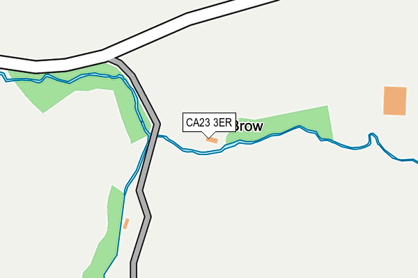
CA23 3ER is in Cleator. CA23 3ER is located in the Cleator Moor East and Frizington electoral ward, within the unitary authority of Cumberland and the English Parliamentary constituency of Copeland. The Sub Integrated Care Board (ICB) Location is NHS North East and North Cumbria ICB - 01H and the police force is Cumbria. This postcode has been in use since January 1980.


GetTheData
Source: OS OpenMap – Local (Ordnance Survey)
Source: OS VectorMap District (Ordnance Survey)
Licence: Open Government Licence (requires attribution)
| Easting | 304346 |
| Northing | 514343 |
| Latitude | 54.515327 |
| Longitude | -3.479093 |
GetTheData
Source: Open Postcode Geo
Licence: Open Government Licence
| Town/City | Cleator |
| Country | England |
| Postcode District | CA23 |
➜ See where CA23 is on a map | |
GetTheData
Source: Land Registry Price Paid Data
Licence: Open Government Licence
Elevation or altitude of CA23 3ER as distance above sea level:
| Metres | Feet | |
|---|---|---|
| Elevation | 150m | 492ft |
Elevation is measured from the approximate centre of the postcode, to the nearest point on an OS contour line from OS Terrain 50, which has contour spacing of ten vertical metres.
➜ How high above sea level am I? Find the elevation of your current position using your device's GPS.
GetTheData
Source: Open Postcode Elevation
Licence: Open Government Licence
| Ward | Cleator Moor East And Frizington |
| Constituency | Copeland |
GetTheData
Source: ONS Postcode Database
Licence: Open Government Licence
| Parkside Inn (A5086) | Wath Brow | 1,433m |
GetTheData
Source: NaPTAN
Licence: Open Government Licence
| Percentage of properties with Next Generation Access | 100.0% |
| Percentage of properties with Superfast Broadband | 0.0% |
| Percentage of properties with Ultrafast Broadband | 0.0% |
| Percentage of properties with Full Fibre Broadband | 0.0% |
Superfast Broadband is between 30Mbps and 300Mbps
Ultrafast Broadband is > 300Mbps
| Percentage of properties unable to receive 2Mbps | 0.0% |
| Percentage of properties unable to receive 5Mbps | 0.0% |
| Percentage of properties unable to receive 10Mbps | 100.0% |
| Percentage of properties unable to receive 30Mbps | 100.0% |
GetTheData
Source: Ofcom
Licence: Ofcom Terms of Use (requires attribution)
GetTheData
Source: ONS Postcode Database
Licence: Open Government Licence


➜ Get more ratings from the Food Standards Agency
GetTheData
Source: Food Standards Agency
Licence: FSA terms & conditions
| Last Collection | |||
|---|---|---|---|
| Location | Mon-Fri | Sat | Distance |
| Hazelholme | 16:30 | 12:00 | 791m |
| Parkside Terrace | 17:00 | 09:45 | 1,398m |
| Wath | 16:45 | 11:30 | 1,717m |
GetTheData
Source: Dracos
Licence: Creative Commons Attribution-ShareAlike
The below table lists the International Territorial Level (ITL) codes (formerly Nomenclature of Territorial Units for Statistics (NUTS) codes) and Local Administrative Units (LAU) codes for CA23 3ER:
| ITL 1 Code | Name |
|---|---|
| TLD | North West (England) |
| ITL 2 Code | Name |
| TLD1 | Cumbria |
| ITL 3 Code | Name |
| TLD11 | West Cumbria |
| LAU 1 Code | Name |
| E07000029 | Copeland |
GetTheData
Source: ONS Postcode Directory
Licence: Open Government Licence
The below table lists the Census Output Area (OA), Lower Layer Super Output Area (LSOA), and Middle Layer Super Output Area (MSOA) for CA23 3ER:
| Code | Name | |
|---|---|---|
| OA | E00097428 | |
| LSOA | E01019276 | Copeland 004G |
| MSOA | E02004003 | Copeland 004 |
GetTheData
Source: ONS Postcode Directory
Licence: Open Government Licence
| CA23 3ES | 329m | |
| CA23 3AF | 809m | |
| CA23 3ET | 1117m | |
| CA25 5HQ | 1211m | |
| CA23 3AQ | 1337m | |
| CA25 5HG | Parkside Road | 1348m |
| CA23 3AE | 1352m | |
| CA23 3EU | East Dent Cottages | 1410m |
| CA25 5HD | Frizington Road | 1456m |
| CA25 5HF | Parkside Road | 1458m |
GetTheData
Source: Open Postcode Geo; Land Registry Price Paid Data
Licence: Open Government Licence