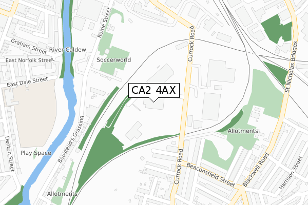
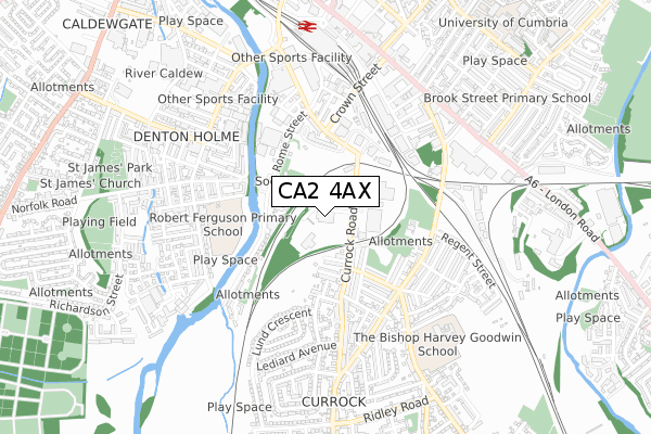
CA2 4AX lies on Currock Road in Carlisle. CA2 4AX is located in the Currock electoral ward, within the unitary authority of Cumberland and the English Parliamentary constituency of Carlisle. The Sub Integrated Care Board (ICB) Location is NHS North East and North Cumbria ICB - 01H and the police force is Cumbria. This postcode has been in use since January 1980.


GetTheData
Source: OS Open Zoomstack (Ordnance Survey)
Licence: Open Government Licence (requires attribution)
Attribution: Contains OS data © Crown copyright and database right 2025
Source: Open Postcode Geo
Licence: Open Government Licence (requires attribution)
Attribution: Contains OS data © Crown copyright and database right 2025; Contains Royal Mail data © Royal Mail copyright and database right 2025; Source: Office for National Statistics licensed under the Open Government Licence v.3.0
| Easting | 340253 |
| Northing | 554826 |
| Latitude | 54.884596 |
| Longitude | -2.932849 |
GetTheData
Source: Open Postcode Geo
Licence: Open Government Licence
| Street | Currock Road |
| Town/City | Carlisle |
| Country | England |
| Postcode District | CA2 |
➜ See where CA2 is on a map ➜ Where is Carlisle? | |
GetTheData
Source: Land Registry Price Paid Data
Licence: Open Government Licence
Elevation or altitude of CA2 4AX as distance above sea level:
| Metres | Feet | |
|---|---|---|
| Elevation | 20m | 66ft |
Elevation is measured from the approximate centre of the postcode, to the nearest point on an OS contour line from OS Terrain 50, which has contour spacing of ten vertical metres.
➜ How high above sea level am I? Find the elevation of your current position using your device's GPS.
GetTheData
Source: Open Postcode Elevation
Licence: Open Government Licence
| Ward | Currock |
| Constituency | Carlisle |
GetTheData
Source: ONS Postcode Database
Licence: Open Government Licence
| Esso Petrol Station (Currock Road) | Currock | 114m |
| Rickerbys (Currock Road) | Currock | 139m |
| Beaconsfield Street (Currock Road) | Currock | 251m |
| Beaconsfield Street (Currock Road) | Currock | 259m |
| Thirlmere Street (Alton Street) | Currock | 344m |
| Carlisle Station | 0.7km |
| Dalston (Cumbria) Station | 5.6km |
GetTheData
Source: NaPTAN
Licence: Open Government Licence
| Percentage of properties with Next Generation Access | 100.0% |
| Percentage of properties with Superfast Broadband | 100.0% |
| Percentage of properties with Ultrafast Broadband | 100.0% |
| Percentage of properties with Full Fibre Broadband | 0.0% |
Superfast Broadband is between 30Mbps and 300Mbps
Ultrafast Broadband is > 300Mbps
| Percentage of properties unable to receive 2Mbps | 0.0% |
| Percentage of properties unable to receive 5Mbps | 0.0% |
| Percentage of properties unable to receive 10Mbps | 0.0% |
| Percentage of properties unable to receive 30Mbps | 0.0% |
GetTheData
Source: Ofcom
Licence: Ofcom Terms of Use (requires attribution)
GetTheData
Source: ONS Postcode Database
Licence: Open Government Licence


➜ Get more ratings from the Food Standards Agency
GetTheData
Source: Food Standards Agency
Licence: FSA terms & conditions
| Last Collection | |||
|---|---|---|---|
| Location | Mon-Fri | Sat | Distance |
| Red Bank Terrace | 16:55 | 12:30 | 235m |
| Currock | 18:40 | 12:00 | 404m |
| Sunnyside | 16:55 | 12:00 | 408m |
GetTheData
Source: Dracos
Licence: Creative Commons Attribution-ShareAlike
The below table lists the International Territorial Level (ITL) codes (formerly Nomenclature of Territorial Units for Statistics (NUTS) codes) and Local Administrative Units (LAU) codes for CA2 4AX:
| ITL 1 Code | Name |
|---|---|
| TLD | North West (England) |
| ITL 2 Code | Name |
| TLD1 | Cumbria |
| ITL 3 Code | Name |
| TLD12 | East Cumbria |
| LAU 1 Code | Name |
| E07000028 | Carlisle |
GetTheData
Source: ONS Postcode Directory
Licence: Open Government Licence
The below table lists the Census Output Area (OA), Lower Layer Super Output Area (LSOA), and Middle Layer Super Output Area (MSOA) for CA2 4AX:
| Code | Name | |
|---|---|---|
| OA | E00097095 | |
| LSOA | E01019211 | Carlisle 010B |
| MSOA | E02003996 | Carlisle 010 |
GetTheData
Source: ONS Postcode Directory
Licence: Open Government Licence
| CA2 4AY | South Western Terrace | 186m |
| CA2 4AS | Currock Road | 206m |
| CA2 4AW | Gardenia Street | 209m |
| CA2 4BD | Red Bank Terrace | 228m |
| CA2 4BB | Currock Road | 262m |
| CA2 4BG | Red Bank Square | 274m |
| CA2 4BE | Adelphi Terrace | 293m |
| CA2 4AP | Thirlmere Street | 303m |
| CA2 4AL | Beaconsfield Street | 315m |
| CA2 4BQ | Coney Street | 331m |
GetTheData
Source: Open Postcode Geo; Land Registry Price Paid Data
Licence: Open Government Licence