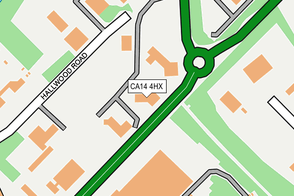
CA14 4HX is located in the Harrington electoral ward, within the unitary authority of Cumberland and the English Parliamentary constituency of Workington. The Sub Integrated Care Board (ICB) Location is NHS North East and North Cumbria ICB - 01H and the police force is Cumbria. This postcode has been in use since January 1991.


GetTheData
Source: OS OpenMap – Local (Ordnance Survey)
Source: OS VectorMap District (Ordnance Survey)
Licence: Open Government Licence (requires attribution)
| Easting | 301520 |
| Northing | 524739 |
| Latitude | 54.608179 |
| Longitude | -3.526215 |
GetTheData
Source: Open Postcode Geo
Licence: Open Government Licence
| Country | England |
| Postcode District | CA14 |
➜ See where CA14 is on a map ➜ Where is Winscales? | |
GetTheData
Source: Land Registry Price Paid Data
Licence: Open Government Licence
Elevation or altitude of CA14 4HX as distance above sea level:
| Metres | Feet | |
|---|---|---|
| Elevation | 90m | 295ft |
Elevation is measured from the approximate centre of the postcode, to the nearest point on an OS contour line from OS Terrain 50, which has contour spacing of ten vertical metres.
➜ How high above sea level am I? Find the elevation of your current position using your device's GPS.
GetTheData
Source: Open Postcode Elevation
Licence: Open Government Licence
| Ward | Harrington |
| Constituency | Workington |
GetTheData
Source: ONS Postcode Database
Licence: Open Government Licence
| Lakes College (Unnamed Road) | Lillyhall | 409m |
| County Garage (Joseph Noble Road) | Lillyhall | 486m |
| Dixons Haulage (Joseph Noble Road) | Lillyhall | 518m |
| Tollbar (A595) | Lillyhall | 593m |
| Ambulance Station (A597) | Lillyhall | 606m |
| Harrington Station | 2.6km |
| Workington Station | 4.6km |
| Parton Station | 5.5km |
GetTheData
Source: NaPTAN
Licence: Open Government Licence
GetTheData
Source: ONS Postcode Database
Licence: Open Government Licence


➜ Get more ratings from the Food Standards Agency
GetTheData
Source: Food Standards Agency
Licence: FSA terms & conditions
| Last Collection | |||
|---|---|---|---|
| Location | Mon-Fri | Sat | Distance |
| Toll Bar Distington | 16:30 | 11:30 | 648m |
| Barffs Road | 15:45 | 11:30 | 1,231m |
| Scaw Road, High Harrington | 16:30 | 11:45 | 1,324m |
GetTheData
Source: Dracos
Licence: Creative Commons Attribution-ShareAlike
The below table lists the International Territorial Level (ITL) codes (formerly Nomenclature of Territorial Units for Statistics (NUTS) codes) and Local Administrative Units (LAU) codes for CA14 4HX:
| ITL 1 Code | Name |
|---|---|
| TLD | North West (England) |
| ITL 2 Code | Name |
| TLD1 | Cumbria |
| ITL 3 Code | Name |
| TLD11 | West Cumbria |
| LAU 1 Code | Name |
| E07000026 | Allerdale |
GetTheData
Source: ONS Postcode Directory
Licence: Open Government Licence
The below table lists the Census Output Area (OA), Lower Layer Super Output Area (LSOA), and Middle Layer Super Output Area (MSOA) for CA14 4HX:
| Code | Name | |
|---|---|---|
| OA | E00096531 | |
| LSOA | E01019101 | Allerdale 011C |
| MSOA | E02003975 | Allerdale 011 |
GetTheData
Source: ONS Postcode Directory
Licence: Open Government Licence
| CA14 4NZ | Furnace Row | 541m |
| CA14 4NY | Winscales Avenue | 549m |
| CA14 4PJ | Staff Houses | 663m |
| CA14 4PB | Toll Bar Houses | 713m |
| CA14 4PD | Toll Bar | 751m |
| CA14 4JX | Hallwood Road | 763m |
| CA14 4JW | Blackwood Road | 859m |
| CA14 4LQ | Bannatyne Drive | 936m |
| CA14 4NB | Moore Way | 949m |
| CA14 4LE | Inglewood Close | 955m |
GetTheData
Source: Open Postcode Geo; Land Registry Price Paid Data
Licence: Open Government Licence