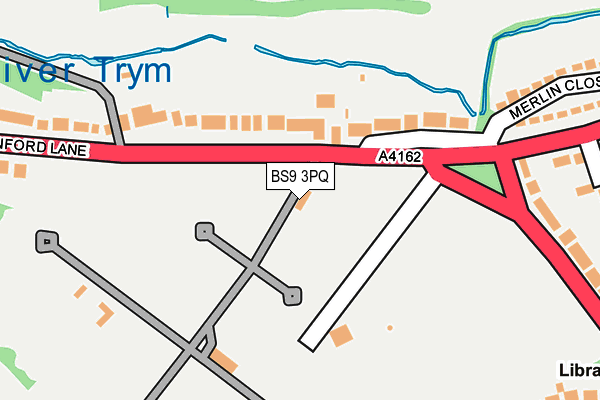
BS9 3PQ is located in the Westbury-on-Trym and Henleaze electoral ward, within the unitary authority of Bristol, City of and the English Parliamentary constituency of Bristol North West. The Sub Integrated Care Board (ICB) Location is NHS Bristol, North Somerset and South Gloucestershire ICB - 15C and the police force is Avon and Somerset. This postcode has been in use since January 1980.


GetTheData
Source: OS OpenMap – Local (Ordnance Survey)
Source: OS VectorMap District (Ordnance Survey)
Licence: Open Government Licence (requires attribution)
| Easting | 356563 |
| Northing | 177455 |
| Latitude | 51.494359 |
| Longitude | -2.627078 |
GetTheData
Source: Open Postcode Geo
Licence: Open Government Licence
| Country | England |
| Postcode District | BS9 |
➜ See where BS9 is on a map ➜ Where is Bristol? | |
GetTheData
Source: Land Registry Price Paid Data
Licence: Open Government Licence
Elevation or altitude of BS9 3PQ as distance above sea level:
| Metres | Feet | |
|---|---|---|
| Elevation | 20m | 66ft |
Elevation is measured from the approximate centre of the postcode, to the nearest point on an OS contour line from OS Terrain 50, which has contour spacing of ten vertical metres.
➜ How high above sea level am I? Find the elevation of your current position using your device's GPS.
GetTheData
Source: Open Postcode Elevation
Licence: Open Government Licence
| Ward | Westbury-on-trym And Henleaze |
| Constituency | Bristol North West |
GetTheData
Source: ONS Postcode Database
Licence: Open Government Licence
| Canford Cemetery (Canford Lane) | Westbury On Trym | 44m |
| Canford Cemetery (Canford Lane) | Westbury On Trym | 62m |
| Canford Park (Canford Lane) | Westbury On Trym | 169m |
| Sandyleaze (Canford Lane) | Westbury On Trym | 297m |
| Sandyleaze | Henbury | 410m |
| Sea Mills Station | 2.3km |
| Redland Station | 3.5km |
| Clifton Down Station | 3.5km |
GetTheData
Source: NaPTAN
Licence: Open Government Licence
GetTheData
Source: ONS Postcode Database
Licence: Open Government Licence


➜ Get more ratings from the Food Standards Agency
GetTheData
Source: Food Standards Agency
Licence: FSA terms & conditions
| Last Collection | |||
|---|---|---|---|
| Location | Mon-Fri | Sat | Distance |
| Canford Park | 16:45 | 11:00 | 77m |
| Abbey Road | 16:30 | 11:45 | 321m |
| Canford Lane | 17:00 | 12:00 | 513m |
GetTheData
Source: Dracos
Licence: Creative Commons Attribution-ShareAlike
The below table lists the International Territorial Level (ITL) codes (formerly Nomenclature of Territorial Units for Statistics (NUTS) codes) and Local Administrative Units (LAU) codes for BS9 3PQ:
| ITL 1 Code | Name |
|---|---|
| TLK | South West (England) |
| ITL 2 Code | Name |
| TLK1 | Gloucestershire, Wiltshire and Bath/Bristol area |
| ITL 3 Code | Name |
| TLK11 | Bristol, City of |
| LAU 1 Code | Name |
| E06000023 | Bristol, City of |
GetTheData
Source: ONS Postcode Directory
Licence: Open Government Licence
The below table lists the Census Output Area (OA), Lower Layer Super Output Area (LSOA), and Middle Layer Super Output Area (MSOA) for BS9 3PQ:
| Code | Name | |
|---|---|---|
| OA | E00074347 | |
| LSOA | E01014715 | Bristol 009A |
| MSOA | E02003020 | Bristol 009 |
GetTheData
Source: ONS Postcode Directory
Licence: Open Government Licence
| BS9 3PD | Canford Lane | 75m |
| BS9 3PB | Canford Lane | 153m |
| BS9 3NY | Canford Lane | 268m |
| BS9 3PF | Canford Lane | 270m |
| BS9 3NX | Canford Lane | 277m |
| BS9 3NZ | Canford Road | 285m |
| BS9 3PG | Canford Lane | 298m |
| BS9 3PA | Merlin Close | 300m |
| BS9 3QJ | Abbey Road | 312m |
| BS9 3QH | Abbey Road | 321m |
GetTheData
Source: Open Postcode Geo; Land Registry Price Paid Data
Licence: Open Government Licence