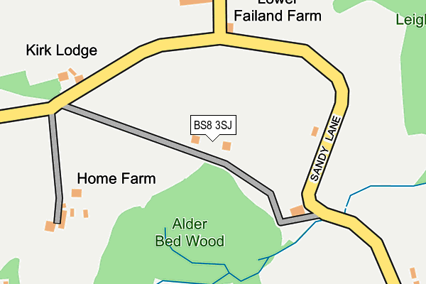
BS8 3SJ is located in the Long Ashton electoral ward, within the unitary authority of North Somerset and the English Parliamentary constituency of North Somerset. The Sub Integrated Care Board (ICB) Location is NHS Bristol, North Somerset and South Gloucestershire ICB - 15C and the police force is Avon and Somerset. This postcode has been in use since January 1980.


GetTheData
Source: OS OpenMap – Local (Ordnance Survey)
Source: OS VectorMap District (Ordnance Survey)
Licence: Open Government Licence (requires attribution)
| Easting | 352046 |
| Northing | 173514 |
| Latitude | 51.458559 |
| Longitude | -2.691604 |
GetTheData
Source: Open Postcode Geo
Licence: Open Government Licence
| Country | England |
| Postcode District | BS8 |
➜ See where BS8 is on a map | |
GetTheData
Source: Land Registry Price Paid Data
Licence: Open Government Licence
Elevation or altitude of BS8 3SJ as distance above sea level:
| Metres | Feet | |
|---|---|---|
| Elevation | 100m | 328ft |
Elevation is measured from the approximate centre of the postcode, to the nearest point on an OS contour line from OS Terrain 50, which has contour spacing of ten vertical metres.
➜ How high above sea level am I? Find the elevation of your current position using your device's GPS.
GetTheData
Source: Open Postcode Elevation
Licence: Open Government Licence
| Ward | Long Ashton |
| Constituency | North Somerset |
GetTheData
Source: ONS Postcode Database
Licence: Open Government Licence
| Martcombe Filling Station | Haberfield Hill | 1,406m |
| Martcombe Filling Station | Haberfield Hill | 1,432m |
| Blackmoor Road (Pill Road) | Abbots Leigh | 1,613m |
| Blackmore Lodge (Pill Road) | Haberfield Hill | 1,628m |
| Blackmoor Road | Abbots Leigh | 1,646m |
| Shirehampton Station | 3km |
| Sea Mills Station | 3.7km |
| Avonmouth Station | 4.7km |
GetTheData
Source: NaPTAN
Licence: Open Government Licence
| Percentage of properties with Next Generation Access | 0.0% |
| Percentage of properties with Superfast Broadband | 0.0% |
| Percentage of properties with Ultrafast Broadband | 0.0% |
| Percentage of properties with Full Fibre Broadband | 0.0% |
Superfast Broadband is between 30Mbps and 300Mbps
Ultrafast Broadband is > 300Mbps
| Percentage of properties unable to receive 2Mbps | 0.0% |
| Percentage of properties unable to receive 5Mbps | 0.0% |
| Percentage of properties unable to receive 10Mbps | 100.0% |
| Percentage of properties unable to receive 30Mbps | 100.0% |
GetTheData
Source: Ofcom
Licence: Ofcom Terms of Use (requires attribution)
GetTheData
Source: ONS Postcode Database
Licence: Open Government Licence


➜ Get more ratings from the Food Standards Agency
GetTheData
Source: Food Standards Agency
Licence: FSA terms & conditions
| Last Collection | |||
|---|---|---|---|
| Location | Mon-Fri | Sat | Distance |
| Dennyview Road | 17:00 | 10:45 | 1,783m |
| The Anchor | 17:15 | 09:00 | 2,014m |
| Eastern In Gorano | 16:30 | 09:30 | 2,062m |
GetTheData
Source: Dracos
Licence: Creative Commons Attribution-ShareAlike
The below table lists the International Territorial Level (ITL) codes (formerly Nomenclature of Territorial Units for Statistics (NUTS) codes) and Local Administrative Units (LAU) codes for BS8 3SJ:
| ITL 1 Code | Name |
|---|---|
| TLK | South West (England) |
| ITL 2 Code | Name |
| TLK1 | Gloucestershire, Wiltshire and Bath/Bristol area |
| ITL 3 Code | Name |
| TLK12 | Bath and North East Somerset, North Somerset and South Gloucestershire |
| LAU 1 Code | Name |
| E06000024 | North Somerset |
GetTheData
Source: ONS Postcode Directory
Licence: Open Government Licence
The below table lists the Census Output Area (OA), Lower Layer Super Output Area (LSOA), and Middle Layer Super Output Area (MSOA) for BS8 3SJ:
| Code | Name | |
|---|---|---|
| OA | E00075042 | |
| LSOA | E01014852 | North Somerset 006E |
| MSOA | E02003070 | North Somerset 006 |
GetTheData
Source: ONS Postcode Directory
Licence: Open Government Licence
| BS8 3SQ | Sandy Lane | 379m |
| BS8 3SL | Ox House Lane | 419m |
| BS8 3SW | Church Lane | 582m |
| BS8 3SR | Sandy Lane | 705m |
| BS8 3TT | Ox House Lane | 840m |
| BS8 3SG | Sandy Lane | 977m |
| BS8 3TR | Green Lane | 984m |
| BS8 3SP | Church Lane | 995m |
| BS20 0QS | Common Lane | 1042m |
| BS8 3ST | Failand Lane | 1165m |
GetTheData
Source: Open Postcode Geo; Land Registry Price Paid Data
Licence: Open Government Licence