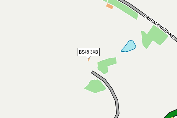
BS48 3XB is located in the Winford electoral ward, within the unitary authority of North Somerset and the English Parliamentary constituency of North Somerset. The Sub Integrated Care Board (ICB) Location is NHS Bristol, North Somerset and South Gloucestershire ICB - 15C and the police force is Avon and Somerset. This postcode has been in use since June 1998.


GetTheData
Source: OS OpenMap – Local (Ordnance Survey)
Source: OS VectorMap District (Ordnance Survey)
Licence: Open Government Licence (requires attribution)
| Easting | 351713 |
| Northing | 166661 |
| Latitude | 51.396917 |
| Longitude | -2.695457 |
GetTheData
Source: Open Postcode Geo
Licence: Open Government Licence
| Country | England |
| Postcode District | BS48 |
➜ See where BS48 is on a map | |
GetTheData
Source: Land Registry Price Paid Data
Licence: Open Government Licence
Elevation or altitude of BS48 3XB as distance above sea level:
| Metres | Feet | |
|---|---|---|
| Elevation | 180m | 591ft |
Elevation is measured from the approximate centre of the postcode, to the nearest point on an OS contour line from OS Terrain 50, which has contour spacing of ten vertical metres.
➜ How high above sea level am I? Find the elevation of your current position using your device's GPS.
GetTheData
Source: Open Postcode Elevation
Licence: Open Government Licence
| Ward | Winford |
| Constituency | North Somerset |
GetTheData
Source: ONS Postcode Database
Licence: Open Government Licence
| Currells Lane | Potters Hill | 618m |
| Currells Lane | Potters Hill | 625m |
| Airport Tavern (A38) | Lulsgate Bottom | 1,010m |
| Post Office (Upper Town Lane) | Felton | 1,140m |
| Airport Tavern | Lulsgate Bottom | 1,142m |
| Nailsea & Backwell Station | 4.6km |
GetTheData
Source: NaPTAN
Licence: Open Government Licence
GetTheData
Source: ONS Postcode Database
Licence: Open Government Licence


➜ Get more ratings from the Food Standards Agency
GetTheData
Source: Food Standards Agency
Licence: FSA terms & conditions
| Last Collection | |||
|---|---|---|---|
| Location | Mon-Fri | Sat | Distance |
| Bourton Road | 16:30 | 10:30 | 2,808m |
| Backwell Post Office | 17:30 | 12:15 | 3,657m |
| Church Lane | 16:15 | 09:30 | 3,783m |
GetTheData
Source: Dracos
Licence: Creative Commons Attribution-ShareAlike
The below table lists the International Territorial Level (ITL) codes (formerly Nomenclature of Territorial Units for Statistics (NUTS) codes) and Local Administrative Units (LAU) codes for BS48 3XB:
| ITL 1 Code | Name |
|---|---|
| TLK | South West (England) |
| ITL 2 Code | Name |
| TLK1 | Gloucestershire, Wiltshire and Bath/Bristol area |
| ITL 3 Code | Name |
| TLK12 | Bath and North East Somerset, North Somerset and South Gloucestershire |
| LAU 1 Code | Name |
| E06000024 | North Somerset |
GetTheData
Source: ONS Postcode Directory
Licence: Open Government Licence
The below table lists the Census Output Area (OA), Lower Layer Super Output Area (LSOA), and Middle Layer Super Output Area (MSOA) for BS48 3XB:
| Code | Name | |
|---|---|---|
| OA | E00074454 | |
| LSOA | E01014740 | North Somerset 011D |
| MSOA | E02003075 | North Somerset 011 |
GetTheData
Source: ONS Postcode Directory
Licence: Open Government Licence
| BS40 9XB | Potters Hill | 545m |
| BS40 9XF | Currells Lane | 639m |
| BS40 9XG | Currells Lane | 857m |
| BS40 9UG | Stanshalls Lane | 930m |
| BS40 9YD | Dial Lane | 943m |
| BS40 9UQ | Stanshalls Lane | 995m |
| BS40 9UR | Bridgwater Road | 1027m |
| BS40 9YB | Upper Town Lane | 1029m |
| BS40 9UJ | Stanshalls Close | 1030m |
| BS40 9UH | Hillview Gardens | 1076m |
GetTheData
Source: Open Postcode Geo; Land Registry Price Paid Data
Licence: Open Government Licence