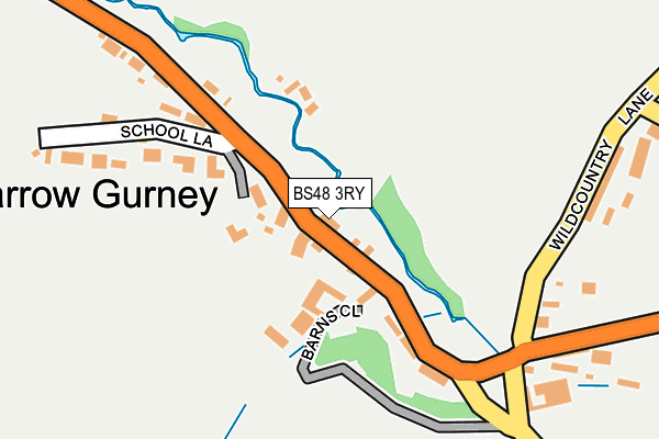
BS48 3RY lies on Barrow Street in Barrow Gurney, Bristol. BS48 3RY is located in the Winford electoral ward, within the unitary authority of North Somerset and the English Parliamentary constituency of North Somerset. The Sub Integrated Care Board (ICB) Location is NHS Bristol, North Somerset and South Gloucestershire ICB - 15C and the police force is Avon and Somerset. This postcode has been in use since December 1997.


GetTheData
Source: OS OpenMap – Local (Ordnance Survey)
Source: OS VectorMap District (Ordnance Survey)
Licence: Open Government Licence (requires attribution)
| Easting | 352993 |
| Northing | 167992 |
| Latitude | 51.408989 |
| Longitude | -2.677240 |
GetTheData
Source: Open Postcode Geo
Licence: Open Government Licence
| Street | Barrow Street |
| Locality | Barrow Gurney |
| Town/City | Bristol |
| Country | England |
| Postcode District | BS48 |
➜ See where BS48 is on a map ➜ Where is Barrow Gurney? | |
GetTheData
Source: Land Registry Price Paid Data
Licence: Open Government Licence
Elevation or altitude of BS48 3RY as distance above sea level:
| Metres | Feet | |
|---|---|---|
| Elevation | 80m | 262ft |
Elevation is measured from the approximate centre of the postcode, to the nearest point on an OS contour line from OS Terrain 50, which has contour spacing of ten vertical metres.
➜ How high above sea level am I? Find the elevation of your current position using your device's GPS.
GetTheData
Source: Open Postcode Elevation
Licence: Open Government Licence
| Ward | Winford |
| Constituency | North Somerset |
GetTheData
Source: ONS Postcode Database
Licence: Open Government Licence
| Fountain | Barrow Gurney | 736m |
| Fountain | Barrow Gurney | 763m |
| Hobbs Lane | Barrow Gurney | 902m |
| Hobbs Lane | Barrow Gurney | 971m |
| Bridgwater Road | Barrow Gurney | 977m |
| Parson Street Station | 5.5km |
GetTheData
Source: NaPTAN
Licence: Open Government Licence
| Percentage of properties with Next Generation Access | 0.0% |
| Percentage of properties with Superfast Broadband | 0.0% |
| Percentage of properties with Ultrafast Broadband | 0.0% |
| Percentage of properties with Full Fibre Broadband | 0.0% |
Superfast Broadband is between 30Mbps and 300Mbps
Ultrafast Broadband is > 300Mbps
| Median download speed | 3.3Mbps |
| Average download speed | 3.4Mbps |
| Maximum download speed | 4.34Mbps |
| Median upload speed | 0.8Mbps |
| Average upload speed | 0.7Mbps |
| Maximum upload speed | 0.96Mbps |
| Percentage of properties unable to receive 2Mbps | 100.0% |
| Percentage of properties unable to receive 5Mbps | 100.0% |
| Percentage of properties unable to receive 10Mbps | 100.0% |
| Percentage of properties unable to receive 30Mbps | 100.0% |
GetTheData
Source: Ofcom
Licence: Ofcom Terms of Use (requires attribution)
Estimated total energy consumption in BS48 3RY by fuel type, 2015.
| Consumption (kWh) | 32,165 |
|---|---|
| Meter count | 6 |
| Mean (kWh/meter) | 5,361 |
| Median (kWh/meter) | 5,692 |
GetTheData
Source: Postcode level gas estimates: 2015 (experimental)
Source: Postcode level electricity estimates: 2015 (experimental)
Licence: Open Government Licence
GetTheData
Source: ONS Postcode Database
Licence: Open Government Licence


➜ Get more ratings from the Food Standards Agency
GetTheData
Source: Food Standards Agency
Licence: FSA terms & conditions
| Last Collection | |||
|---|---|---|---|
| Location | Mon-Fri | Sat | Distance |
| Arch Grove | 17:15 | 09:00 | 2,198m |
| Long Ashton Post Office | 17:00 | 12:30 | 2,419m |
| Bourton Road | 16:30 | 10:30 | 2,511m |
GetTheData
Source: Dracos
Licence: Creative Commons Attribution-ShareAlike
The below table lists the International Territorial Level (ITL) codes (formerly Nomenclature of Territorial Units for Statistics (NUTS) codes) and Local Administrative Units (LAU) codes for BS48 3RY:
| ITL 1 Code | Name |
|---|---|
| TLK | South West (England) |
| ITL 2 Code | Name |
| TLK1 | Gloucestershire, Wiltshire and Bath/Bristol area |
| ITL 3 Code | Name |
| TLK12 | Bath and North East Somerset, North Somerset and South Gloucestershire |
| LAU 1 Code | Name |
| E06000024 | North Somerset |
GetTheData
Source: ONS Postcode Directory
Licence: Open Government Licence
The below table lists the Census Output Area (OA), Lower Layer Super Output Area (LSOA), and Middle Layer Super Output Area (MSOA) for BS48 3RY:
| Code | Name | |
|---|---|---|
| OA | E00074454 | |
| LSOA | E01014740 | North Somerset 011D |
| MSOA | E02003075 | North Somerset 011 |
GetTheData
Source: ONS Postcode Directory
Licence: Open Government Licence
| BS48 3SB | Compton Mead | 36m |
| BS48 3SA | Barrow Street | 46m |
| BS48 3RL | Barns Close | 64m |
| BS48 3RZ | School Lane | 178m |
| BS48 3RX | Hillside Cottages | 237m |
| BS48 3RU | Barrow Street | 655m |
| BS48 3SU | Hobbs Lane | 802m |
| BS48 3ST | Naish Lane | 1092m |
| BS48 3SL | Bridgwater Road | 1110m |
| BS48 3RW | Barrow Court Lane | 1179m |
GetTheData
Source: Open Postcode Geo; Land Registry Price Paid Data
Licence: Open Government Licence