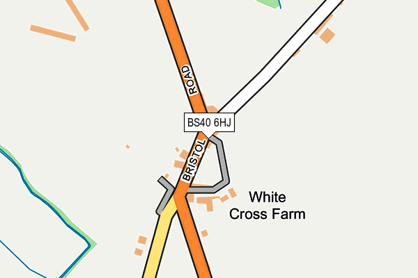
BS40 6HJ lies on Bristol Road in West Harptree, Bristol. BS40 6HJ is located in the Mendip electoral ward, within the unitary authority of Bath and North East Somerset and the English Parliamentary constituency of North East Somerset. The Sub Integrated Care Board (ICB) Location is NHS Bath and North East Somerset, Swindon and Wiltshire ICB - 92 and the police force is Avon and Somerset. This postcode has been in use since December 1997.


GetTheData
Source: OS OpenMap – Local (Ordnance Survey)
Source: OS VectorMap District (Ordnance Survey)
Licence: Open Government Licence (requires attribution)
| Easting | 355706 |
| Northing | 157677 |
| Latitude | 51.316467 |
| Longitude | -2.636945 |
GetTheData
Source: Open Postcode Geo
Licence: Open Government Licence
| Street | Bristol Road |
| Locality | West Harptree |
| Town/City | Bristol |
| Country | England |
| Postcode District | BS40 |
➜ See where BS40 is on a map | |
GetTheData
Source: Land Registry Price Paid Data
Licence: Open Government Licence
Elevation or altitude of BS40 6HJ as distance above sea level:
| Metres | Feet | |
|---|---|---|
| Elevation | 80m | 262ft |
Elevation is measured from the approximate centre of the postcode, to the nearest point on an OS contour line from OS Terrain 50, which has contour spacing of ten vertical metres.
➜ How high above sea level am I? Find the elevation of your current position using your device's GPS.
GetTheData
Source: Open Postcode Elevation
Licence: Open Government Licence
| Ward | Mendip |
| Constituency | North East Somerset |
GetTheData
Source: ONS Postcode Database
Licence: Open Government Licence
| The Crown (A368) | West Harptree | 897m |
| The Crown (A368) | West Harptree | 904m |
| Fairash Cross Roads (A368) | Ridge | 957m |
| Fairash Crossroads (A368) | Ridge | 967m |
| Compton Martin Po (A368) | Compton Martin | 1,358m |
GetTheData
Source: NaPTAN
Licence: Open Government Licence
| Percentage of properties with Next Generation Access | 100.0% |
| Percentage of properties with Superfast Broadband | 100.0% |
| Percentage of properties with Ultrafast Broadband | 0.0% |
| Percentage of properties with Full Fibre Broadband | 0.0% |
Superfast Broadband is between 30Mbps and 300Mbps
Ultrafast Broadband is > 300Mbps
| Percentage of properties unable to receive 2Mbps | 0.0% |
| Percentage of properties unable to receive 5Mbps | 0.0% |
| Percentage of properties unable to receive 10Mbps | 0.0% |
| Percentage of properties unable to receive 30Mbps | 0.0% |
GetTheData
Source: Ofcom
Licence: Ofcom Terms of Use (requires attribution)
GetTheData
Source: ONS Postcode Database
Licence: Open Government Licence


➜ Get more ratings from the Food Standards Agency
GetTheData
Source: Food Standards Agency
Licence: FSA terms & conditions
| Last Collection | |||
|---|---|---|---|
| Location | Mon-Fri | Sat | Distance |
| West Harptree Post Office | 17:00 | 11:30 | 946m |
| Newbury Hill | 17:15 | 11:15 | 1,556m |
| Bellevue | 15:30 | 08:00 | 4,776m |
GetTheData
Source: Dracos
Licence: Creative Commons Attribution-ShareAlike
The below table lists the International Territorial Level (ITL) codes (formerly Nomenclature of Territorial Units for Statistics (NUTS) codes) and Local Administrative Units (LAU) codes for BS40 6HJ:
| ITL 1 Code | Name |
|---|---|
| TLK | South West (England) |
| ITL 2 Code | Name |
| TLK1 | Gloucestershire, Wiltshire and Bath/Bristol area |
| ITL 3 Code | Name |
| TLK12 | Bath and North East Somerset, North Somerset and South Gloucestershire |
| LAU 1 Code | Name |
| E06000022 | Bath and North East Somerset |
GetTheData
Source: ONS Postcode Directory
Licence: Open Government Licence
The below table lists the Census Output Area (OA), Lower Layer Super Output Area (LSOA), and Middle Layer Super Output Area (MSOA) for BS40 6HJ:
| Code | Name | |
|---|---|---|
| OA | E00072837 | |
| LSOA | E01014418 | Bath and North East Somerset 021D |
| MSOA | E02003005 | Bath and North East Somerset 021 |
GetTheData
Source: ONS Postcode Directory
Licence: Open Government Licence
| BS40 6HL | Stratford Lane | 27m |
| BS40 6HQ | Bristol Road | 137m |
| BS40 6HG | Bristol Road | 551m |
| BS40 6NQ | Bristol Road | 560m |
| BS40 6HF | Bristol Road | 759m |
| BS40 6HS | Newton Close | 810m |
| BS40 6EB | High Street | 899m |
| BS40 6EG | Compton Martin Road | 927m |
| BS40 6HA | The Street | 934m |
| BS40 6HB | Bath Road | 942m |
GetTheData
Source: Open Postcode Geo; Land Registry Price Paid Data
Licence: Open Government Licence