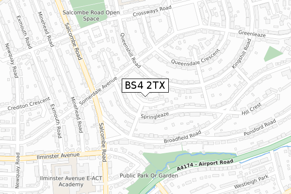
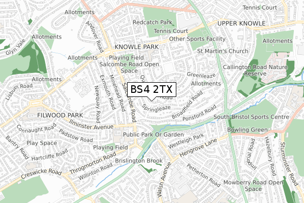
BS4 2TX lies on Dundry View in Bristol. BS4 2TX is located in the Knowle electoral ward, within the unitary authority of Bristol, City of and the English Parliamentary constituency of Bristol South. The Sub Integrated Care Board (ICB) Location is NHS Bristol, North Somerset and South Gloucestershire ICB - 15C and the police force is Avon and Somerset. This postcode has been in use since January 1980.


GetTheData
Source: OS Open Zoomstack (Ordnance Survey)
Licence: Open Government Licence (requires attribution)
Attribution: Contains OS data © Crown copyright and database right 2025
Source: Open Postcode Geo
Licence: Open Government Licence (requires attribution)
Attribution: Contains OS data © Crown copyright and database right 2025; Contains Royal Mail data © Royal Mail copyright and database right 2025; Source: Office for National Statistics licensed under the Open Government Licence v.3.0
| Easting | 360284 |
| Northing | 170091 |
| Latitude | 51.428423 |
| Longitude | -2.572652 |
GetTheData
Source: Open Postcode Geo
Licence: Open Government Licence
| Street | Dundry View |
| Town/City | Bristol |
| Country | England |
| Postcode District | BS4 |
➜ See where BS4 is on a map ➜ Where is Bristol? | |
GetTheData
Source: Land Registry Price Paid Data
Licence: Open Government Licence
Elevation or altitude of BS4 2TX as distance above sea level:
| Metres | Feet | |
|---|---|---|
| Elevation | 50m | 164ft |
Elevation is measured from the approximate centre of the postcode, to the nearest point on an OS contour line from OS Terrain 50, which has contour spacing of ten vertical metres.
➜ How high above sea level am I? Find the elevation of your current position using your device's GPS.
GetTheData
Source: Open Postcode Elevation
Licence: Open Government Licence
| Ward | Knowle |
| Constituency | Bristol South |
GetTheData
Source: ONS Postcode Database
Licence: Open Government Licence
| Salcombe Green (Salcombe Road) | Knowle | 176m |
| Salcombe Green (Salcombe Road) | Knowle | 180m |
| Teignmouth Road (Salcombe Road) | Knowle | 262m |
| Teignmouth Road (Salcombe Road) | Knowle | 300m |
| Beechmount Grove (Airport Road) | Hengrove | 364m |
| Bedminster Station | 2km |
| Bristol Temple Meads Station | 2.4km |
| Parson Street Station | 2.5km |
GetTheData
Source: NaPTAN
Licence: Open Government Licence
| Percentage of properties with Next Generation Access | 100.0% |
| Percentage of properties with Superfast Broadband | 100.0% |
| Percentage of properties with Ultrafast Broadband | 100.0% |
| Percentage of properties with Full Fibre Broadband | 100.0% |
Superfast Broadband is between 30Mbps and 300Mbps
Ultrafast Broadband is > 300Mbps
| Median download speed | 100.0Mbps |
| Average download speed | 124.1Mbps |
| Maximum download speed | 350.00Mbps |
| Median upload speed | 4.7Mbps |
| Average upload speed | 3.9Mbps |
| Maximum upload speed | 5.50Mbps |
| Percentage of properties unable to receive 2Mbps | 0.0% |
| Percentage of properties unable to receive 5Mbps | 0.0% |
| Percentage of properties unable to receive 10Mbps | 0.0% |
| Percentage of properties unable to receive 30Mbps | 0.0% |
GetTheData
Source: Ofcom
Licence: Ofcom Terms of Use (requires attribution)
Estimated total energy consumption in BS4 2TX by fuel type, 2015.
| Consumption (kWh) | 181,146 |
|---|---|
| Meter count | 18 |
| Mean (kWh/meter) | 10,064 |
| Median (kWh/meter) | 10,136 |
| Consumption (kWh) | 71,150 |
|---|---|
| Meter count | 18 |
| Mean (kWh/meter) | 3,953 |
| Median (kWh/meter) | 3,854 |
GetTheData
Source: Postcode level gas estimates: 2015 (experimental)
Source: Postcode level electricity estimates: 2015 (experimental)
Licence: Open Government Licence
GetTheData
Source: ONS Postcode Database
Licence: Open Government Licence


➜ Get more ratings from the Food Standards Agency
GetTheData
Source: Food Standards Agency
Licence: FSA terms & conditions
| Last Collection | |||
|---|---|---|---|
| Location | Mon-Fri | Sat | Distance |
| Hill Crest | 17:15 | 11:45 | 272m |
| Knowle Park Post Office | 17:15 | 12:00 | 343m |
| Broadwalk | 16:45 | 11:45 | 530m |
GetTheData
Source: Dracos
Licence: Creative Commons Attribution-ShareAlike
The below table lists the International Territorial Level (ITL) codes (formerly Nomenclature of Territorial Units for Statistics (NUTS) codes) and Local Administrative Units (LAU) codes for BS4 2TX:
| ITL 1 Code | Name |
|---|---|
| TLK | South West (England) |
| ITL 2 Code | Name |
| TLK1 | Gloucestershire, Wiltshire and Bath/Bristol area |
| ITL 3 Code | Name |
| TLK11 | Bristol, City of |
| LAU 1 Code | Name |
| E06000023 | Bristol, City of |
GetTheData
Source: ONS Postcode Directory
Licence: Open Government Licence
The below table lists the Census Output Area (OA), Lower Layer Super Output Area (LSOA), and Middle Layer Super Output Area (MSOA) for BS4 2TX:
| Code | Name | |
|---|---|---|
| OA | E00073994 | |
| LSOA | E01014646 | Bristol 042B |
| MSOA | E02003053 | Bristol 042 |
GetTheData
Source: ONS Postcode Directory
Licence: Open Government Licence
| BS4 2TY | Springleaze | 64m |
| BS4 2XL | Queenshill Road | 71m |
| BS4 2XJ | Queenshill Road | 105m |
| BS4 2TU | Springleaze | 122m |
| BS4 2XN | Somerdale Avenue | 125m |
| BS4 2TT | Springleaze | 131m |
| BS4 2UZ | Broadfield Road | 136m |
| BS4 2XH | Somerdale Avenue | 143m |
| BS4 2UU | Broadfield Road | 145m |
| BS4 2TR | Queensdale Crescent | 174m |
GetTheData
Source: Open Postcode Geo; Land Registry Price Paid Data
Licence: Open Government Licence