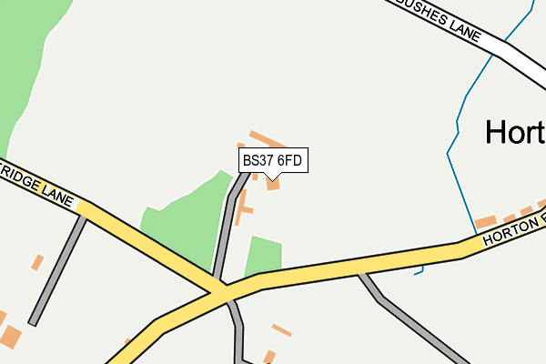
BS37 6FD is located in the Chipping Sodbury & Cotswold Edge electoral ward, within the unitary authority of South Gloucestershire and the English Parliamentary constituency of Thornbury and Yate. The Sub Integrated Care Board (ICB) Location is NHS Bristol, North Somerset and South Gloucestershire ICB - 15C and the police force is Avon and Somerset. This postcode has been in use since July 2011.


GetTheData
Source: OS OpenMap – Local (Ordnance Survey)
Source: OS VectorMap District (Ordnance Survey)
Licence: Open Government Licence (requires attribution)
| Easting | 375126 |
| Northing | 184491 |
| Latitude | 51.558746 |
| Longitude | -2.360192 |
GetTheData
Source: Open Postcode Geo
Licence: Open Government Licence
| Country | England |
| Postcode District | BS37 |
➜ See where BS37 is on a map | |
GetTheData
Source: Land Registry Price Paid Data
Licence: Open Government Licence
Elevation or altitude of BS37 6FD as distance above sea level:
| Metres | Feet | |
|---|---|---|
| Elevation | 110m | 361ft |
Elevation is measured from the approximate centre of the postcode, to the nearest point on an OS contour line from OS Terrain 50, which has contour spacing of ten vertical metres.
➜ How high above sea level am I? Find the elevation of your current position using your device's GPS.
GetTheData
Source: Open Postcode Elevation
Licence: Open Government Licence
| Ward | Chipping Sodbury & Cotswold Edge |
| Constituency | Thornbury And Yate |
GetTheData
Source: ONS Postcode Database
Licence: Open Government Licence
| Mapleridge Lane | Horton | 107m |
| Mapleridge Lane (Horton Road) | Horton | 132m |
| Totteroak Farm (Horton Road) | Horton | 454m |
| Totteroak Farm (Horton Road) | Horton | 467m |
| Social Club | Horton | 501m |
GetTheData
Source: NaPTAN
Licence: Open Government Licence
| Percentage of properties with Next Generation Access | 100.0% |
| Percentage of properties with Superfast Broadband | 80.0% |
| Percentage of properties with Ultrafast Broadband | 0.0% |
| Percentage of properties with Full Fibre Broadband | 0.0% |
Superfast Broadband is between 30Mbps and 300Mbps
Ultrafast Broadband is > 300Mbps
| Percentage of properties unable to receive 2Mbps | 0.0% |
| Percentage of properties unable to receive 5Mbps | 0.0% |
| Percentage of properties unable to receive 10Mbps | 20.0% |
| Percentage of properties unable to receive 30Mbps | 20.0% |
GetTheData
Source: Ofcom
Licence: Ofcom Terms of Use (requires attribution)
GetTheData
Source: ONS Postcode Database
Licence: Open Government Licence


➜ Get more ratings from the Food Standards Agency
GetTheData
Source: Food Standards Agency
Licence: FSA terms & conditions
| Last Collection | |||
|---|---|---|---|
| Location | Mon-Fri | Sat | Distance |
| Lower Horton | 16:30 | 09:15 | 542m |
| Little Sodbury End | 16:30 | 09:15 | 793m |
| Horton | 16:30 | 09:30 | 898m |
GetTheData
Source: Dracos
Licence: Creative Commons Attribution-ShareAlike
The below table lists the International Territorial Level (ITL) codes (formerly Nomenclature of Territorial Units for Statistics (NUTS) codes) and Local Administrative Units (LAU) codes for BS37 6FD:
| ITL 1 Code | Name |
|---|---|
| TLK | South West (England) |
| ITL 2 Code | Name |
| TLK1 | Gloucestershire, Wiltshire and Bath/Bristol area |
| ITL 3 Code | Name |
| TLK12 | Bath and North East Somerset, North Somerset and South Gloucestershire |
| LAU 1 Code | Name |
| E06000025 | South Gloucestershire |
GetTheData
Source: ONS Postcode Directory
Licence: Open Government Licence
The below table lists the Census Output Area (OA), Lower Layer Super Output Area (LSOA), and Middle Layer Super Output Area (MSOA) for BS37 6FD:
| Code | Name | |
|---|---|---|
| OA | E00075247 | |
| LSOA | E01014890 | South Gloucestershire 024E |
| MSOA | E02003113 | South Gloucestershire 024 |
GetTheData
Source: ONS Postcode Directory
Licence: Open Government Licence
| BS37 6QL | Bushes Lane | 231m |
| BS37 6QH | Horton Road | 384m |
| BS37 6QG | Totteroak Cottages | 429m |
| BS37 6PD | King Lane | 613m |
| BS37 6QE | Little Sodbury End | 772m |
| BS37 6QN | Horton Hill | 833m |
| BS37 6PE | Vinney Lane | 835m |
| BS37 6QW | 895m | |
| BS37 6QF | Little Sodbury Common | 965m |
| BS37 6PL | Common Gate | 978m |
GetTheData
Source: Open Postcode Geo; Land Registry Price Paid Data
Licence: Open Government Licence