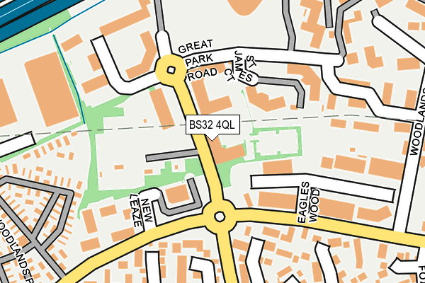
BS32 4QL is located in the Bradley Stoke North electoral ward, within the unitary authority of South Gloucestershire and the English Parliamentary constituency of Filton and Bradley Stoke. The Sub Integrated Care Board (ICB) Location is NHS Bristol, North Somerset and South Gloucestershire ICB - 15C and the police force is Avon and Somerset. This postcode has been in use since December 1997.


GetTheData
Source: OS OpenMap – Local (Ordnance Survey)
Source: OS VectorMap District (Ordnance Survey)
Licence: Open Government Licence (requires attribution)
| Easting | 361394 |
| Northing | 183339 |
| Latitude | 51.547613 |
| Longitude | -2.558142 |
GetTheData
Source: Open Postcode Geo
Licence: Open Government Licence
| Country | England |
| Postcode District | BS32 |
➜ See where BS32 is on a map ➜ Where is Bradley Stoke? | |
GetTheData
Source: Land Registry Price Paid Data
Licence: Open Government Licence
Elevation or altitude of BS32 4QL as distance above sea level:
| Metres | Feet | |
|---|---|---|
| Elevation | 70m | 230ft |
Elevation is measured from the approximate centre of the postcode, to the nearest point on an OS contour line from OS Terrain 50, which has contour spacing of ten vertical metres.
➜ How high above sea level am I? Find the elevation of your current position using your device's GPS.
GetTheData
Source: Open Postcode Elevation
Licence: Open Government Licence
| Ward | Bradley Stoke North |
| Constituency | Filton And Bradley Stoke |
GetTheData
Source: ONS Postcode Database
Licence: Open Government Licence
| Eagles Wood (Woodlands Lane) | Bradley Stoke | 179m |
| Newleaze (Woodlands Lane) | Bradley Stoke | 189m |
| Eagles Wood (Woodlands Lane) | Bradley Stoke | 208m |
| Newleaze (Woodlands Lane) | Bradley Stoke | 254m |
| Pear Tree Road | Bradley Stoke | 355m |
| Patchway Station | 2.4km |
| Bristol Parkway Station | 3.9km |
| Filton Abbey Wood Station | 4.8km |
GetTheData
Source: NaPTAN
Licence: Open Government Licence
GetTheData
Source: ONS Postcode Database
Licence: Open Government Licence


➜ Get more ratings from the Food Standards Agency
GetTheData
Source: Food Standards Agency
Licence: FSA terms & conditions
| Last Collection | |||
|---|---|---|---|
| Location | Mon-Fri | Sat | Distance |
| Beaufort Park | 18:30 | 277m | |
| Woodlands | 17:30 | 12:15 | 285m |
| Woodlands/Hawkley Drive | 17:00 | 11:30 | 477m |
GetTheData
Source: Dracos
Licence: Creative Commons Attribution-ShareAlike
The below table lists the International Territorial Level (ITL) codes (formerly Nomenclature of Territorial Units for Statistics (NUTS) codes) and Local Administrative Units (LAU) codes for BS32 4QL:
| ITL 1 Code | Name |
|---|---|
| TLK | South West (England) |
| ITL 2 Code | Name |
| TLK1 | Gloucestershire, Wiltshire and Bath/Bristol area |
| ITL 3 Code | Name |
| TLK12 | Bath and North East Somerset, North Somerset and South Gloucestershire |
| LAU 1 Code | Name |
| E06000025 | South Gloucestershire |
GetTheData
Source: ONS Postcode Directory
Licence: Open Government Licence
The below table lists the Census Output Area (OA), Lower Layer Super Output Area (LSOA), and Middle Layer Super Output Area (MSOA) for BS32 4QL:
| Code | Name | |
|---|---|---|
| OA | E00075175 | |
| LSOA | E01014879 | South Gloucestershire 009E |
| MSOA | E02003098 | South Gloucestershire 009 |
GetTheData
Source: ONS Postcode Directory
Licence: Open Government Licence
| BS32 4EU | Eagles Wood Business Park | 171m |
| BS32 0BA | Cooks Close | 226m |
| BS32 0AL | Ottrells Mead | 227m |
| BS32 4NF | Beaufort Office Park | 308m |
| BS32 0AJ | Ottrells Mead | 335m |
| BS32 0BG | Apseleys Mead | 345m |
| BS32 0BB | Cooks Close | 351m |
| BS32 4JT | Woodlands | 394m |
| BS32 0AP | The Park | 402m |
| BS32 0BS | Badgers Close | 426m |
GetTheData
Source: Open Postcode Geo; Land Registry Price Paid Data
Licence: Open Government Licence