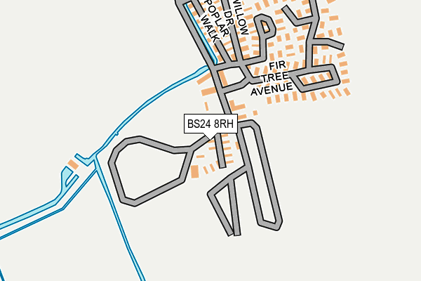
BS24 8RH is located in the Hutton & Locking electoral ward, within the unitary authority of North Somerset and the English Parliamentary constituency of Weston-Super-Mare. The Sub Integrated Care Board (ICB) Location is NHS Bristol, North Somerset and South Gloucestershire ICB - 15C and the police force is Avon and Somerset. This postcode has been in use since January 1980.


GetTheData
Source: OS OpenMap – Local (Ordnance Survey)
Source: OS VectorMap District (Ordnance Survey)
Licence: Open Government Licence (requires attribution)
| Easting | 335352 |
| Northing | 159884 |
| Latitude | 51.334357 |
| Longitude | -2.929364 |
GetTheData
Source: Open Postcode Geo
Licence: Open Government Licence
| Country | England |
| Postcode District | BS24 |
➜ See where BS24 is on a map ➜ Where is Locking? | |
GetTheData
Source: Land Registry Price Paid Data
Licence: Open Government Licence
Elevation or altitude of BS24 8RH as distance above sea level:
| Metres | Feet | |
|---|---|---|
| Elevation | 10m | 33ft |
Elevation is measured from the approximate centre of the postcode, to the nearest point on an OS contour line from OS Terrain 50, which has contour spacing of ten vertical metres.
➜ How high above sea level am I? Find the elevation of your current position using your device's GPS.
GetTheData
Source: Open Postcode Elevation
Licence: Open Government Licence
| Ward | Hutton & Locking |
| Constituency | Weston-super-mare |
GetTheData
Source: ONS Postcode Database
Licence: Open Government Licence
| Oaktree Park Homes | Locking | 97m |
| Helicopter Museum (A371) | Locking | 550m |
| Elm Tree Road (A371) | Locking | 559m |
| Elm Tree Road Garage (Elm Tree Road) | Locking | 567m |
| South Lawn (Elm Tree Road) | Locking | 568m |
| Weston Milton Station | 1.8km |
| Worle Station | 3km |
| Weston-super-Mare Station | 3.1km |
GetTheData
Source: NaPTAN
Licence: Open Government Licence
| Percentage of properties with Next Generation Access | 100.0% |
| Percentage of properties with Superfast Broadband | 100.0% |
| Percentage of properties with Ultrafast Broadband | 0.0% |
| Percentage of properties with Full Fibre Broadband | 0.0% |
Superfast Broadband is between 30Mbps and 300Mbps
Ultrafast Broadband is > 300Mbps
| Percentage of properties unable to receive 2Mbps | 0.0% |
| Percentage of properties unable to receive 5Mbps | 0.0% |
| Percentage of properties unable to receive 10Mbps | 0.0% |
| Percentage of properties unable to receive 30Mbps | 0.0% |
GetTheData
Source: Ofcom
Licence: Ofcom Terms of Use (requires attribution)
GetTheData
Source: ONS Postcode Database
Licence: Open Government Licence


➜ Get more ratings from the Food Standards Agency
GetTheData
Source: Food Standards Agency
Licence: FSA terms & conditions
| Last Collection | |||
|---|---|---|---|
| Location | Mon-Fri | Sat | Distance |
| Moorcroft Road | 17:30 | 11:30 | 841m |
| Aller Parade Post Office | 17:30 | 12:15 | 980m |
| Upper Village Hutton | 17:30 | 09:30 | 1,087m |
GetTheData
Source: Dracos
Licence: Creative Commons Attribution-ShareAlike
The below table lists the International Territorial Level (ITL) codes (formerly Nomenclature of Territorial Units for Statistics (NUTS) codes) and Local Administrative Units (LAU) codes for BS24 8RH:
| ITL 1 Code | Name |
|---|---|
| TLK | South West (England) |
| ITL 2 Code | Name |
| TLK1 | Gloucestershire, Wiltshire and Bath/Bristol area |
| ITL 3 Code | Name |
| TLK12 | Bath and North East Somerset, North Somerset and South Gloucestershire |
| LAU 1 Code | Name |
| E06000024 | North Somerset |
GetTheData
Source: ONS Postcode Directory
Licence: Open Government Licence
The below table lists the Census Output Area (OA), Lower Layer Super Output Area (LSOA), and Middle Layer Super Output Area (MSOA) for BS24 8RH:
| Code | Name | |
|---|---|---|
| OA | E00074626 | |
| LSOA | E01014770 | North Somerset 023D |
| MSOA | E02003087 | North Somerset 023 |
GetTheData
Source: ONS Postcode Directory
Licence: Open Government Licence
| BS24 8EN | Elm Grove | 482m |
| BS24 8EL | Elm Tree Road | 525m |
| BS24 8EJ | Elm Tree Road | 527m |
| BS24 8DZ | The Orchard | 578m |
| BS24 8AA | South Lawn | 596m |
| BS24 8AE | South Lawn Close | 609m |
| BS24 8DY | The Orchard Close | 625m |
| BS24 8EA | Homefield | 645m |
| BS24 8AD | South Lawn | 666m |
| BS24 8EB | Homefield Close | 667m |
GetTheData
Source: Open Postcode Geo; Land Registry Price Paid Data
Licence: Open Government Licence