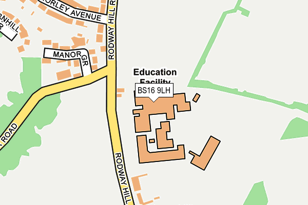
BS16 9LH is located in the Emersons Green electoral ward, within the unitary authority of South Gloucestershire and the English Parliamentary constituency of Kingswood. The Sub Integrated Care Board (ICB) Location is NHS Bristol, North Somerset and South Gloucestershire ICB - 15C and the police force is Avon and Somerset. This postcode has been in use since December 1997.


GetTheData
Source: OS OpenMap – Local (Ordnance Survey)
Source: OS VectorMap District (Ordnance Survey)
Licence: Open Government Licence (requires attribution)
| Easting | 366520 |
| Northing | 175773 |
| Latitude | 51.479915 |
| Longitude | -2.483499 |
GetTheData
Source: Open Postcode Geo
Licence: Open Government Licence
| Country | England |
| Postcode District | BS16 |
➜ See where BS16 is on a map | |
GetTheData
Source: Land Registry Price Paid Data
Licence: Open Government Licence
Elevation or altitude of BS16 9LH as distance above sea level:
| Metres | Feet | |
|---|---|---|
| Elevation | 80m | 262ft |
Elevation is measured from the approximate centre of the postcode, to the nearest point on an OS contour line from OS Terrain 50, which has contour spacing of ten vertical metres.
➜ How high above sea level am I? Find the elevation of your current position using your device's GPS.
GetTheData
Source: Open Postcode Elevation
Licence: Open Government Licence
| Ward | Emersons Green |
| Constituency | Kingswood |
GetTheData
Source: ONS Postcode Database
Licence: Open Government Licence
| Mangotsfield School (Rodway Hill) | Soundwell | 117m |
| Mangotsfield School (Rodway Hill) | Soundwell | 127m |
| The Salutation (Mangotsfield Road) | Staple Hill | 362m |
| Cossham Street | Mangotsfield | 371m |
| Cossham Street | Mangotsfield | 389m |
| Bristol Parkway Station | 5.5km |
GetTheData
Source: NaPTAN
Licence: Open Government Licence
GetTheData
Source: ONS Postcode Database
Licence: Open Government Licence


➜ Get more ratings from the Food Standards Agency
GetTheData
Source: Food Standards Agency
Licence: FSA terms & conditions
| Last Collection | |||
|---|---|---|---|
| Location | Mon-Fri | Sat | Distance |
| Mangotsfield Common | 17:15 | 12:15 | 451m |
| Mangotsfield Road | 17:45 | 12:30 | 649m |
| Mangotsfield Post Office | 17:30 | 12:00 | 667m |
GetTheData
Source: Dracos
Licence: Creative Commons Attribution-ShareAlike
The below table lists the International Territorial Level (ITL) codes (formerly Nomenclature of Territorial Units for Statistics (NUTS) codes) and Local Administrative Units (LAU) codes for BS16 9LH:
| ITL 1 Code | Name |
|---|---|
| TLK | South West (England) |
| ITL 2 Code | Name |
| TLK1 | Gloucestershire, Wiltshire and Bath/Bristol area |
| ITL 3 Code | Name |
| TLK12 | Bath and North East Somerset, North Somerset and South Gloucestershire |
| LAU 1 Code | Name |
| E06000025 | South Gloucestershire |
GetTheData
Source: ONS Postcode Directory
Licence: Open Government Licence
The below table lists the Census Output Area (OA), Lower Layer Super Output Area (LSOA), and Middle Layer Super Output Area (MSOA) for BS16 9LH:
| Code | Name | |
|---|---|---|
| OA | E00075609 | |
| LSOA | E01033338 | South Gloucestershire 019F |
| MSOA | E02003108 | South Gloucestershire 019 |
GetTheData
Source: ONS Postcode Directory
Licence: Open Government Licence
| BS16 9LQ | Rodway Hill | 158m |
| BS16 9LE | Rodway Hill Road | 168m |
| BS16 9LF | Manor Grove | 196m |
| BS16 9JD | Rodway Hill Road | 229m |
| BS16 9JE | Morley Avenue | 277m |
| BS16 9JF | Louise Avenue | 292m |
| BS16 9JA | St James Place | 309m |
| BS16 9JW | Charnhill Brow | 352m |
| BS16 9EN | Cossham Street | 355m |
| BS16 9JG | Mangotsfield Road | 368m |
GetTheData
Source: Open Postcode Geo; Land Registry Price Paid Data
Licence: Open Government Licence