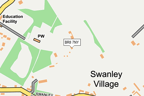
BR8 7NY is located in the Swanley Christchurch and Swanley Village electoral ward, within the local authority district of Sevenoaks and the English Parliamentary constituency of Sevenoaks. The Sub Integrated Care Board (ICB) Location is NHS Kent and Medway ICB - 91Q and the police force is Kent. This postcode has been in use since January 1980.


GetTheData
Source: OS OpenMap – Local (Ordnance Survey)
Source: OS VectorMap District (Ordnance Survey)
Licence: Open Government Licence (requires attribution)
| Easting | 553089 |
| Northing | 169776 |
| Latitude | 51.406353 |
| Longitude | 0.199674 |
GetTheData
Source: Open Postcode Geo
Licence: Open Government Licence
| Country | England |
| Postcode District | BR8 |
➜ See where BR8 is on a map ➜ Where is Swanley Village? | |
GetTheData
Source: Land Registry Price Paid Data
Licence: Open Government Licence
Elevation or altitude of BR8 7NY as distance above sea level:
| Metres | Feet | |
|---|---|---|
| Elevation | 50m | 164ft |
Elevation is measured from the approximate centre of the postcode, to the nearest point on an OS contour line from OS Terrain 50, which has contour spacing of ten vertical metres.
➜ How high above sea level am I? Find the elevation of your current position using your device's GPS.
GetTheData
Source: Open Postcode Elevation
Licence: Open Government Licence
| Ward | Swanley Christchurch And Swanley Village |
| Constituency | Sevenoaks |
GetTheData
Source: ONS Postcode Database
Licence: Open Government Licence
| Five Wents (Main Road) | Swanley | 1,051m |
| Five Wents (Swanley Lane) | Swanley | 1,163m |
| Goss Hill (Top Dartford Road) | Hextable | 1,168m |
| Goss Hill (Dartford Road) | Hextable | 1,175m |
| Rollo Road (Main Road) | Hextable | 1,188m |
| Farningham Road Station | 2.5km |
| Swanley Station | 2.6km |
| Dartford Station | 4.8km |
GetTheData
Source: NaPTAN
Licence: Open Government Licence
| Percentage of properties with Next Generation Access | 100.0% |
| Percentage of properties with Superfast Broadband | 100.0% |
| Percentage of properties with Ultrafast Broadband | 0.0% |
| Percentage of properties with Full Fibre Broadband | 0.0% |
Superfast Broadband is between 30Mbps and 300Mbps
Ultrafast Broadband is > 300Mbps
| Percentage of properties unable to receive 2Mbps | 0.0% |
| Percentage of properties unable to receive 5Mbps | 0.0% |
| Percentage of properties unable to receive 10Mbps | 0.0% |
| Percentage of properties unable to receive 30Mbps | 0.0% |
GetTheData
Source: Ofcom
Licence: Ofcom Terms of Use (requires attribution)
GetTheData
Source: ONS Postcode Database
Licence: Open Government Licence


➜ Get more ratings from the Food Standards Agency
GetTheData
Source: Food Standards Agency
Licence: FSA terms & conditions
| Last Collection | |||
|---|---|---|---|
| Location | Mon-Fri | Sat | Distance |
| Swanley Village Road (1) | 18:00 | 09:00 | 255m |
| Swanley Village Road | 18:00 | 12:00 | 509m |
| Lower Road (35) | 18:00 | 12:00 | 1,005m |
GetTheData
Source: Dracos
Licence: Creative Commons Attribution-ShareAlike
The below table lists the International Territorial Level (ITL) codes (formerly Nomenclature of Territorial Units for Statistics (NUTS) codes) and Local Administrative Units (LAU) codes for BR8 7NY:
| ITL 1 Code | Name |
|---|---|
| TLJ | South East (England) |
| ITL 2 Code | Name |
| TLJ4 | Kent |
| ITL 3 Code | Name |
| TLJ46 | West Kent |
| LAU 1 Code | Name |
| E07000111 | Sevenoaks |
GetTheData
Source: ONS Postcode Directory
Licence: Open Government Licence
The below table lists the Census Output Area (OA), Lower Layer Super Output Area (LSOA), and Middle Layer Super Output Area (MSOA) for BR8 7NY:
| Code | Name | |
|---|---|---|
| OA | E00124223 | |
| LSOA | E01024472 | Sevenoaks 001D |
| MSOA | E02005087 | Sevenoaks 001 |
GetTheData
Source: ONS Postcode Directory
Licence: Open Government Licence
| BR8 7NG | Swanley Village Road | 253m |
| BR8 7NL | Olive Villas | 254m |
| BR8 7NX | Swanley Village Road | 266m |
| BR8 7UX | Hotham Close | 301m |
| BR8 7NT | Swanley Village Road | 302m |
| BR8 7NF | Swanley Village Road | 378m |
| BR8 7WX | Hogs Orchard | 403m |
| BR8 7NP | Model Cottages | 411m |
| BR8 7WY | The Staples | 420m |
| BR8 7NU | Swanley Village Road | 424m |
GetTheData
Source: Open Postcode Geo; Land Registry Price Paid Data
Licence: Open Government Licence