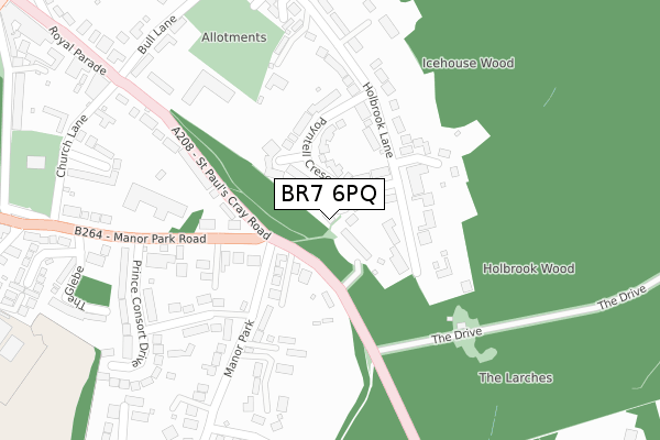
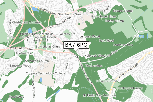
BR7 6PQ lies on Barnard Close in Chislehurst. BR7 6PQ is located in the Chislehurst electoral ward, within the London borough of Bromley and the English Parliamentary constituency of Bromley and Chislehurst. The Sub Integrated Care Board (ICB) Location is NHS South East London ICB - 72Q and the police force is Metropolitan Police. This postcode has been in use since January 1980.


GetTheData
Source: OS Open Zoomstack (Ordnance Survey)
Licence: Open Government Licence (requires attribution)
Attribution: Contains OS data © Crown copyright and database right 2025
Source: Open Postcode Geo
Licence: Open Government Licence (requires attribution)
Attribution: Contains OS data © Crown copyright and database right 2025; Contains Royal Mail data © Royal Mail copyright and database right 2025; Source: Office for National Statistics licensed under the Open Government Licence v.3.0
| Easting | 544863 |
| Northing | 169830 |
| Latitude | 51.408997 |
| Longitude | 0.081486 |
GetTheData
Source: Open Postcode Geo
Licence: Open Government Licence
| Street | Barnard Close |
| Town/City | Chislehurst |
| Country | England |
| Postcode District | BR7 |
➜ See where BR7 is on a map ➜ Where is Chislehurst? | |
GetTheData
Source: Land Registry Price Paid Data
Licence: Open Government Licence
Elevation or altitude of BR7 6PQ as distance above sea level:
| Metres | Feet | |
|---|---|---|
| Elevation | 100m | 328ft |
Elevation is measured from the approximate centre of the postcode, to the nearest point on an OS contour line from OS Terrain 50, which has contour spacing of ten vertical metres.
➜ How high above sea level am I? Find the elevation of your current position using your device's GPS.
GetTheData
Source: Open Postcode Elevation
Licence: Open Government Licence
| Ward | Chislehurst |
| Constituency | Bromley And Chislehurst |
GetTheData
Source: ONS Postcode Database
Licence: Open Government Licence
2013 25 JAN £500,000 |
3, BARNARD CLOSE, CHISLEHURST, BR7 6PQ 2005 22 JUL £465,000 |
2000 15 DEC £105,000 |
GetTheData
Source: HM Land Registry Price Paid Data
Licence: Contains HM Land Registry data © Crown copyright and database right 2025. This data is licensed under the Open Government Licence v3.0.
| Manor Park Road (St Paul's Cray Road) | Chislehurst | 59m |
| Manor Park Road (St Paul's Cray Road) | Chislehurst | 167m |
| St Pauls Cray Road Church Ln (St Paul's Cray Road) | Chislehurst | 330m |
| Bromley La Chislehurst War Memorial | Chislehurst | 525m |
| Royal Parade (Br7) (Royal Parade) | Chislehurst | 553m |
| Chislehurst Station | 1.7km |
| Petts Wood Station | 2.3km |
| St Mary Cray Station | 2.3km |
GetTheData
Source: NaPTAN
Licence: Open Government Licence
| Percentage of properties with Next Generation Access | 100.0% |
| Percentage of properties with Superfast Broadband | 100.0% |
| Percentage of properties with Ultrafast Broadband | 100.0% |
| Percentage of properties with Full Fibre Broadband | 0.0% |
Superfast Broadband is between 30Mbps and 300Mbps
Ultrafast Broadband is > 300Mbps
| Percentage of properties unable to receive 2Mbps | 0.0% |
| Percentage of properties unable to receive 5Mbps | 0.0% |
| Percentage of properties unable to receive 10Mbps | 0.0% |
| Percentage of properties unable to receive 30Mbps | 0.0% |
GetTheData
Source: Ofcom
Licence: Ofcom Terms of Use (requires attribution)
GetTheData
Source: ONS Postcode Database
Licence: Open Government Licence


➜ Get more ratings from the Food Standards Agency
GetTheData
Source: Food Standards Agency
Licence: FSA terms & conditions
| Last Collection | |||
|---|---|---|---|
| Location | Mon-Fri | Sat | Distance |
| Holbrook Lane (43) | 18:30 | 12:00 | 576m |
| Top St.pauls Wood Hill (183) | 17:45 | 12:00 | 930m |
| Fairmead (4) | 18:15 | 12:00 | 940m |
GetTheData
Source: Dracos
Licence: Creative Commons Attribution-ShareAlike
The below table lists the International Territorial Level (ITL) codes (formerly Nomenclature of Territorial Units for Statistics (NUTS) codes) and Local Administrative Units (LAU) codes for BR7 6PQ:
| ITL 1 Code | Name |
|---|---|
| TLI | London |
| ITL 2 Code | Name |
| TLI6 | Outer London - South |
| ITL 3 Code | Name |
| TLI61 | Bromley |
| LAU 1 Code | Name |
| E09000006 | Bromley |
GetTheData
Source: ONS Postcode Directory
Licence: Open Government Licence
The below table lists the Census Output Area (OA), Lower Layer Super Output Area (LSOA), and Middle Layer Super Output Area (MSOA) for BR7 6PQ:
| Code | Name | |
|---|---|---|
| OA | E00003339 | |
| LSOA | E01000693 | Bromley 010A |
| MSOA | E02000136 | Bromley 010 |
GetTheData
Source: ONS Postcode Directory
Licence: Open Government Licence
| BR7 6QE | St Pauls Cray Road | 53m |
| BR7 6PJ | Poyntell Crescent | 88m |
| BR7 6QQ | St Pauls Cray Road | 93m |
| BR7 6PG | Stainmore Close | 125m |
| BR7 6PF | Holbrook Lane | 157m |
| BR7 5QB | Manor Park Road | 172m |
| BR7 6QA | St Pauls Cray Road | 179m |
| BR7 6SA | Cardinal Close | 183m |
| BR7 5PY | Manor Park Road | 255m |
| BR7 6PE | Holbrook Lane | 270m |
GetTheData
Source: Open Postcode Geo; Land Registry Price Paid Data
Licence: Open Government Licence