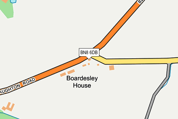
BN8 6DB is in Laughton, Lewes. BN8 6DB is located in the Arlington electoral ward, within the local authority district of Wealden and the English Parliamentary constituency of Wealden. The Sub Integrated Care Board (ICB) Location is NHS Sussex ICB - 97R and the police force is Sussex. This postcode has been in use since January 1980.


GetTheData
Source: OS OpenMap – Local (Ordnance Survey)
Source: OS VectorMap District (Ordnance Survey)
Licence: Open Government Licence (requires attribution)
| Easting | 548275 |
| Northing | 112822 |
| Latitude | 50.895850 |
| Longitude | 0.107042 |
GetTheData
Source: Open Postcode Geo
Licence: Open Government Licence
| Locality | Laughton |
| Town/City | Lewes |
| Country | England |
| Postcode District | BN8 |
➜ See where BN8 is on a map | |
GetTheData
Source: Land Registry Price Paid Data
Licence: Open Government Licence
Elevation or altitude of BN8 6DB as distance above sea level:
| Metres | Feet | |
|---|---|---|
| Elevation | 10m | 33ft |
Elevation is measured from the approximate centre of the postcode, to the nearest point on an OS contour line from OS Terrain 50, which has contour spacing of ten vertical metres.
➜ How high above sea level am I? Find the elevation of your current position using your device's GPS.
GetTheData
Source: Open Postcode Elevation
Licence: Open Government Licence
| Ward | Arlington |
| Constituency | Wealden |
GetTheData
Source: ONS Postcode Database
Licence: Open Government Licence
| Harvey's Lane (The Broyle) | Shortgate | 1,350m |
| Harvey's Lane (The Broyle) | Shortgate | 1,359m |
| Raystede Animal Centre (The Broyle) | Shortgate | 1,431m |
| Raystede Animal Centre (The Broyle) | Shortgate | 1,445m |
| Raystede Animal Centre (Raystede Centre Grounds) | Shortgate | 1,489m |
| Glynde Station | 4.8km |
GetTheData
Source: NaPTAN
Licence: Open Government Licence
| Percentage of properties with Next Generation Access | 100.0% |
| Percentage of properties with Superfast Broadband | 0.0% |
| Percentage of properties with Ultrafast Broadband | 0.0% |
| Percentage of properties with Full Fibre Broadband | 0.0% |
Superfast Broadband is between 30Mbps and 300Mbps
Ultrafast Broadband is > 300Mbps
| Median download speed | 5.8Mbps |
| Average download speed | 5.9Mbps |
| Maximum download speed | 11.40Mbps |
| Median upload speed | 1.0Mbps |
| Average upload speed | 0.9Mbps |
| Maximum upload speed | 1.30Mbps |
| Percentage of properties unable to receive 2Mbps | 0.0% |
| Percentage of properties unable to receive 5Mbps | 0.0% |
| Percentage of properties unable to receive 10Mbps | 0.0% |
| Percentage of properties unable to receive 30Mbps | 100.0% |
GetTheData
Source: Ofcom
Licence: Ofcom Terms of Use (requires attribution)
GetTheData
Source: ONS Postcode Database
Licence: Open Government Licence


➜ Get more ratings from the Food Standards Agency
GetTheData
Source: Food Standards Agency
Licence: FSA terms & conditions
| Last Collection | |||
|---|---|---|---|
| Location | Mon-Fri | Sat | Distance |
| Laughton Place | 16:00 | 10:00 | 65m |
| Laughton Lodge | 16:00 | 10:00 | 1,287m |
| Broyle | 16:15 | 09:45 | 1,335m |
GetTheData
Source: Dracos
Licence: Creative Commons Attribution-ShareAlike
The below table lists the International Territorial Level (ITL) codes (formerly Nomenclature of Territorial Units for Statistics (NUTS) codes) and Local Administrative Units (LAU) codes for BN8 6DB:
| ITL 1 Code | Name |
|---|---|
| TLJ | South East (England) |
| ITL 2 Code | Name |
| TLJ2 | Surrey, East and West Sussex |
| ITL 3 Code | Name |
| TLJ22 | East Sussex CC |
| LAU 1 Code | Name |
| E07000065 | Wealden |
GetTheData
Source: ONS Postcode Directory
Licence: Open Government Licence
The below table lists the Census Output Area (OA), Lower Layer Super Output Area (LSOA), and Middle Layer Super Output Area (MSOA) for BN8 6DB:
| Code | Name | |
|---|---|---|
| OA | E00107429 | |
| LSOA | E01021148 | Wealden 013C |
| MSOA | E02004415 | Wealden 013 |
GetTheData
Source: ONS Postcode Directory
Licence: Open Government Licence
| BN8 6DU | Cow Lane | 34m |
| BN8 6DJ | Decoy Cottages | 361m |
| BN8 6DA | Laughton Place | 973m |
| BN8 5UT | Laughton Road | 1150m |
| BN8 6BY | 1304m | |
| BN8 5AL | The Broyle | 1316m |
| BN8 6BJ | Lewes Road | 1340m |
| BN8 5AH | The Broyle | 1375m |
| BN8 5NJ | Laughton Road | 1493m |
| BN8 5AJ | The Broyle | 1505m |
GetTheData
Source: Open Postcode Geo; Land Registry Price Paid Data
Licence: Open Government Licence