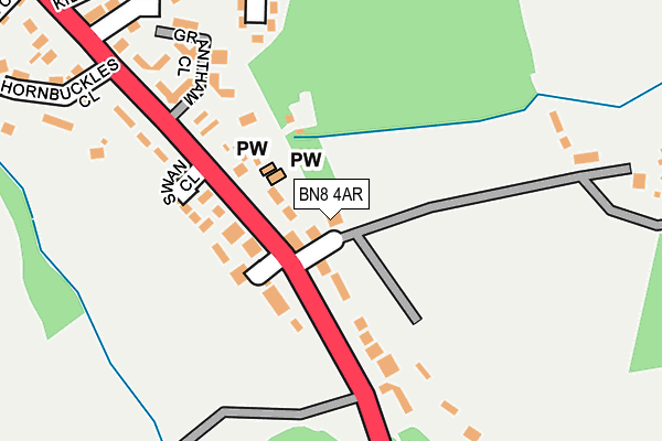
BN8 4AR is located in the Chailey, Barcombe & Hamsey electoral ward, within the local authority district of Lewes and the English Parliamentary constituency of Lewes. The Sub Integrated Care Board (ICB) Location is NHS Sussex ICB - 97R and the police force is Sussex. This postcode has been in use since January 1980.


GetTheData
Source: OS OpenMap – Local (Ordnance Survey)
Source: OS VectorMap District (Ordnance Survey)
Licence: Open Government Licence (requires attribution)
| Easting | 539329 |
| Northing | 117125 |
| Latitude | 50.936742 |
| Longitude | -0.018414 |
GetTheData
Source: Open Postcode Geo
Licence: Open Government Licence
| Country | England |
| Postcode District | BN8 |
➜ See where BN8 is on a map ➜ Where is South Chailey? | |
GetTheData
Source: Land Registry Price Paid Data
Licence: Open Government Licence
Elevation or altitude of BN8 4AR as distance above sea level:
| Metres | Feet | |
|---|---|---|
| Elevation | 30m | 98ft |
Elevation is measured from the approximate centre of the postcode, to the nearest point on an OS contour line from OS Terrain 50, which has contour spacing of ten vertical metres.
➜ How high above sea level am I? Find the elevation of your current position using your device's GPS.
GetTheData
Source: Open Postcode Elevation
Licence: Open Government Licence
| Ward | Chailey, Barcombe & Hamsey |
| Constituency | Lewes |
GetTheData
Source: ONS Postcode Database
Licence: Open Government Licence
| The Swan (A275) | South Chailey | 62m |
| The Swan (A275) | South Chailey | 64m |
| Mill Lane (Lewes Road) | South Chailey | 466m |
| Mill Lane (Lewes Road) | South Chailey | 543m |
| County Secondary School (Mill Lane) | South Chailey | 772m |
| Plumpton Station | 3.1km |
| Cooksbridge Station | 3.7km |
GetTheData
Source: NaPTAN
Licence: Open Government Licence
| Percentage of properties with Next Generation Access | 100.0% |
| Percentage of properties with Superfast Broadband | 100.0% |
| Percentage of properties with Ultrafast Broadband | 0.0% |
| Percentage of properties with Full Fibre Broadband | 0.0% |
Superfast Broadband is between 30Mbps and 300Mbps
Ultrafast Broadband is > 300Mbps
| Percentage of properties unable to receive 2Mbps | 0.0% |
| Percentage of properties unable to receive 5Mbps | 0.0% |
| Percentage of properties unable to receive 10Mbps | 0.0% |
| Percentage of properties unable to receive 30Mbps | 0.0% |
GetTheData
Source: Ofcom
Licence: Ofcom Terms of Use (requires attribution)
GetTheData
Source: ONS Postcode Database
Licence: Open Government Licence


➜ Get more ratings from the Food Standards Agency
GetTheData
Source: Food Standards Agency
Licence: FSA terms & conditions
| Last Collection | |||
|---|---|---|---|
| Location | Mon-Fri | Sat | Distance |
| Mill Lane | 16:30 | 11:00 | 932m |
| Marshstakes Lane | 15:00 | 09:15 | 1,790m |
| East Chiltington | 16:00 | 09:15 | 1,974m |
GetTheData
Source: Dracos
Licence: Creative Commons Attribution-ShareAlike
The below table lists the International Territorial Level (ITL) codes (formerly Nomenclature of Territorial Units for Statistics (NUTS) codes) and Local Administrative Units (LAU) codes for BN8 4AR:
| ITL 1 Code | Name |
|---|---|
| TLJ | South East (England) |
| ITL 2 Code | Name |
| TLJ2 | Surrey, East and West Sussex |
| ITL 3 Code | Name |
| TLJ22 | East Sussex CC |
| LAU 1 Code | Name |
| E07000063 | Lewes |
GetTheData
Source: ONS Postcode Directory
Licence: Open Government Licence
The below table lists the Census Output Area (OA), Lower Layer Super Output Area (LSOA), and Middle Layer Super Output Area (MSOA) for BN8 4AR:
| Code | Name | |
|---|---|---|
| OA | E00106775 | |
| LSOA | E01021024 | Lewes 001B |
| MSOA | E02004379 | Lewes 001 |
GetTheData
Source: ONS Postcode Directory
Licence: Open Government Licence
| BN8 4AN | 59m | |
| BN8 4BN | Swan Court | 77m |
| BN8 4AQ | Swan Close | 134m |
| BN8 4AT | 138m | |
| BN8 4AJ | 189m | |
| BN8 4AU | Kilnwood Lane | 266m |
| BN8 4AH | Hornbuckles Close | 280m |
| BN8 4AF | Appledene Corner | 280m |
| BN8 4AP | 328m | |
| BN8 4AE | Whitegates Close | 377m |
GetTheData
Source: Open Postcode Geo; Land Registry Price Paid Data
Licence: Open Government Licence