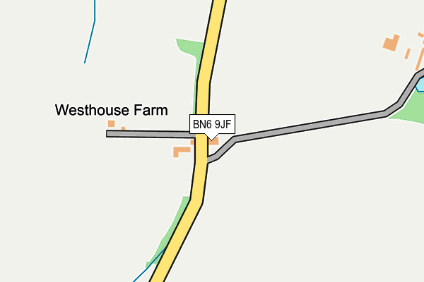
BN6 9JF lies on Twineham Lane in Sayers Common, Hassocks. BN6 9JF is located in the Downland Villages electoral ward, within the local authority district of Mid Sussex and the English Parliamentary constituency of Arundel and South Downs. The Sub Integrated Care Board (ICB) Location is NHS Sussex ICB - 70F and the police force is Sussex. This postcode has been in use since January 1980.


GetTheData
Source: OS OpenMap – Local (Ordnance Survey)
Source: OS VectorMap District (Ordnance Survey)
Licence: Open Government Licence (requires attribution)
| Easting | 525728 |
| Northing | 118811 |
| Latitude | 50.955019 |
| Longitude | -0.211295 |
GetTheData
Source: Open Postcode Geo
Licence: Open Government Licence
| Street | Twineham Lane |
| Locality | Sayers Common |
| Town/City | Hassocks |
| Country | England |
| Postcode District | BN6 |
➜ See where BN6 is on a map | |
GetTheData
Source: Land Registry Price Paid Data
Licence: Open Government Licence
Elevation or altitude of BN6 9JF as distance above sea level:
| Metres | Feet | |
|---|---|---|
| Elevation | 20m | 66ft |
Elevation is measured from the approximate centre of the postcode, to the nearest point on an OS contour line from OS Terrain 50, which has contour spacing of ten vertical metres.
➜ How high above sea level am I? Find the elevation of your current position using your device's GPS.
GetTheData
Source: Open Postcode Elevation
Licence: Open Government Licence
| Ward | Downland Villages |
| Constituency | Arundel And South Downs |
GetTheData
Source: ONS Postcode Database
Licence: Open Government Licence
| School (B2118) | Sayers Common | 1,078m |
| School (B2118) | Sayers Common | 1,108m |
| Show Jumping Course (A23 Slip Road) | Sayers Common | 1,241m |
| Furzeland Way (B2118) | Sayers Common | 1,257m |
| Coombe Wood (London Road B2118) | Sayers Common | 1,406m |
| Hassocks Station | 5.7km |
GetTheData
Source: NaPTAN
Licence: Open Government Licence
| Percentage of properties with Next Generation Access | 100.0% |
| Percentage of properties with Superfast Broadband | 0.0% |
| Percentage of properties with Ultrafast Broadband | 0.0% |
| Percentage of properties with Full Fibre Broadband | 0.0% |
Superfast Broadband is between 30Mbps and 300Mbps
Ultrafast Broadband is > 300Mbps
| Median download speed | 2.8Mbps |
| Average download speed | 4.1Mbps |
| Maximum download speed | 12.79Mbps |
| Median upload speed | 0.4Mbps |
| Average upload speed | 0.5Mbps |
| Maximum upload speed | 0.78Mbps |
| Percentage of properties unable to receive 2Mbps | 0.0% |
| Percentage of properties unable to receive 5Mbps | 60.0% |
| Percentage of properties unable to receive 10Mbps | 60.0% |
| Percentage of properties unable to receive 30Mbps | 100.0% |
GetTheData
Source: Ofcom
Licence: Ofcom Terms of Use (requires attribution)
GetTheData
Source: ONS Postcode Database
Licence: Open Government Licence


➜ Get more ratings from the Food Standards Agency
GetTheData
Source: Food Standards Agency
Licence: FSA terms & conditions
| Last Collection | |||
|---|---|---|---|
| Location | Mon-Fri | Sat | Distance |
| Weald Close | 17:45 | 07:45 | 2,847m |
| Goddards Green | 16:00 | 07:30 | 3,024m |
| Cuckfield Road | 17:45 | 08:45 | 3,059m |
GetTheData
Source: Dracos
Licence: Creative Commons Attribution-ShareAlike
The below table lists the International Territorial Level (ITL) codes (formerly Nomenclature of Territorial Units for Statistics (NUTS) codes) and Local Administrative Units (LAU) codes for BN6 9JF:
| ITL 1 Code | Name |
|---|---|
| TLJ | South East (England) |
| ITL 2 Code | Name |
| TLJ2 | Surrey, East and West Sussex |
| ITL 3 Code | Name |
| TLJ28 | West Sussex (North East) |
| LAU 1 Code | Name |
| E07000228 | Mid Sussex |
GetTheData
Source: ONS Postcode Directory
Licence: Open Government Licence
The below table lists the Census Output Area (OA), Lower Layer Super Output Area (LSOA), and Middle Layer Super Output Area (MSOA) for BN6 9JF:
| Code | Name | |
|---|---|---|
| OA | E00161984 | |
| LSOA | E01031771 | Mid Sussex 016E |
| MSOA | E02006619 | Mid Sussex 016 |
GetTheData
Source: ONS Postcode Directory
Licence: Open Government Licence
| BN6 9JQ | Reeds Lane | 678m |
| BN6 9JP | Twineham Lane | 906m |
| BN6 9JG | Reeds Lane | 976m |
| RH17 5NP | Twineham Lane | 978m |
| BN6 9GB | Meadow View | 1013m |
| BN6 9SL | Dunlop Close | 1050m |
| RH17 5NR | Church Lane | 1054m |
| BN6 9HT | London Road | 1064m |
| BN6 9JR | Osborn Close | 1071m |
| BN6 9GE | The Nook | 1102m |
GetTheData
Source: Open Postcode Geo; Land Registry Price Paid Data
Licence: Open Government Licence