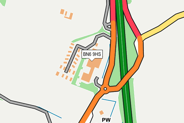
BN6 9HS is located in the Downland Villages electoral ward, within the local authority district of Mid Sussex and the English Parliamentary constituency of Arundel and South Downs. The Sub Integrated Care Board (ICB) Location is NHS Sussex ICB - 70F and the police force is Sussex. This postcode has been in use since June 2000.


GetTheData
Source: OS OpenMap – Local (Ordnance Survey)
Source: OS VectorMap District (Ordnance Survey)
Licence: Open Government Licence (requires attribution)
| Easting | 526889 |
| Northing | 118843 |
| Latitude | 50.955057 |
| Longitude | -0.194790 |
GetTheData
Source: Open Postcode Geo
Licence: Open Government Licence
| Country | England |
| Postcode District | BN6 |
➜ See where BN6 is on a map ➜ Where is Sayers Common? | |
GetTheData
Source: Land Registry Price Paid Data
Licence: Open Government Licence
Elevation or altitude of BN6 9HS as distance above sea level:
| Metres | Feet | |
|---|---|---|
| Elevation | 20m | 66ft |
Elevation is measured from the approximate centre of the postcode, to the nearest point on an OS contour line from OS Terrain 50, which has contour spacing of ten vertical metres.
➜ How high above sea level am I? Find the elevation of your current position using your device's GPS.
GetTheData
Source: Open Postcode Elevation
Licence: Open Government Licence
| Ward | Downland Villages |
| Constituency | Arundel And South Downs |
GetTheData
Source: ONS Postcode Database
Licence: Open Government Licence
| Show Jumping Course (A23 Slip Road) | Sayers Common | 211m |
| School (B2118) | Sayers Common | 315m |
| School (B2118) | Sayers Common | 437m |
| Show Jumping Course (A23) | Hickstead | 676m |
| Furzeland Way (B2118) | Sayers Common | 919m |
| Burgess Hill Station | 4.7km |
| Hassocks Station | 4.8km |
GetTheData
Source: NaPTAN
Licence: Open Government Licence
GetTheData
Source: ONS Postcode Database
Licence: Open Government Licence


➜ Get more ratings from the Food Standards Agency
GetTheData
Source: Food Standards Agency
Licence: FSA terms & conditions
| Last Collection | |||
|---|---|---|---|
| Location | Mon-Fri | Sat | Distance |
| Goddards Green | 16:00 | 07:30 | 2,021m |
| Weald Close | 17:45 | 07:45 | 2,174m |
| Cuckfield Road | 17:45 | 08:45 | 2,347m |
GetTheData
Source: Dracos
Licence: Creative Commons Attribution-ShareAlike
The below table lists the International Territorial Level (ITL) codes (formerly Nomenclature of Territorial Units for Statistics (NUTS) codes) and Local Administrative Units (LAU) codes for BN6 9HS:
| ITL 1 Code | Name |
|---|---|
| TLJ | South East (England) |
| ITL 2 Code | Name |
| TLJ2 | Surrey, East and West Sussex |
| ITL 3 Code | Name |
| TLJ28 | West Sussex (North East) |
| LAU 1 Code | Name |
| E07000228 | Mid Sussex |
GetTheData
Source: ONS Postcode Directory
Licence: Open Government Licence
The below table lists the Census Output Area (OA), Lower Layer Super Output Area (LSOA), and Middle Layer Super Output Area (MSOA) for BN6 9HS:
| Code | Name | |
|---|---|---|
| OA | E00161984 | |
| LSOA | E01031771 | Mid Sussex 016E |
| MSOA | E02006619 | Mid Sussex 016 |
GetTheData
Source: ONS Postcode Directory
Licence: Open Government Licence
| BN6 9JA | Oakhurst | 315m |
| BN6 9JW | The Acorns | 349m |
| BN6 9HT | London Road | 416m |
| BN6 9HX | London Road | 456m |
| BN6 9HN | Mill Lane | 490m |
| BN6 9SL | Dunlop Close | 537m |
| BN6 9HA | Langton Lane | 553m |
| BN6 9FJ | Dukes Place | 580m |
| BN6 9XP | The Sycamores | 583m |
| BN6 9XH | Berrylands Farm | 591m |
GetTheData
Source: Open Postcode Geo; Land Registry Price Paid Data
Licence: Open Government Licence