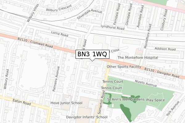
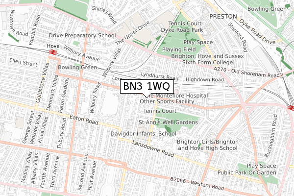
BN3 1WQ maps, stats, and open data
BN3 1WQ lies on Davigdor Road in Hove. BN3 1WQ is located in the Goldsmid electoral ward, within the unitary authority of Brighton and Hove and the English Parliamentary constituency of Hove. The Sub Integrated Care Board (ICB) Location is NHS Sussex ICB - 09D and the police force is Sussex. This postcode has been in use since June 2000.
BN3 1WQ maps


Licence: Open Government Licence (requires attribution)
Attribution: Contains OS data © Crown copyright and database right 2025
Source: Open Postcode Geo
Licence: Open Government Licence (requires attribution)
Attribution: Contains OS data © Crown copyright and database right 2025; Contains Royal Mail data © Royal Mail copyright and database right 2025; Source: Office for National Statistics licensed under the Open Government Licence v.3.0
BN3 1WQ geodata
| Easting | 529738 |
| Northing | 105174 |
| Latitude | 50.831570 |
| Longitude | -0.159100 |
Where is BN3 1WQ?
| Street | Davigdor Road |
| Town/City | Hove |
| Country | England |
| Postcode District | BN3 |
BN3 1WQ Elevation
Elevation or altitude of BN3 1WQ as distance above sea level:
| Metres | Feet | |
|---|---|---|
| Elevation | 30m | 98ft |
Elevation is measured from the approximate centre of the postcode, to the nearest point on an OS contour line from OS Terrain 50, which has contour spacing of ten vertical metres.
➜ How high above sea level am I? Find the elevation of your current position using your device's GPS.
Politics
| Ward | Goldsmid |
|---|---|
| Constituency | Hove |
Transport
Nearest bus stops to BN3 1WQ
| Lyon Close (Davigdor Road) | Hove | 17m |
| Lyon Close (Davigdor Road) | Hove | 41m |
| Holland Road (Cromwell Road) | Hove | 139m |
| Montefiore Road South (Davigdor Road) | Hove | 242m |
| Montefiore Road South (Davigdor Road) | Hove | 308m |
Nearest railway stations to BN3 1WQ
| Hove Station | 0.9km |
| Brighton Station | 1.3km |
| Preston Park Station | 1.6km |
Broadband
Broadband access in BN3 1WQ (2020 data)
| Percentage of properties with Next Generation Access | 100.0% |
| Percentage of properties with Superfast Broadband | 100.0% |
| Percentage of properties with Ultrafast Broadband | 100.0% |
| Percentage of properties with Full Fibre Broadband | 100.0% |
Superfast Broadband is between 30Mbps and 300Mbps
Ultrafast Broadband is > 300Mbps
Broadband speed in BN3 1WQ (2019 data)
Download
| Median download speed | 70.2Mbps |
| Average download speed | 52.3Mbps |
| Maximum download speed | 80.00Mbps |
Upload
| Median upload speed | 19.5Mbps |
| Average upload speed | 12.0Mbps |
| Maximum upload speed | 20.00Mbps |
Broadband limitations in BN3 1WQ (2020 data)
| Percentage of properties unable to receive 2Mbps | 0.0% |
| Percentage of properties unable to receive 5Mbps | 0.0% |
| Percentage of properties unable to receive 10Mbps | 0.0% |
| Percentage of properties unable to receive 30Mbps | 0.0% |
BN3 1WQ gas and electricity consumption
Estimated total energy consumption in BN3 1WQ by fuel type, 2015.
Gas
| Consumption (kWh) | 198,510 |
|---|---|
| Meter count | 29 |
| Mean (kWh/meter) | 6,845 |
| Median (kWh/meter) | 6,239 |
Electricity
| Consumption (kWh) | 73,592 |
|---|---|
| Meter count | 28 |
| Mean (kWh/meter) | 2,628 |
| Median (kWh/meter) | 2,452 |
- Consumption: The estimated total energy consumption, in kWh, across all meters in BN3 1WQ, for 2015.
- Meter count: The total number of meters in BN3 1WQ.
- Mean: The mean average consumption per meter, in kWh.
- Median: The median average consumption per meter, in kWh.
Source: Postcode level electricity estimates: 2015 (experimental)
Licence: Open Government Licence
Deprivation
39.7% of English postcodes are less deprived than BN3 1WQ:Food Standards Agency
Three nearest food hygiene ratings to BN3 1WQ (metres)


➜ Get more ratings from the Food Standards Agency
Nearest post box to BN3 1WQ
| Last Collection | |||
|---|---|---|---|
| Location | Mon-Fri | Sat | Distance |
| Cromwell Road | 18:15 | 11:30 | 81m |
| Davigdor Road | 18:30 | 11:30 | 100m |
| Palmeira Avenue | 18:15 | 11:30 | 409m |
BN3 1WQ ITL and BN3 1WQ LAU
The below table lists the International Territorial Level (ITL) codes (formerly Nomenclature of Territorial Units for Statistics (NUTS) codes) and Local Administrative Units (LAU) codes for BN3 1WQ:
| ITL 1 Code | Name |
|---|---|
| TLJ | South East (England) |
| ITL 2 Code | Name |
| TLJ2 | Surrey, East and West Sussex |
| ITL 3 Code | Name |
| TLJ21 | Brighton and Hove |
| LAU 1 Code | Name |
| E06000043 | Brighton and Hove |
BN3 1WQ census areas
The below table lists the Census Output Area (OA), Lower Layer Super Output Area (LSOA), and Middle Layer Super Output Area (MSOA) for BN3 1WQ:
| Code | Name | |
|---|---|---|
| OA | E00085184 | |
| LSOA | E01016874 | Brighton and Hove 020B |
| MSOA | E02003510 | Brighton and Hove 020 |
Nearest postcodes to BN3 1WQ
| BN3 1WG | Davigdor Road | 32m |
| BN3 1WE | Chatsworth Square | 42m |
| BN3 1WF | Chatsworth Square | 50m |
| BN3 1RP | Somerhill Road | 77m |
| BN3 1WD | Chatsworth Square | 81m |
| BN3 1JQ | Holland Road | 88m |
| BN3 1JR | Holland Road | 89m |
| BN3 1JS | Holland Road | 95m |
| BN3 1RH | Somerhill Road | 95m |
| BN3 1RW | Somerhill Avenue | 99m |