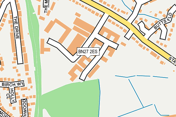
BN27 2ES is located in the Hailsham East electoral ward, within the local authority district of Wealden and the English Parliamentary constituency of Wealden. The Sub Integrated Care Board (ICB) Location is NHS Sussex ICB - 97R and the police force is Sussex. This postcode has been in use since January 1980.


GetTheData
Source: OS OpenMap – Local (Ordnance Survey)
Source: OS VectorMap District (Ordnance Survey)
Licence: Open Government Licence (requires attribution)
| Easting | 559215 |
| Northing | 108658 |
| Latitude | 50.855520 |
| Longitude | 0.260696 |
GetTheData
Source: Open Postcode Geo
Licence: Open Government Licence
| Country | England |
| Postcode District | BN27 |
➜ See where BN27 is on a map ➜ Where is Hailsham? | |
GetTheData
Source: Land Registry Price Paid Data
Licence: Open Government Licence
Elevation or altitude of BN27 2ES as distance above sea level:
| Metres | Feet | |
|---|---|---|
| Elevation | 20m | 66ft |
Elevation is measured from the approximate centre of the postcode, to the nearest point on an OS contour line from OS Terrain 50, which has contour spacing of ten vertical metres.
➜ How high above sea level am I? Find the elevation of your current position using your device's GPS.
GetTheData
Source: Open Postcode Elevation
Licence: Open Government Licence
| Ward | Hailsham East |
| Constituency | Wealden |
GetTheData
Source: ONS Postcode Database
Licence: Open Government Licence
| Swan Road (Station Road) | Hailsham | 156m |
| Ersham Way (The Avenue) | Hailsham | 317m |
| The Drive | Hailsham | 381m |
| Bowley Road (Swan Road) | Hailsham | 412m |
| Windsor Road | Hailsham | 476m |
| Polegate Station | 4km |
| Pevensey & Westham Station | 6.3km |
GetTheData
Source: NaPTAN
Licence: Open Government Licence
GetTheData
Source: ONS Postcode Database
Licence: Open Government Licence


➜ Get more ratings from the Food Standards Agency
GetTheData
Source: Food Standards Agency
Licence: FSA terms & conditions
| Last Collection | |||
|---|---|---|---|
| Location | Mon-Fri | Sat | Distance |
| Station Road | 17:15 | 12:00 | 216m |
| Ersham Park | 17:00 | 12:00 | 321m |
| String Walk | 17:00 | 12:00 | 359m |
GetTheData
Source: Dracos
Licence: Creative Commons Attribution-ShareAlike
The below table lists the International Territorial Level (ITL) codes (formerly Nomenclature of Territorial Units for Statistics (NUTS) codes) and Local Administrative Units (LAU) codes for BN27 2ES:
| ITL 1 Code | Name |
|---|---|
| TLJ | South East (England) |
| ITL 2 Code | Name |
| TLJ2 | Surrey, East and West Sussex |
| ITL 3 Code | Name |
| TLJ22 | East Sussex CC |
| LAU 1 Code | Name |
| E07000065 | Wealden |
GetTheData
Source: ONS Postcode Directory
Licence: Open Government Licence
The below table lists the Census Output Area (OA), Lower Layer Super Output Area (LSOA), and Middle Layer Super Output Area (MSOA) for BN27 2ES:
| Code | Name | |
|---|---|---|
| OA | E00107601 | |
| LSOA | E01021185 | Wealden 017D |
| MSOA | E02004419 | Wealden 017 |
GetTheData
Source: ONS Postcode Directory
Licence: Open Government Licence
| BN27 2ET | Station Road Industrial Estate | 37m |
| BN27 2GB | The Sidings | 132m |
| BN27 2EG | Station Road | 144m |
| BN27 2EE | Station Road | 150m |
| BN27 2EQ | Station Road | 195m |
| BN27 2DS | The Mount | 202m |
| BN27 2BX | The Lawns | 217m |
| BN27 3HW | The Drive | 239m |
| BN27 2HB | Archery Walk | 248m |
| BN27 2DT | The Mount | 249m |
GetTheData
Source: Open Postcode Geo; Land Registry Price Paid Data
Licence: Open Government Licence