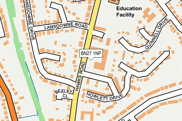
BN27 1NP is located in the Hailsham North electoral ward, within the local authority district of Wealden and the English Parliamentary constituency of Wealden. The Sub Integrated Care Board (ICB) Location is NHS Sussex ICB - 97R and the police force is Sussex. This postcode has been in use since January 1980.


GetTheData
Source: OS OpenMap – Local (Ordnance Survey)
Source: OS VectorMap District (Ordnance Survey)
Licence: Open Government Licence (requires attribution)
| Easting | 558676 |
| Northing | 110781 |
| Latitude | 50.874744 |
| Longitude | 0.253965 |
GetTheData
Source: Open Postcode Geo
Licence: Open Government Licence
| Country | England |
| Postcode District | BN27 |
➜ See where BN27 is on a map ➜ Where is Hailsham? | |
GetTheData
Source: Land Registry Price Paid Data
Licence: Open Government Licence
Elevation or altitude of BN27 1NP as distance above sea level:
| Metres | Feet | |
|---|---|---|
| Elevation | 30m | 98ft |
Elevation is measured from the approximate centre of the postcode, to the nearest point on an OS contour line from OS Terrain 50, which has contour spacing of ten vertical metres.
➜ How high above sea level am I? Find the elevation of your current position using your device's GPS.
GetTheData
Source: Open Postcode Elevation
Licence: Open Government Licence
| Ward | Hailsham North |
| Constituency | Wealden |
GetTheData
Source: ONS Postcode Database
Licence: Open Government Licence
| Lansdowne Road (Hawks Road) | Hailsham | 91m |
| Lansdowne Road (Hawks Road) | Hailsham | 142m |
| Lansdowne Gardens (Lansdowne Drive) | Hailsham | 171m |
| Hawthylands Road (Hawks Road) | Hailsham | 177m |
| Hawthylands Crescent (Hawthylands Road) | Hailsham | 188m |
GetTheData
Source: NaPTAN
Licence: Open Government Licence
GetTheData
Source: ONS Postcode Database
Licence: Open Government Licence


➜ Get more ratings from the Food Standards Agency
GetTheData
Source: Food Standards Agency
Licence: FSA terms & conditions
| Last Collection | |||
|---|---|---|---|
| Location | Mon-Fri | Sat | Distance |
| Howletts Drive | 16:45 | 12:00 | 34m |
| Hawthylands Road | 17:00 | 12:00 | 204m |
| Hawks Road | 17:00 | 12:00 | 351m |
GetTheData
Source: Dracos
Licence: Creative Commons Attribution-ShareAlike
The below table lists the International Territorial Level (ITL) codes (formerly Nomenclature of Territorial Units for Statistics (NUTS) codes) and Local Administrative Units (LAU) codes for BN27 1NP:
| ITL 1 Code | Name |
|---|---|
| TLJ | South East (England) |
| ITL 2 Code | Name |
| TLJ2 | Surrey, East and West Sussex |
| ITL 3 Code | Name |
| TLJ22 | East Sussex CC |
| LAU 1 Code | Name |
| E07000065 | Wealden |
GetTheData
Source: ONS Postcode Directory
Licence: Open Government Licence
The below table lists the Census Output Area (OA), Lower Layer Super Output Area (LSOA), and Middle Layer Super Output Area (MSOA) for BN27 1NP:
| Code | Name | |
|---|---|---|
| OA | E00107571 | |
| LSOA | E01021176 | Wealden 015C |
| MSOA | E02004417 | Wealden 015 |
GetTheData
Source: ONS Postcode Directory
Licence: Open Government Licence
| BN27 1NG | Hawks Road | 84m |
| BN27 1NF | Hawks Farm Close | 84m |
| BN27 1QW | Howlett Drive | 121m |
| BN27 1QN | Quinnell Drive | 129m |
| BN27 1NJ | Hawks Road | 134m |
| BN27 1LQ | Lansdowne Gardens | 151m |
| BN27 1LG | Lansdowne Drive | 159m |
| BN27 1LL | Lansdowne Road | 168m |
| BN27 1NL | Hawks Road | 175m |
| BN27 1NH | Bexley Close | 181m |
GetTheData
Source: Open Postcode Geo; Land Registry Price Paid Data
Licence: Open Government Licence