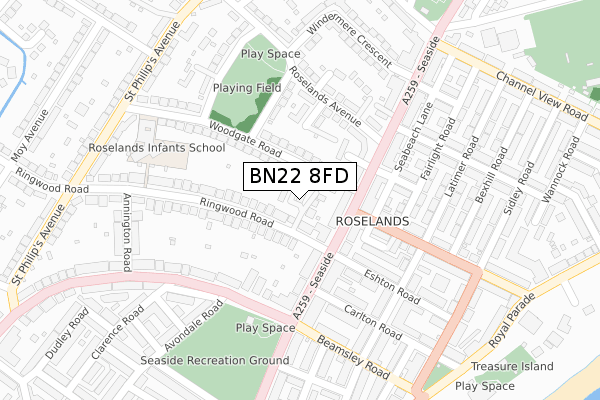
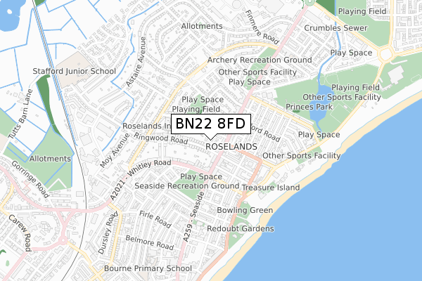
BN22 8FD is located in the St Anthony's electoral ward, within the local authority district of Eastbourne and the English Parliamentary constituency of Eastbourne. The Sub Integrated Care Board (ICB) Location is NHS Sussex ICB - 97R and the police force is Sussex. This postcode has been in use since November 2019.


GetTheData
Source: OS Open Zoomstack (Ordnance Survey)
Licence: Open Government Licence (requires attribution)
Attribution: Contains OS data © Crown copyright and database right 2024
Source: Open Postcode Geo
Licence: Open Government Licence (requires attribution)
Attribution: Contains OS data © Crown copyright and database right 2024; Contains Royal Mail data © Royal Mail copyright and database right 2024; Source: Office for National Statistics licensed under the Open Government Licence v.3.0
| Easting | 562114 |
| Northing | 100197 |
| Latitude | 50.778691 |
| Longitude | 0.298114 |
GetTheData
Source: Open Postcode Geo
Licence: Open Government Licence
| Country | England |
| Postcode District | BN22 |
| ➜ BN22 open data dashboard ➜ See where BN22 is on a map ➜ Where is Eastbourne? | |
GetTheData
Source: Land Registry Price Paid Data
Licence: Open Government Licence
| Ward | St Anthony's |
| Constituency | Eastbourne |
GetTheData
Source: ONS Postcode Database
Licence: Open Government Licence
12, SWAN MEWS, EASTBOURNE, BN22 8FD 2022 30 SEP £497,000 |
5, SWAN MEWS, EASTBOURNE, BN22 8FD 2018 20 NOV £418,000 |
12, SWAN MEWS, EASTBOURNE, BN22 8FD 2018 22 JUN £400,000 |
GetTheData
Source: HM Land Registry Price Paid Data
Licence: Contains HM Land Registry data © Crown copyright and database right 2024. This data is licensed under the Open Government Licence v3.0.
| December 2023 | Violence and sexual offences | On or near Channel View Road | 473m |
| December 2023 | Vehicle crime | On or near Channel View Road | 473m |
| December 2023 | Anti-social behaviour | On or near Channel View Road | 473m |
| ➜ Get more crime data in our Crime section | |||
GetTheData
Source: data.police.uk
Licence: Open Government Licence
| Beach Road (Seaside) | Roselands | 80m |
| Beach Road (Seaside) | Roselands | 102m |
| Carlton Road (Seaside) | Roselands | 141m |
| The Archery (Seaside) | Roselands | 291m |
| Whitley Rec (Seaside) | Roselands | 308m |
| Eastbourne Station | 1.6km |
| Hampden Park (Sussex) Station | 2.4km |
| Pevensey & Westham Station | 4.5km |
GetTheData
Source: NaPTAN
Licence: Open Government Licence
GetTheData
Source: ONS Postcode Database
Licence: Open Government Licence


➜ Get more ratings from the Food Standards Agency
GetTheData
Source: Food Standards Agency
Licence: FSA terms & conditions
| Last Collection | |||
|---|---|---|---|
| Location | Mon-Fri | Sat | Distance |
| Beamsley Road | 17:15 | 11:00 | 210m |
| Redoubt Road | 17:30 | 11:00 | 498m |
| Firle Road | 17:30 | 12:00 | 683m |
GetTheData
Source: Dracos
Licence: Creative Commons Attribution-ShareAlike
| Facility | Distance |
|---|---|
| Roselands Recreation Ground Roselands Avenue, Eastbourne Grass Pitches | 202m |
| Seaside Recreation Ground Gilbert Road, Eastbourne Grass Pitches | 307m |
| Princes Park (The Oval) Channel View Road, Eastbourne Grass Pitches | 564m |
GetTheData
Source: Active Places
Licence: Open Government Licence
| School | Phase of Education | Distance |
|---|---|---|
| Roselands Infants' School Woodgate Road, Eastbourne, BN22 8PD | Primary | 271m |
| Anderida Learning Centre Neville Mews, 6a Neville Road, Eastbourne, BN22 8HR | Not applicable | 583m |
| St Andrew's Church of England Infants School Winchelsea Road, Eastbourne, BN22 7PP | Primary | 646m |
GetTheData
Source: Edubase
Licence: Open Government Licence
| Risk of BN22 8FD flooding from rivers and sea | Low |
| ➜ BN22 8FD flood map | |
GetTheData
Source: Open Flood Risk by Postcode
Licence: Open Government Licence
The below table lists the International Territorial Level (ITL) codes (formerly Nomenclature of Territorial Units for Statistics (NUTS) codes) and Local Administrative Units (LAU) codes for BN22 8FD:
| ITL 1 Code | Name |
|---|---|
| TLJ | South East (England) |
| ITL 2 Code | Name |
| TLJ2 | Surrey, East and West Sussex |
| ITL 3 Code | Name |
| TLJ22 | East Sussex CC |
| LAU 1 Code | Name |
| E07000061 | Eastbourne |
GetTheData
Source: ONS Postcode Directory
Licence: Open Government Licence
The below table lists the Census Output Area (OA), Lower Layer Super Output Area (LSOA), and Middle Layer Super Output Area (MSOA) for BN22 8FD:
| Code | Name | |
|---|---|---|
| OA | E00106370 | |
| LSOA | E01020954 | Eastbourne 007E |
| MSOA | E02004362 | Eastbourne 007 |
GetTheData
Source: ONS Postcode Directory
Licence: Open Government Licence
| BN22 8TN | Wesley Place | 47m |
| BN22 8PA | Woodgate Road | 48m |
| BN22 7RB | Ringwood Court | 63m |
| BN22 7RD | Seaside | 69m |
| BN22 8TA | Ringwood Road | 85m |
| BN22 7RE | Seaside | 105m |
| BN22 7RF | Belle Vue Road | 112m |
| BN22 7NT | Seaside | 114m |
| BN22 7RA | Seaside | 123m |
| BN22 7NU | Seaside | 138m |
GetTheData
Source: Open Postcode Geo; Land Registry Price Paid Data
Licence: Open Government Licence