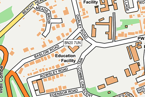
BN20 7UN is located in the Meads electoral ward, within the local authority district of Eastbourne and the English Parliamentary constituency of Eastbourne. The Sub Integrated Care Board (ICB) Location is NHS Sussex ICB - 97R and the police force is Sussex. This postcode has been in use since January 1980.


GetTheData
Source: OS OpenMap – Local (Ordnance Survey)
Source: OS VectorMap District (Ordnance Survey)
Licence: Open Government Licence (requires attribution)
| Easting | 559740 |
| Northing | 97417 |
| Latitude | 50.754375 |
| Longitude | 0.263234 |
GetTheData
Source: Open Postcode Geo
Licence: Open Government Licence
| Country | England |
| Postcode District | BN20 |
➜ See where BN20 is on a map ➜ Where is Eastbourne? | |
GetTheData
Source: Land Registry Price Paid Data
Licence: Open Government Licence
Elevation or altitude of BN20 7UN as distance above sea level:
| Metres | Feet | |
|---|---|---|
| Elevation | 60m | 197ft |
Elevation is measured from the approximate centre of the postcode, to the nearest point on an OS contour line from OS Terrain 50, which has contour spacing of ten vertical metres.
➜ How high above sea level am I? Find the elevation of your current position using your device's GPS.
GetTheData
Source: Open Postcode Elevation
Licence: Open Government Licence
| Ward | Meads |
| Constituency | Eastbourne |
GetTheData
Source: ONS Postcode Database
Licence: Open Government Licence
| Rowsley Road (Wellcombe Crescent) | Meads | 78m |
| Edensor Road (Wellcombe Crescent) | Meads | 124m |
| The Ship (Meads Street) | Meads | 324m |
| All Saints (Darley Road) | Meads | 376m |
| St Bedes School (Upper Dukes Drive) | Meads | 389m |
| Eastbourne Station | 2.1km |
| Hampden Park (Sussex) Station | 4.8km |
GetTheData
Source: NaPTAN
Licence: Open Government Licence
GetTheData
Source: ONS Postcode Database
Licence: Open Government Licence


➜ Get more ratings from the Food Standards Agency
GetTheData
Source: Food Standards Agency
Licence: FSA terms & conditions
| Last Collection | |||
|---|---|---|---|
| Location | Mon-Fri | Sat | Distance |
| Welcombe Crescent | 17:15 | 11:00 | 90m |
| Meads Post Office | 17:15 | 12:00 | 387m |
| Salisbury Road | 17:15 | 11:00 | 390m |
GetTheData
Source: Dracos
Licence: Creative Commons Attribution-ShareAlike
The below table lists the International Territorial Level (ITL) codes (formerly Nomenclature of Territorial Units for Statistics (NUTS) codes) and Local Administrative Units (LAU) codes for BN20 7UN:
| ITL 1 Code | Name |
|---|---|
| TLJ | South East (England) |
| ITL 2 Code | Name |
| TLJ2 | Surrey, East and West Sussex |
| ITL 3 Code | Name |
| TLJ22 | East Sussex CC |
| LAU 1 Code | Name |
| E07000061 | Eastbourne |
GetTheData
Source: ONS Postcode Directory
Licence: Open Government Licence
The below table lists the Census Output Area (OA), Lower Layer Super Output Area (LSOA), and Middle Layer Super Output Area (MSOA) for BN20 7UN:
| Code | Name | |
|---|---|---|
| OA | E00106257 | |
| LSOA | E01020933 | Eastbourne 012C |
| MSOA | E02004367 | Eastbourne 012 |
GetTheData
Source: ONS Postcode Directory
Licence: Open Government Licence
| BN20 7UJ | Baslow Road | 49m |
| BN20 7XS | Rowsley Road | 127m |
| BN20 7YD | Edensor Road | 164m |
| BN20 7UP | Meads Brow | 168m |
| BN20 7UH | Darley Road | 180m |
| BN20 7UL | Baslow Road | 200m |
| BN20 7XR | Edensor Road | 223m |
| BN20 7XW | Wellcombe Crescent | 224m |
| BN20 7UT | Darley Road | 229m |
| BN20 7XU | Upper Dukes Drive | 254m |
GetTheData
Source: Open Postcode Geo; Land Registry Price Paid Data
Licence: Open Government Licence