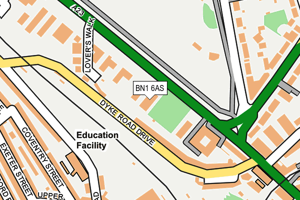
BN1 6AS is located in the Preston Park electoral ward, within the unitary authority of Brighton and Hove and the English Parliamentary constituency of Brighton, Pavilion. The Sub Integrated Care Board (ICB) Location is NHS Sussex ICB - 09D and the police force is Sussex. This postcode has been in use since January 1980.


GetTheData
Source: OS OpenMap – Local (Ordnance Survey)
Source: OS VectorMap District (Ordnance Survey)
Licence: Open Government Licence (requires attribution)
| Easting | 530684 |
| Northing | 105796 |
| Latitude | 50.836948 |
| Longitude | -0.145453 |
GetTheData
Source: Open Postcode Geo
Licence: Open Government Licence
| Country | England |
| Postcode District | BN1 |
➜ See where BN1 is on a map ➜ Where is Brighton? | |
GetTheData
Source: Land Registry Price Paid Data
Licence: Open Government Licence
Elevation or altitude of BN1 6AS as distance above sea level:
| Metres | Feet | |
|---|---|---|
| Elevation | 30m | 98ft |
Elevation is measured from the approximate centre of the postcode, to the nearest point on an OS contour line from OS Terrain 50, which has contour spacing of ten vertical metres.
➜ How high above sea level am I? Find the elevation of your current position using your device's GPS.
GetTheData
Source: Open Postcode Elevation
Licence: Open Government Licence
| Ward | Preston Park |
| Constituency | Brighton, Pavilion |
GetTheData
Source: ONS Postcode Database
Licence: Open Government Licence
| Stanford Avenue (Preston Road) | Brighton | 84m |
| Lovers Walk (Preston Road) | Brighton | 167m |
| Stanford Avenue | Brighton | 220m |
| Springfield Road (Preston Road) | Brighton | 285m |
| Nestor Court (Preston Road) | Brighton | 304m |
| London Road (Brighton) Station | 0.6km |
| Brighton Station | 0.9km |
| Preston Park Station | 1.2km |
GetTheData
Source: NaPTAN
Licence: Open Government Licence
GetTheData
Source: ONS Postcode Database
Licence: Open Government Licence


➜ Get more ratings from the Food Standards Agency
GetTheData
Source: Food Standards Agency
Licence: FSA terms & conditions
| Last Collection | |||
|---|---|---|---|
| Location | Mon-Fri | Sat | Distance |
| Lovers Walk | 16:00 | 11:30 | 203m |
| Stanford Avenue No 1 | 16:15 | 12:30 | 207m |
| Ditchling Rise | 16:15 | 11:30 | 301m |
GetTheData
Source: Dracos
Licence: Creative Commons Attribution-ShareAlike
The below table lists the International Territorial Level (ITL) codes (formerly Nomenclature of Territorial Units for Statistics (NUTS) codes) and Local Administrative Units (LAU) codes for BN1 6AS:
| ITL 1 Code | Name |
|---|---|
| TLJ | South East (England) |
| ITL 2 Code | Name |
| TLJ2 | Surrey, East and West Sussex |
| ITL 3 Code | Name |
| TLJ21 | Brighton and Hove |
| LAU 1 Code | Name |
| E06000043 | Brighton and Hove |
GetTheData
Source: ONS Postcode Directory
Licence: Open Government Licence
The below table lists the Census Output Area (OA), Lower Layer Super Output Area (LSOA), and Middle Layer Super Output Area (MSOA) for BN1 6AS:
| Code | Name | |
|---|---|---|
| OA | E00085491 | |
| LSOA | E01016936 | Brighton and Hove 014D |
| MSOA | E02003504 | Brighton and Hove 014 |
GetTheData
Source: ONS Postcode Directory
Licence: Open Government Licence
| BN1 6AF | Preston Road | 30m |
| BN1 6AU | Preston Road | 71m |
| BN1 6AN | Lovers Walk Cottages | 105m |
| BN1 6AJ | Dyke Road Drive | 107m |
| BN1 6AH | Lovers Walk | 165m |
| BN1 5PR | Stanford Road | 197m |
| BN1 6AX | Stanford Avenue | 204m |
| BN1 6HP | Preston Park Avenue | 204m |
| BN1 6AL | Parkmore Terrace | 216m |
| BN1 5DR | Stanford Road | 218m |
GetTheData
Source: Open Postcode Geo; Land Registry Price Paid Data
Licence: Open Government Licence