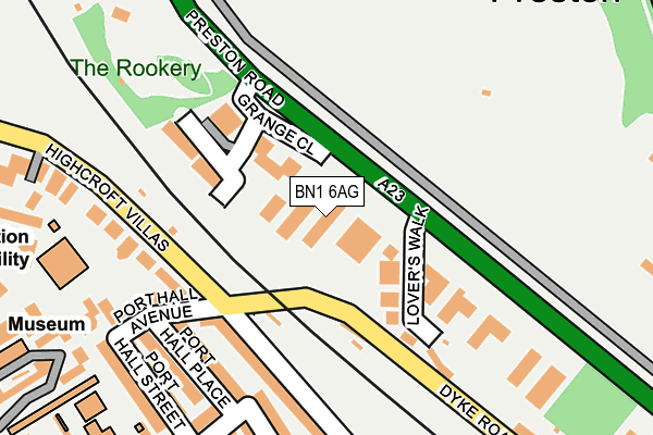
BN1 6AG lies on Preston Road in Brighton. BN1 6AG is located in the Preston Park electoral ward, within the unitary authority of Brighton and Hove and the English Parliamentary constituency of Brighton, Pavilion. The Sub Integrated Care Board (ICB) Location is NHS Sussex ICB - 09D and the police force is Sussex. This postcode has been in use since January 1980.


GetTheData
Source: OS OpenMap – Local (Ordnance Survey)
Source: OS VectorMap District (Ordnance Survey)
Licence: Open Government Licence (requires attribution)
| Easting | 530480 |
| Northing | 105950 |
| Latitude | 50.838378 |
| Longitude | -0.148293 |
GetTheData
Source: Open Postcode Geo
Licence: Open Government Licence
| Street | Preston Road |
| Town/City | Brighton |
| Country | England |
| Postcode District | BN1 |
➜ See where BN1 is on a map ➜ Where is Brighton? | |
GetTheData
Source: Land Registry Price Paid Data
Licence: Open Government Licence
Elevation or altitude of BN1 6AG as distance above sea level:
| Metres | Feet | |
|---|---|---|
| Elevation | 30m | 98ft |
Elevation is measured from the approximate centre of the postcode, to the nearest point on an OS contour line from OS Terrain 50, which has contour spacing of ten vertical metres.
➜ How high above sea level am I? Find the elevation of your current position using your device's GPS.
GetTheData
Source: Open Postcode Elevation
Licence: Open Government Licence
| Ward | Preston Park |
| Constituency | Brighton, Pavilion |
GetTheData
Source: ONS Postcode Database
Licence: Open Government Licence
169, PRESTON ROAD, BRIGHTON, BN1 6AG 2013 13 DEC £315,000 |
GetTheData
Source: HM Land Registry Price Paid Data
Licence: Contains HM Land Registry data © Crown copyright and database right 2025. This data is licensed under the Open Government Licence v3.0.
| Nestor Court (Preston Road) | Brighton | 72m |
| Nestor Court (Preston Road) | Brighton | 106m |
| Lovers Walk (Preston Road) | Brighton | 122m |
| Preston Park | Brighton | 331m |
| Stanford Avenue (Preston Road) | Brighton | 334m |
| London Road (Brighton) Station | 0.9km |
| Preston Park Station | 1km |
| Brighton Station | 1.2km |
GetTheData
Source: NaPTAN
Licence: Open Government Licence
GetTheData
Source: ONS Postcode Database
Licence: Open Government Licence


➜ Get more ratings from the Food Standards Agency
GetTheData
Source: Food Standards Agency
Licence: FSA terms & conditions
| Last Collection | |||
|---|---|---|---|
| Location | Mon-Fri | Sat | Distance |
| Lovers Walk | 16:00 | 11:30 | 72m |
| Exeter Street | 16:45 | 11:45 | 233m |
| Stanford Avenue No 1 | 16:15 | 12:30 | 453m |
GetTheData
Source: Dracos
Licence: Creative Commons Attribution-ShareAlike
The below table lists the International Territorial Level (ITL) codes (formerly Nomenclature of Territorial Units for Statistics (NUTS) codes) and Local Administrative Units (LAU) codes for BN1 6AG:
| ITL 1 Code | Name |
|---|---|
| TLJ | South East (England) |
| ITL 2 Code | Name |
| TLJ2 | Surrey, East and West Sussex |
| ITL 3 Code | Name |
| TLJ21 | Brighton and Hove |
| LAU 1 Code | Name |
| E06000043 | Brighton and Hove |
GetTheData
Source: ONS Postcode Directory
Licence: Open Government Licence
The below table lists the Census Output Area (OA), Lower Layer Super Output Area (LSOA), and Middle Layer Super Output Area (MSOA) for BN1 6AG:
| Code | Name | |
|---|---|---|
| OA | E00085488 | |
| LSOA | E01016935 | Brighton and Hove 014C |
| MSOA | E02003504 | Brighton and Hove 014 |
GetTheData
Source: ONS Postcode Directory
Licence: Open Government Licence
| BN1 6AH | Lovers Walk | 97m |
| BN1 6BH | Grange Close | 127m |
| BN1 6AP | Grange Close | 137m |
| BN1 5PW | Park View Terrace | 145m |
| BN1 6AN | Lovers Walk Cottages | 167m |
| BN1 5PN | Port Hall Place | 168m |
| BN1 5PL | Port Hall Avenue | 172m |
| BN1 6AU | Preston Road | 185m |
| BN1 5AX | Dyke Road | 220m |
| BN1 6AF | Preston Road | 226m |
GetTheData
Source: Open Postcode Geo; Land Registry Price Paid Data
Licence: Open Government Licence