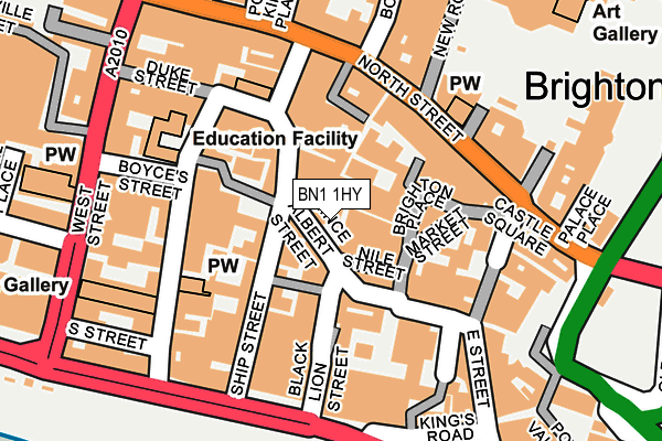
BN1 1HY is located in the Regency electoral ward, within the unitary authority of Brighton and Hove and the English Parliamentary constituency of Brighton, Pavilion. The Sub Integrated Care Board (ICB) Location is NHS Sussex ICB - 09D and the police force is Sussex. This postcode has been in use since January 1980.


GetTheData
Source: OS OpenMap – Local (Ordnance Survey)
Source: OS VectorMap District (Ordnance Survey)
Licence: Open Government Licence (requires attribution)
| Easting | 531033 |
| Northing | 104107 |
| Latitude | 50.821689 |
| Longitude | -0.141102 |
GetTheData
Source: Open Postcode Geo
Licence: Open Government Licence
| Country | England |
| Postcode District | BN1 |
➜ See where BN1 is on a map ➜ Where is Brighton? | |
GetTheData
Source: Land Registry Price Paid Data
Licence: Open Government Licence
Elevation or altitude of BN1 1HY as distance above sea level:
| Metres | Feet | |
|---|---|---|
| Elevation | 10m | 33ft |
Elevation is measured from the approximate centre of the postcode, to the nearest point on an OS contour line from OS Terrain 50, which has contour spacing of ten vertical metres.
➜ How high above sea level am I? Find the elevation of your current position using your device's GPS.
GetTheData
Source: Open Postcode Elevation
Licence: Open Government Licence
| Ward | Regency |
| Constituency | Brighton, Pavilion |
GetTheData
Source: ONS Postcode Database
Licence: Open Government Licence
| North Street | Brighton | 134m |
| North Street | Brighton | 140m |
| North Street | Brighton | 141m |
| North Street | Brighton | 148m |
| North Street | Brighton | 153m |
| Brighton Station | 0.8km |
| London Road (Brighton) Station | 1.7km |
| Hove Station | 2.6km |
GetTheData
Source: NaPTAN
Licence: Open Government Licence
GetTheData
Source: ONS Postcode Database
Licence: Open Government Licence


➜ Get more ratings from the Food Standards Agency
GetTheData
Source: Food Standards Agency
Licence: FSA terms & conditions
| Last Collection | |||
|---|---|---|---|
| Location | Mon-Fri | Sat | Distance |
| Ship Streetpost Office | 18:45 | 12:45 | 97m |
| Ship Streetpost Office | 19:15 | 97m | |
| Town Hall Bartholomew Sq | 18:45 | 12:45 | 132m |
GetTheData
Source: Dracos
Licence: Creative Commons Attribution-ShareAlike
The below table lists the International Territorial Level (ITL) codes (formerly Nomenclature of Territorial Units for Statistics (NUTS) codes) and Local Administrative Units (LAU) codes for BN1 1HY:
| ITL 1 Code | Name |
|---|---|
| TLJ | South East (England) |
| ITL 2 Code | Name |
| TLJ2 | Surrey, East and West Sussex |
| ITL 3 Code | Name |
| TLJ21 | Brighton and Hove |
| LAU 1 Code | Name |
| E06000043 | Brighton and Hove |
GetTheData
Source: ONS Postcode Directory
Licence: Open Government Licence
The below table lists the Census Output Area (OA), Lower Layer Super Output Area (LSOA), and Middle Layer Super Output Area (MSOA) for BN1 1HY:
| Code | Name | |
|---|---|---|
| OA | E00085586 | |
| LSOA | E01016952 | Brighton and Hove 027A |
| MSOA | E02003517 | Brighton and Hove 027 |
GetTheData
Source: ONS Postcode Directory
Licence: Open Government Licence
| BN1 1HE | Prince Albert Street | 37m |
| BN1 1HW | Nile Street | 43m |
| BN1 1AE | Ship Street | 57m |
| BN1 1HA | Union Street | 57m |
| BN1 1HB | Meeting House Lane | 58m |
| BN1 1NL | Black Lion Lane | 62m |
| BN1 1ND | Black Lion Street | 69m |
| BN1 1AD | Ship Street | 77m |
| BN1 1HJ | Brighton Place | 89m |
| BN1 1JE | Bartholomew Square | 93m |
GetTheData
Source: Open Postcode Geo; Land Registry Price Paid Data
Licence: Open Government Licence