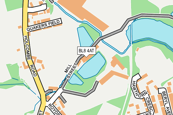
BL8 4AT is located in the Tottington electoral ward, within the metropolitan district of Bury and the English Parliamentary constituency of Bury North. The Sub Integrated Care Board (ICB) Location is NHS Greater Manchester ICB - 00V and the police force is Greater Manchester. This postcode has been in use since January 1980.


GetTheData
Source: OS OpenMap – Local (Ordnance Survey)
Source: OS VectorMap District (Ordnance Survey)
Licence: Open Government Licence (requires attribution)
| Easting | 377677 |
| Northing | 413543 |
| Latitude | 53.617966 |
| Longitude | -2.338932 |
GetTheData
Source: Open Postcode Geo
Licence: Open Government Licence
| Country | England |
| Postcode District | BL8 |
➜ See where BL8 is on a map ➜ Where is Bury? | |
GetTheData
Source: Land Registry Price Paid Data
Licence: Open Government Licence
Elevation or altitude of BL8 4AT as distance above sea level:
| Metres | Feet | |
|---|---|---|
| Elevation | 130m | 427ft |
Elevation is measured from the approximate centre of the postcode, to the nearest point on an OS contour line from OS Terrain 50, which has contour spacing of ten vertical metres.
➜ How high above sea level am I? Find the elevation of your current position using your device's GPS.
GetTheData
Source: Open Postcode Elevation
Licence: Open Government Licence
| Ward | Tottington |
| Constituency | Bury North |
GetTheData
Source: ONS Postcode Database
Licence: Open Government Licence
| Chapel St/Royds St (Chapel St) | Tottington | 278m |
| Holcombe Brook/Oswestry Cl (Holcombe Road) | Tottington | 284m |
| Holcombe Brook/Oswestry Cl (Holcombe Road) | Tottington | 296m |
| Chapel St/Royds St (Chapel St) | Tottington | 313m |
| Market St/Robin Hood (Market St) | Tottington | 384m |
| Bromley Cross Station | 4.8km |
| Hall i' th' Wood Station | 5.4km |
| Entwistle Station | 6.5km |
GetTheData
Source: NaPTAN
Licence: Open Government Licence
GetTheData
Source: ONS Postcode Database
Licence: Open Government Licence


➜ Get more ratings from the Food Standards Agency
GetTheData
Source: Food Standards Agency
Licence: FSA terms & conditions
| Last Collection | |||
|---|---|---|---|
| Location | Mon-Fri | Sat | Distance |
| Springside View | 17:55 | 09:00 | 1,293m |
| Owlerbarrow Road | 17:35 | 11:05 | 2,407m |
| Brandle Avenue | 18:30 | 11:10 | 2,532m |
GetTheData
Source: Dracos
Licence: Creative Commons Attribution-ShareAlike
The below table lists the International Territorial Level (ITL) codes (formerly Nomenclature of Territorial Units for Statistics (NUTS) codes) and Local Administrative Units (LAU) codes for BL8 4AT:
| ITL 1 Code | Name |
|---|---|
| TLD | North West (England) |
| ITL 2 Code | Name |
| TLD3 | Greater Manchester |
| ITL 3 Code | Name |
| TLD37 | Greater Manchester North East |
| LAU 1 Code | Name |
| E08000002 | Bury |
GetTheData
Source: ONS Postcode Directory
Licence: Open Government Licence
The below table lists the Census Output Area (OA), Lower Layer Super Output Area (LSOA), and Middle Layer Super Output Area (MSOA) for BL8 4AT:
| Code | Name | |
|---|---|---|
| OA | E00025552 | |
| LSOA | E01005049 | Bury 003D |
| MSOA | E02001021 | Bury 003 |
GetTheData
Source: ONS Postcode Directory
Licence: Open Government Licence
| BL8 4AU | Stormer Hill Fold | 169m |
| BL8 4AZ | Quakersfield | 172m |
| BL8 4AS | Garden Street | 187m |
| BL8 4AR | Holcombe Road | 198m |
| BL8 4AX | 214m | |
| BL8 4BY | Oswestry Close | 222m |
| BL8 4BT | Holcombe Road | 226m |
| BL8 3ND | Old Doctors Street | 246m |
| BL8 3NG | Hawthorn Crescent | 258m |
| BL8 3NH | Royds Street | 269m |
GetTheData
Source: Open Postcode Geo; Land Registry Price Paid Data
Licence: Open Government Licence