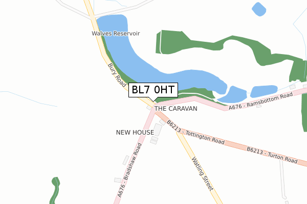
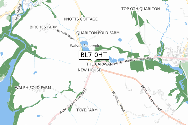
BL7 0HT is located in the Bradshaw electoral ward, within the metropolitan district of Bolton and the English Parliamentary constituency of Bolton North East. The Sub Integrated Care Board (ICB) Location is NHS Greater Manchester ICB - 00T and the police force is Greater Manchester. This postcode has been in use since January 1980.


GetTheData
Source: OS Open Zoomstack (Ordnance Survey)
Licence: Open Government Licence (requires attribution)
Attribution: Contains OS data © Crown copyright and database right 2025
Source: Open Postcode Geo
Licence: Open Government Licence (requires attribution)
Attribution: Contains OS data © Crown copyright and database right 2025; Contains Royal Mail data © Royal Mail copyright and database right 2025; Source: Office for National Statistics licensed under the Open Government Licence v.3.0
| Easting | 374729 |
| Northing | 414966 |
| Latitude | 53.630621 |
| Longitude | -2.383612 |
GetTheData
Source: Open Postcode Geo
Licence: Open Government Licence
| Country | England |
| Postcode District | BL7 |
➜ See where BL7 is on a map | |
GetTheData
Source: Land Registry Price Paid Data
Licence: Open Government Licence
Elevation or altitude of BL7 0HT as distance above sea level:
| Metres | Feet | |
|---|---|---|
| Elevation | 200m | 656ft |
Elevation is measured from the approximate centre of the postcode, to the nearest point on an OS contour line from OS Terrain 50, which has contour spacing of ten vertical metres.
➜ How high above sea level am I? Find the elevation of your current position using your device's GPS.
GetTheData
Source: Open Postcode Elevation
Licence: Open Government Licence
| Ward | Bradshaw |
| Constituency | Bolton North East |
GetTheData
Source: ONS Postcode Database
Licence: Open Government Licence
| Bury Road (Sbd) (Bury Road) | Walves | 53m |
| Bradshaw Road/The Willows (Bradshaw Road) | Walves | 53m |
| Bury Road/Walves (Bury Road) | Walves | 57m |
| Bradshaw Road/The Willows (Bradshaw Road) | Walves | 83m |
| Ramsbottom Road/Walves (Ramsbottom Road) | Walves | 84m |
| Bromley Cross Station | 2.6km |
| Entwistle Station | 3.5km |
| Hall i' th' Wood Station | 4.2km |
GetTheData
Source: NaPTAN
Licence: Open Government Licence
| Percentage of properties with Next Generation Access | 100.0% |
| Percentage of properties with Superfast Broadband | 100.0% |
| Percentage of properties with Ultrafast Broadband | 0.0% |
| Percentage of properties with Full Fibre Broadband | 0.0% |
Superfast Broadband is between 30Mbps and 300Mbps
Ultrafast Broadband is > 300Mbps
| Percentage of properties unable to receive 2Mbps | 0.0% |
| Percentage of properties unable to receive 5Mbps | 0.0% |
| Percentage of properties unable to receive 10Mbps | 0.0% |
| Percentage of properties unable to receive 30Mbps | 0.0% |
GetTheData
Source: Ofcom
Licence: Ofcom Terms of Use (requires attribution)
GetTheData
Source: ONS Postcode Database
Licence: Open Government Licence


➜ Get more ratings from the Food Standards Agency
GetTheData
Source: Food Standards Agency
Licence: FSA terms & conditions
| Last Collection | |||
|---|---|---|---|
| Location | Mon-Fri | Sat | Distance |
| Bolton Road Edgworth | 17:30 | 11:50 | 1,206m |
| Edgworth P O | 16:55 | 11:45 | 2,030m |
| 52 Hillside Avenue | 18:00 | 12:10 | 2,174m |
GetTheData
Source: Dracos
Licence: Creative Commons Attribution-ShareAlike
The below table lists the International Territorial Level (ITL) codes (formerly Nomenclature of Territorial Units for Statistics (NUTS) codes) and Local Administrative Units (LAU) codes for BL7 0HT:
| ITL 1 Code | Name |
|---|---|
| TLD | North West (England) |
| ITL 2 Code | Name |
| TLD3 | Greater Manchester |
| ITL 3 Code | Name |
| TLD36 | Greater Manchester North West |
| LAU 1 Code | Name |
| E08000001 | Bolton |
GetTheData
Source: ONS Postcode Directory
Licence: Open Government Licence
The below table lists the Census Output Area (OA), Lower Layer Super Output Area (LSOA), and Middle Layer Super Output Area (MSOA) for BL7 0HT:
| Code | Name | |
|---|---|---|
| OA | E00024259 | |
| LSOA | E01004789 | Bolton 006D |
| MSOA | E02000989 | Bolton 006 |
GetTheData
Source: ONS Postcode Directory
Licence: Open Government Licence
| BL7 0HS | Tottington Road | 38m |
| BL7 0HR | Bradshaw Road | 201m |
| BL7 0HP | Bradshaw Road | 387m |
| BL8 4JS | Ramsbottom Road | 765m |
| BL8 3QJ | Watling Street | 785m |
| BL7 0HX | Birches Road | 818m |
| BL8 4JT | Lower Fold | 849m |
| BL7 0HW | Walsh Fold | 856m |
| BL8 3QQ | Turton Road | 872m |
| BL7 0BX | Bury Road | 880m |
GetTheData
Source: Open Postcode Geo; Land Registry Price Paid Data
Licence: Open Government Licence