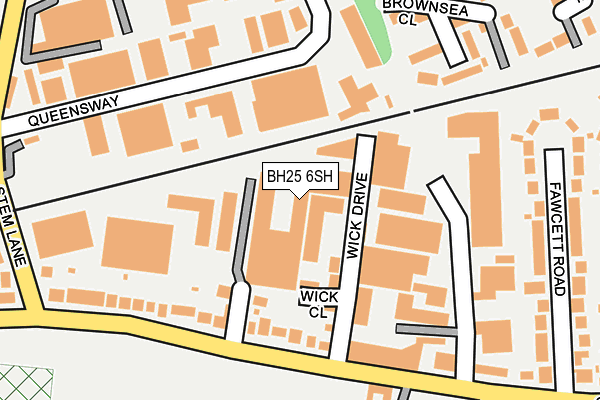
BH25 6SH is located in the Milton electoral ward, within the local authority district of New Forest and the English Parliamentary constituency of New Forest West. The Sub Integrated Care Board (ICB) Location is NHS Hampshire and Isle of Wight ICB - D9Y0V and the police force is Hampshire. This postcode has been in use since January 1980.


GetTheData
Source: OS OpenMap – Local (Ordnance Survey)
Source: OS VectorMap District (Ordnance Survey)
Licence: Open Government Licence (requires attribution)
| Easting | 423346 |
| Northing | 94899 |
| Latitude | 50.753215 |
| Longitude | -1.670412 |
GetTheData
Source: Open Postcode Geo
Licence: Open Government Licence
| Country | England |
| Postcode District | BH25 |
➜ See where BH25 is on a map ➜ Where is New Milton? | |
GetTheData
Source: Land Registry Price Paid Data
Licence: Open Government Licence
Elevation or altitude of BH25 6SH as distance above sea level:
| Metres | Feet | |
|---|---|---|
| Elevation | 40m | 131ft |
Elevation is measured from the approximate centre of the postcode, to the nearest point on an OS contour line from OS Terrain 50, which has contour spacing of ten vertical metres.
➜ How high above sea level am I? Find the elevation of your current position using your device's GPS.
GetTheData
Source: Open Postcode Elevation
Licence: Open Government Licence
| Ward | Milton |
| Constituency | New Forest West |
GetTheData
Source: ONS Postcode Database
Licence: Open Government Licence
| Stem Lane (Gore Road) | New Milton | 234m |
| Brownsea Close (Chatsworth Way) | New Milton | 260m |
| Stem Lane (Gore Road) | New Milton | 326m |
| Milton Mead (Gore Road) | Gore | 337m |
| Milton Mead (Gore Road) | Gore | 349m |
| New Milton Station | 0.9km |
| Hinton Admiral Station | 3.1km |
| Sway Station | 5.5km |
GetTheData
Source: NaPTAN
Licence: Open Government Licence
| Median download speed | 17.3Mbps |
| Average download speed | 26.7Mbps |
| Maximum download speed | 55.40Mbps |
| Median upload speed | 1.0Mbps |
| Average upload speed | 4.9Mbps |
| Maximum upload speed | 12.60Mbps |
GetTheData
Source: Ofcom
Licence: Ofcom Terms of Use (requires attribution)
GetTheData
Source: ONS Postcode Database
Licence: Open Government Licence


➜ Get more ratings from the Food Standards Agency
GetTheData
Source: Food Standards Agency
Licence: FSA terms & conditions
| Last Collection | |||
|---|---|---|---|
| Location | Mon-Fri | Sat | Distance |
| Gore Road | 17:00 | 11:30 | 238m |
| 14 Stem Lane | 18:00 | 283m | |
| Albert Road | 17:00 | 11:30 | 621m |
GetTheData
Source: Dracos
Licence: Creative Commons Attribution-ShareAlike
The below table lists the International Territorial Level (ITL) codes (formerly Nomenclature of Territorial Units for Statistics (NUTS) codes) and Local Administrative Units (LAU) codes for BH25 6SH:
| ITL 1 Code | Name |
|---|---|
| TLJ | South East (England) |
| ITL 2 Code | Name |
| TLJ3 | Hampshire and Isle of Wight |
| ITL 3 Code | Name |
| TLJ36 | Central Hampshire |
| LAU 1 Code | Name |
| E07000091 | New Forest |
GetTheData
Source: ONS Postcode Directory
Licence: Open Government Licence
The below table lists the Census Output Area (OA), Lower Layer Super Output Area (LSOA), and Middle Layer Super Output Area (MSOA) for BH25 6SH:
| Code | Name | |
|---|---|---|
| OA | E00117165 | |
| LSOA | E01023055 | New Forest 020D |
| MSOA | E02004798 | New Forest 020 |
GetTheData
Source: ONS Postcode Directory
Licence: Open Government Licence
| BH25 6RH | Milton Business Centre | 41m |
| BH25 6TJ | Wick Ii Industrial Estate | 103m |
| BH25 6SJ | Gore Road | 123m |
| BH25 6TL | Hamilton Business Park | 193m |
| BH25 5UG | Brownsea Close | 204m |
| BH25 5NN | Queensway | 225m |
| BH25 6SU | Fawcett Road | 240m |
| BH25 5XE | Stratfield Place | 285m |
| BH25 5NE | Stem Lane | 308m |
| BH25 5UF | Balmoral Walk | 311m |
GetTheData
Source: Open Postcode Geo; Land Registry Price Paid Data
Licence: Open Government Licence