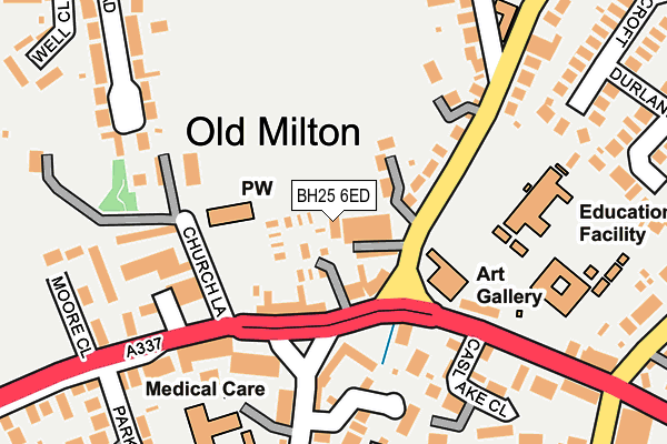
BH25 6ED is located in the Milton electoral ward, within the local authority district of New Forest and the English Parliamentary constituency of New Forest West. The Sub Integrated Care Board (ICB) Location is NHS Hampshire and Isle of Wight ICB - D9Y0V and the police force is Hampshire. This postcode has been in use since March 2014.


GetTheData
Source: OS OpenMap – Local (Ordnance Survey)
Source: OS VectorMap District (Ordnance Survey)
Licence: Open Government Licence (requires attribution)
| Easting | 423862 |
| Northing | 94348 |
| Latitude | 50.748249 |
| Longitude | -1.663140 |
GetTheData
Source: Open Postcode Geo
Licence: Open Government Licence
| Country | England |
| Postcode District | BH25 |
➜ See where BH25 is on a map ➜ Where is New Milton? | |
GetTheData
Source: Land Registry Price Paid Data
Licence: Open Government Licence
Elevation or altitude of BH25 6ED as distance above sea level:
| Metres | Feet | |
|---|---|---|
| Elevation | 30m | 98ft |
Elevation is measured from the approximate centre of the postcode, to the nearest point on an OS contour line from OS Terrain 50, which has contour spacing of ten vertical metres.
➜ How high above sea level am I? Find the elevation of your current position using your device's GPS.
GetTheData
Source: Open Postcode Elevation
Licence: Open Government Licence
| Ward | Milton |
| Constituency | New Forest West |
GetTheData
Source: ONS Postcode Database
Licence: Open Government Licence
| New Milton Junior School (Old Milton Road) | Old Milton | 74m |
| New Milton Junior School (Old Milton Road) | Old Milton | 87m |
| The Green (Old Milton Green) | New Milton | 94m |
| The Green (Old Milton Green) | New Milton | 109m |
| Old Milton Green (Southern Lane) | Old Milton | 148m |
| New Milton Station | 0.9km |
| Hinton Admiral Station | 3.6km |
| Sway Station | 5.5km |
GetTheData
Source: NaPTAN
Licence: Open Government Licence
GetTheData
Source: ONS Postcode Database
Licence: Open Government Licence


➜ Get more ratings from the Food Standards Agency
GetTheData
Source: Food Standards Agency
Licence: FSA terms & conditions
| Last Collection | |||
|---|---|---|---|
| Location | Mon-Fri | Sat | Distance |
| Milton P.o. | 17:15 | 12:30 | 173m |
| Barton Court Ave | 17:00 | 11:30 | 301m |
| Old Milton Road | 17:00 | 11:30 | 344m |
GetTheData
Source: Dracos
Licence: Creative Commons Attribution-ShareAlike
The below table lists the International Territorial Level (ITL) codes (formerly Nomenclature of Territorial Units for Statistics (NUTS) codes) and Local Administrative Units (LAU) codes for BH25 6ED:
| ITL 1 Code | Name |
|---|---|
| TLJ | South East (England) |
| ITL 2 Code | Name |
| TLJ3 | Hampshire and Isle of Wight |
| ITL 3 Code | Name |
| TLJ36 | Central Hampshire |
| LAU 1 Code | Name |
| E07000091 | New Forest |
GetTheData
Source: ONS Postcode Directory
Licence: Open Government Licence
The below table lists the Census Output Area (OA), Lower Layer Super Output Area (LSOA), and Middle Layer Super Output Area (MSOA) for BH25 6ED:
| Code | Name | |
|---|---|---|
| OA | E00117167 | |
| LSOA | E01023054 | New Forest 021C |
| MSOA | E02004799 | New Forest 021 |
GetTheData
Source: ONS Postcode Directory
Licence: Open Government Licence
| BH25 6QJ | King George Mobile Home Park | 58m |
| BH25 6EB | Old Milton Road | 79m |
| BH25 6QA | Old Milton Green Parade | 147m |
| BH25 7JE | Southern Lane | 155m |
| BH25 7LY | Chaucombe Place | 155m |
| BH25 6QL | Church Lane | 162m |
| BH25 6PU | Caslake Close | 164m |
| BH25 7HU | Middleton Mews | 190m |
| BH25 6QP | Manor Farm Close | 192m |
| BH25 6QD | Caslake Close | 196m |
GetTheData
Source: Open Postcode Geo; Land Registry Price Paid Data
Licence: Open Government Licence