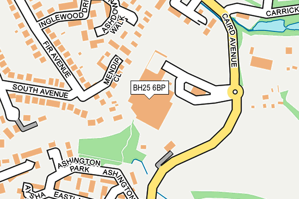
BH25 6BP is located in the Milton electoral ward, within the local authority district of New Forest and the English Parliamentary constituency of New Forest West. The Sub Integrated Care Board (ICB) Location is NHS Hampshire and Isle of Wight ICB - D9Y0V and the police force is Hampshire. This postcode has been in use since December 1994.


GetTheData
Source: OS OpenMap – Local (Ordnance Survey)
Source: OS VectorMap District (Ordnance Survey)
Licence: Open Government Licence (requires attribution)
| Easting | 425099 |
| Northing | 94600 |
| Latitude | 50.750454 |
| Longitude | -1.645583 |
GetTheData
Source: Open Postcode Geo
Licence: Open Government Licence
| Country | England |
| Postcode District | BH25 |
➜ See where BH25 is on a map ➜ Where is New Milton? | |
GetTheData
Source: Land Registry Price Paid Data
Licence: Open Government Licence
Elevation or altitude of BH25 6BP as distance above sea level:
| Metres | Feet | |
|---|---|---|
| Elevation | 30m | 98ft |
Elevation is measured from the approximate centre of the postcode, to the nearest point on an OS contour line from OS Terrain 50, which has contour spacing of ten vertical metres.
➜ How high above sea level am I? Find the elevation of your current position using your device's GPS.
GetTheData
Source: Open Postcode Elevation
Licence: Open Government Licence
| Ward | Milton |
| Constituency | New Forest West |
GetTheData
Source: ONS Postcode Database
Licence: Open Government Licence
| Caird Avenue Tesco (Caird Avenue) | New Milton | 59m |
| Glengarry (Caird Avenue) | New Milton | 235m |
| Carrick Way (Caird Avenue) | New Milton | 236m |
| Fir Avenue (Inglewood Drive) | New Milton | 264m |
| Fir Avenue (Inglewood Drive) | New Milton | 270m |
| New Milton Station | 1km |
| Sway Station | 4.6km |
| Hinton Admiral Station | 4.8km |
GetTheData
Source: NaPTAN
Licence: Open Government Licence
GetTheData
Source: ONS Postcode Database
Licence: Open Government Licence


➜ Get more ratings from the Food Standards Agency
GetTheData
Source: Food Standards Agency
Licence: FSA terms & conditions
| Last Collection | |||
|---|---|---|---|
| Location | Mon-Fri | Sat | Distance |
| Caird Ave | 17:00 | 12:00 | 230m |
| Milton Grove | 16:00 | 11:45 | 320m |
| Lane Corner | 16:00 | 09:00 | 582m |
GetTheData
Source: Dracos
Licence: Creative Commons Attribution-ShareAlike
The below table lists the International Territorial Level (ITL) codes (formerly Nomenclature of Territorial Units for Statistics (NUTS) codes) and Local Administrative Units (LAU) codes for BH25 6BP:
| ITL 1 Code | Name |
|---|---|
| TLJ | South East (England) |
| ITL 2 Code | Name |
| TLJ3 | Hampshire and Isle of Wight |
| ITL 3 Code | Name |
| TLJ36 | Central Hampshire |
| LAU 1 Code | Name |
| E07000091 | New Forest |
GetTheData
Source: ONS Postcode Directory
Licence: Open Government Licence
The below table lists the Census Output Area (OA), Lower Layer Super Output Area (LSOA), and Middle Layer Super Output Area (MSOA) for BH25 6BP:
| Code | Name | |
|---|---|---|
| OA | E00117151 | |
| LSOA | E01023056 | New Forest 021D |
| MSOA | E02004799 | New Forest 021 |
GetTheData
Source: ONS Postcode Directory
Licence: Open Government Licence
| BH25 6TY | Mendip Close | 85m |
| BH25 6EU | Fir Avenue | 164m |
| BH25 6UA | Glengarry | 180m |
| BH25 5PF | Baden Close | 186m |
| BH25 6TX | Ashdown Walk | 189m |
| BH25 5PH | Eastlands | 209m |
| BH25 6TT | Inglewood Drive | 209m |
| BH25 6EY | South Avenue | 232m |
| BH25 5PJ | Eastlands | 254m |
| BH25 6TU | Glenavon | 255m |
GetTheData
Source: Open Postcode Geo; Land Registry Price Paid Data
Licence: Open Government Licence