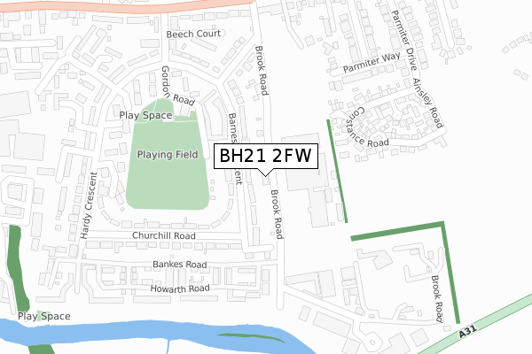
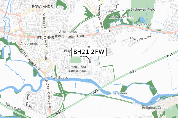
BH21 2FW is located in the Wimborne Minster electoral ward, within the unitary authority of Dorset and the English Parliamentary constituency of Mid Dorset and North Poole. The Sub Integrated Care Board (ICB) Location is NHS Dorset ICB - 11J and the police force is Dorset. This postcode has been in use since April 2020.


GetTheData
Source: OS Open Zoomstack (Ordnance Survey)
Licence: Open Government Licence (requires attribution)
Attribution: Contains OS data © Crown copyright and database right 2024
Source: Open Postcode Geo
Licence: Open Government Licence (requires attribution)
Attribution: Contains OS data © Crown copyright and database right 2024; Contains Royal Mail data © Royal Mail copyright and database right 2024; Source: Office for National Statistics licensed under the Open Government Licence v.3.0
| Easting | 402256 |
| Northing | 99469 |
| Latitude | 50.794773 |
| Longitude | -1.969351 |
GetTheData
Source: Open Postcode Geo
Licence: Open Government Licence
| Country | England |
| Postcode District | BH21 |
| ➜ BH21 open data dashboard ➜ See where BH21 is on a map ➜ Where is Wimborne Minster? | |
GetTheData
Source: Land Registry Price Paid Data
Licence: Open Government Licence
| Ward | Wimborne Minster |
| Constituency | Mid Dorset And North Poole |
GetTheData
Source: ONS Postcode Database
Licence: Open Government Licence
| December 2023 | Anti-social behaviour | On or near Hardy Crescent | 293m |
| November 2023 | Violence and sexual offences | On or near Hardy Crescent | 293m |
| October 2023 | Violence and sexual offences | On or near Hardy Crescent | 293m |
| ➜ Get more crime data in our Crime section | |||
GetTheData
Source: data.police.uk
Licence: Open Government Licence
| Barnes Crescent | Wimborne Minster | 48m |
| Barnes Crescent | Wimborne Minster | 158m |
| Churchill Road | Wimborne Minster | 252m |
| Barnes Crescent | Wimborne Minster | 274m |
| Hardy Crescent | Wimborne Minster | 340m |
GetTheData
Source: NaPTAN
Licence: Open Government Licence
GetTheData
Source: ONS Postcode Database
Licence: Open Government Licence


➜ Get more ratings from the Food Standards Agency
GetTheData
Source: Food Standards Agency
Licence: FSA terms & conditions
| Last Collection | |||
|---|---|---|---|
| Location | Mon-Fri | Sat | Distance |
| Churchill Road | 17:15 | 11:00 | 302m |
| Leigh Park P.o. | 17:30 | 11:00 | 397m |
| Leigh Common | 17:30 | 11:30 | 449m |
GetTheData
Source: Dracos
Licence: Creative Commons Attribution-ShareAlike
| Facility | Distance |
|---|---|
| J&b’s Stadium New Cuthbury Constance Road, Wimborne Grass Pitches, Artificial Grass Pitch | 224m |
| Leigh Park Gordon Road, Wimborne Grass Pitches | 224m |
| Merley And Cobham Yfc (Merley First School) Oakley Straight, Wimborne Grass Pitches | 1km |
GetTheData
Source: Active Places
Licence: Open Government Licence
| School | Phase of Education | Distance |
|---|---|---|
| St John's Church of England First School, Wimborne St John's Hill, Wimborne, BH21 1BX | Primary | 872m |
| Merley First School Oakley Straight, Merley, Wimborne, BH21 1SD | Primary | 1km |
| Canford School Canford Magna, Wimborne, BH21 3AD | Not applicable | 1.2km |
GetTheData
Source: Edubase
Licence: Open Government Licence
The below table lists the International Territorial Level (ITL) codes (formerly Nomenclature of Territorial Units for Statistics (NUTS) codes) and Local Administrative Units (LAU) codes for BH21 2FW:
| ITL 1 Code | Name |
|---|---|
| TLK | South West (England) |
| ITL 2 Code | Name |
| TLK2 | Dorset and Somerset |
| ITL 3 Code | Name |
| TLK25 | Dorset |
| LAU 1 Code | Name |
| E06000059 | Dorset |
GetTheData
Source: ONS Postcode Directory
Licence: Open Government Licence
The below table lists the Census Output Area (OA), Lower Layer Super Output Area (LSOA), and Middle Layer Super Output Area (MSOA) for BH21 2FW:
| Code | Name | |
|---|---|---|
| OA | E00103504 | |
| LSOA | E01020427 | East Dorset 010B |
| MSOA | E02004252 | East Dorset 010 |
GetTheData
Source: ONS Postcode Directory
Licence: Open Government Licence
| BH21 2AY | Barnes Crescent | 92m |
| BH21 2AZ | Barnes Crescent | 135m |
| BH21 2FJ | Ryan Way | 189m |
| BH21 2AU | Churchill Road | 198m |
| BH21 2AT | Churchill Road | 215m |
| BH21 2FG | Howarth Road | 217m |
| BH21 2FH | Fletcher Way | 248m |
| BH21 2AX | Livingstone Road | 270m |
| BH21 2AS | Hardy Crescent | 276m |
| BH21 2AP | Gordon Road | 278m |
GetTheData
Source: Open Postcode Geo; Land Registry Price Paid Data
Licence: Open Government Licence