Canford School is located in Wimborne and falls under the local authority of Bournemouth, Christchurch and Poole. The school's religious denomination is Anglican/Church of England. This mixed-sex school has 646 pupils, with a capacity of 680, aged from thirteen up to eighteen, and the type of establishment is other independent school.
| Address | Canford School Canford Magna Wimborne Dorset BH21 3AD |
| Website | http://www.canford.com |
| Headmaster | Mr Ben Vessey |
GetTheData
Source: Get Information About Schools
Licence: Open Government Licence
| Phase of Education | Not applicable |
| Type of Establishment | Other independent school |
| Admissions Policy | Selective |
| Statutory Low Age | 13 |
| Statutory High Age | 18 |
| Boarders | Boarding school |
| Boarding Establishment | Has boarders |
| Official Sixth Form | Has a sixth form |
| Gender | Mixed |
| Religious Character | Anglican/Church of England |
| Diocese | Not applicable |
| Special Classes | No Special Classes |
GetTheData
Source: Get Information About Schools
Licence: Open Government Licence
| Census Date | 20th January 2022 | |
| School Capacity | 680 | |
| Number of Pupils | 646 | 95% capacity |
| Number of Boys | 363 | 56% |
| Number of Girls | 283 | 44% |
| Free School Meals (%) | 0.0% |
GetTheData
Source: Get Information About Schools
Licence: Open Government Licence
| Street Address | Canford Magna |
| Town | Wimborne |
| County | Dorset |
| Postcode | BH21 3AD |
| ➜ More BH21 3AD open data | |
GetTheData
Source: Get Information About Schools
Licence: Open Government Licence

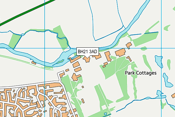
GetTheData
Source: OS VectorMap District (Ordnance Survey)
Licence: Open Government Licence (requires attribution)
| Ofsted Special Measures | Not applicable |
GetTheData
Source: Get Information About Schools
Licence: Open Government Licence
| Establishment Name | Canford School |
| Establishment Number | 6000 |
| Previous Establishment Number | 6019 |
| Unique Reference Number | 113922 |
| Local Authority | Bournemouth, Christchurch and Poole |
| Local Authority Code | 839 |
| Previous Local Authority | Pre-LGR 2019 Poole |
| Previous Local Authority Code | 836 |
| Government Statistical Service Local Authority Code | X999999 |
| Government Office Region | South West |
| District | Bournemouth, Christchurch and Poole |
| District Code | E06000058 |
| Ward | Bearwood & Merley |
| Parliamentary Constituency | Mid Dorset and North Poole |
| Urban/Rural Description | (England/Wales) Urban city and town |
| Middle Super Output Area | Bournemouth, Christchurch and Poole 001 |
| Lower Super Output Area | Bournemouth, Christchurch and Poole 001A |
GetTheData
Source: Get Information About Schools
Licence: Open Government Licence
| Establishment Status | Open |
| Last Changed Date | 26th September 2023 |
| Reason Establishment Opened | Not applicable |
| Open Date | 1st January 1930 |
| Reason Establishment Closed | Not applicable |
GetTheData
Source: Get Information About Schools
Licence: Open Government Licence
| Teenage Mothers | Not applicable |
| Child Care Facilities | Not applicable |
| Special Educational Needs (SEN) Provision in Primary Care Unit | Not applicable |
| Pupil Referral Unit (PRU) Provides for Educational and Behavioural Difficulties (EBD) | Not applicable |
| Pupil Referral Unit (PRU) Offers Tuition by Another Provider | Not applicable |
GetTheData
Source: Get Information About Schools
Licence: Open Government Licence
| Section 41 Approved | Not approved |
GetTheData
Source: Get Information About Schools
Licence: Open Government Licence
| Trust flag | Not applicable |
| School Sponsor flag | Not applicable |
GetTheData
Source: Get Information About Schools
Licence: Open Government Licence
| Federation flag | Not applicable |
GetTheData
Source: Get Information About Schools
Licence: Open Government Licence
| UK Provider Reference Number | 10008144 |
| Further Education Type | Not applicable |
GetTheData
Source: Get Information About Schools
Licence: Open Government Licence
| Easting | 403350 |
| Northing | 98917 |
| Latitude | 50.78982 |
| Longitude | -1.95384 |
GetTheData
Source: Get Information About Schools
Licence: Open Government Licence
| School | Phase of Education | Distance |
|---|---|---|
| Merley First School Oakley Straight, Merley, Wimborne, BH21 1SD | Primary | 1.4km |
| Hayeswood First School Cutlers Place, Colehill, Wimborne, BH21 2HN | Primary | 1.8km |
| The White House School 170 Magna Road, Poole, BH21 3AP | Not applicable | 1.8km |
| Hampreston Church of England Voluntary Aided First School Hampreston Village, Wimborne, BH21 7LX | Primary | 2.1km |
| St John's Church of England First School, Wimborne St John's Hill, Wimborne, BH21 1BX | Primary | 2.1km |
| Colehill First School Pilford Heath Road, Colehill, Wimborne, BH21 2LZ | Primary | 2.2km |
| Beaucroft Foundation School Wimborne Road, Colehill, Wimborne, BH21 2SS | Not applicable | 2.3km |
| St Michael's Church of England Middle School, Colehill Colehill Lane, Colehill, Wimborne, BH21 7AB | Middle deemed secondary | 2.4km |
| Bearwood Primary and Nursery School Barons Road, Bearwood, Bournemouth, BH11 9UN | Primary | 2.5km |
| South West Regional Assessment Centre Merley House, Merley House Lane, Merley House Events, Wimborne, BH21 3AA | Not applicable | 2.6km |
GetTheData
Source: Get Information About Schools
Licence: Open Government Licence