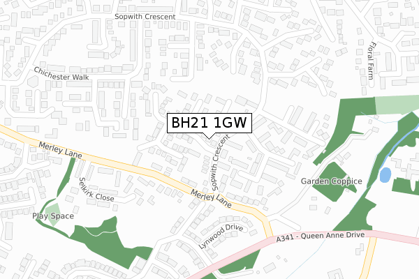
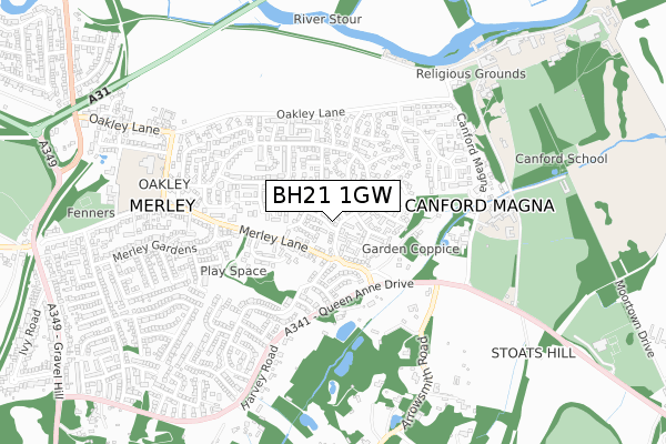
BH21 1GW is located in the Bearwood & Merley electoral ward, within the unitary authority of Bournemouth, Christchurch and Poole and the English Parliamentary constituency of Mid Dorset and North Poole. The Sub Integrated Care Board (ICB) Location is NHS Dorset ICB - 11J and the police force is Dorset. This postcode has been in use since April 2020.


GetTheData
Source: OS Open Zoomstack (Ordnance Survey)
Licence: Open Government Licence (requires attribution)
Attribution: Contains OS data © Crown copyright and database right 2024
Source: Open Postcode Geo
Licence: Open Government Licence (requires attribution)
Attribution: Contains OS data © Crown copyright and database right 2024; Contains Royal Mail data © Royal Mail copyright and database right 2024; Source: Office for National Statistics licensed under the Open Government Licence v.3.0
| Easting | 402489 |
| Northing | 98289 |
| Latitude | 50.784160 |
| Longitude | -1.966053 |
GetTheData
Source: Open Postcode Geo
Licence: Open Government Licence
| Country | England |
| Postcode District | BH21 |
| ➜ BH21 open data dashboard ➜ See where BH21 is on a map ➜ Where is Merley? | |
GetTheData
Source: Land Registry Price Paid Data
Licence: Open Government Licence
| Ward | Bearwood & Merley |
| Constituency | Mid Dorset And North Poole |
GetTheData
Source: ONS Postcode Database
Licence: Open Government Licence
| October 2023 | Violence and sexual offences | On or near Merley Lane | 241m |
| October 2023 | Violence and sexual offences | On or near Merley Lane | 241m |
| August 2023 | Violence and sexual offences | On or near Sopwith Crescent | 153m |
| ➜ Get more crime data in our Crime section | |||
GetTheData
Source: data.police.uk
Licence: Open Government Licence
| Selkirk Close (Merley Lane) | Merley | 119m |
| Oakley Shopping Centre (Merley Lane) | Merley | 140m |
| Cockerell Close (Sopwith Crescent) | Merley | 234m |
| Merley Lane (Sopwith Crescent) | Merley | 250m |
| Sopwith Crescent | Merley | 255m |
GetTheData
Source: NaPTAN
Licence: Open Government Licence
GetTheData
Source: ONS Postcode Database
Licence: Open Government Licence


➜ Get more ratings from the Food Standards Agency
GetTheData
Source: Food Standards Agency
Licence: FSA terms & conditions
| Last Collection | |||
|---|---|---|---|
| Location | Mon-Fri | Sat | Distance |
| Merley P.o. | 17:30 | 12:00 | 157m |
| Chichester Walk | 17:15 | 12:00 | 163m |
| Oakley Straight | 17:15 | 11:30 | 478m |
GetTheData
Source: Dracos
Licence: Creative Commons Attribution-ShareAlike
| Facility | Distance |
|---|---|
| Merley And Cobham Yfc (Merley First School) Oakley Straight, Wimborne Grass Pitches | 522m |
| Fenners Playing Field Merley Lane, Poole Grass Pitches | 744m |
| Canford School Sports Centre Canford Magna, Wimborne Health and Fitness Gym, Swimming Pool, Sports Hall, Artificial Grass Pitch, Grass Pitches, Golf, Squash Courts, Studio, Outdoor Tennis Courts | 1.1km |
GetTheData
Source: Active Places
Licence: Open Government Licence
| School | Phase of Education | Distance |
|---|---|---|
| Merley First School Oakley Straight, Merley, Wimborne, BH21 1SD | Primary | 515m |
| Canford School Canford Magna, Wimborne, BH21 3AD | Not applicable | 1.1km |
| South West Regional Assessment Centre Merley House, Merley House Lane, Merley House Events, Wimborne, BH21 3AA | Not applicable | 1.6km |
GetTheData
Source: Edubase
Licence: Open Government Licence
The below table lists the International Territorial Level (ITL) codes (formerly Nomenclature of Territorial Units for Statistics (NUTS) codes) and Local Administrative Units (LAU) codes for BH21 1GW:
| ITL 1 Code | Name |
|---|---|
| TLK | South West (England) |
| ITL 2 Code | Name |
| TLK2 | Dorset and Somerset |
| ITL 3 Code | Name |
| TLK24 | Bournemouth, Christchurch and Poole |
| LAU 1 Code | Name |
| E06000058 | Bournemouth, Christchurch and Poole |
GetTheData
Source: ONS Postcode Directory
Licence: Open Government Licence
The below table lists the Census Output Area (OA), Lower Layer Super Output Area (LSOA), and Middle Layer Super Output Area (MSOA) for BH21 1GW:
| Code | Name | |
|---|---|---|
| OA | E00078018 | |
| LSOA | E01015432 | Poole 001B |
| MSOA | E02003194 | Poole 001 |
GetTheData
Source: ONS Postcode Directory
Licence: Open Government Licence
| BH21 1XS | Cockerell Close | 71m |
| BH21 1XR | Cockerell Close | 93m |
| BH21 1ST | Chichester Walk | 95m |
| BH21 1SN | Chichester Walk | 117m |
| BH21 3AZ | Merley Lane | 117m |
| BH21 1TN | Selkirk Close | 127m |
| BH21 1SL | Chichester Walk | 137m |
| BH21 1XT | Cockerell Close | 146m |
| BH21 1XP | Cockerell Close | 160m |
| BH21 3AQ | Merley Lane | 176m |
GetTheData
Source: Open Postcode Geo; Land Registry Price Paid Data
Licence: Open Government Licence