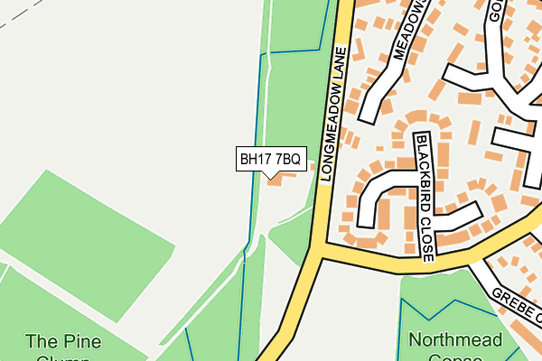
BH17 7BQ is located in the Creekmoor electoral ward, within the unitary authority of Bournemouth, Christchurch and Poole and the English Parliamentary constituency of Poole. The Sub Integrated Care Board (ICB) Location is NHS Dorset ICB - 11J and the police force is Dorset. This postcode has been in use since January 1992.


GetTheData
Source: OS OpenMap – Local (Ordnance Survey)
Source: OS VectorMap District (Ordnance Survey)
Licence: Open Government Licence (requires attribution)
| Easting | 399181 |
| Northing | 93725 |
| Latitude | 50.743122 |
| Longitude | -2.012967 |
GetTheData
Source: Open Postcode Geo
Licence: Open Government Licence
| Country | England |
| Postcode District | BH17 |
➜ See where BH17 is on a map ➜ Where is Poole? | |
GetTheData
Source: Land Registry Price Paid Data
Licence: Open Government Licence
Elevation or altitude of BH17 7BQ as distance above sea level:
| Metres | Feet | |
|---|---|---|
| Elevation | 10m | 33ft |
Elevation is measured from the approximate centre of the postcode, to the nearest point on an OS contour line from OS Terrain 50, which has contour spacing of ten vertical metres.
➜ How high above sea level am I? Find the elevation of your current position using your device's GPS.
GetTheData
Source: Open Postcode Elevation
Licence: Open Government Licence
| Ward | Creekmoor |
| Constituency | Poole |
GetTheData
Source: ONS Postcode Database
Licence: Open Government Licence
| Woodpecker Drive (Longmeadow Lane) | Creekmoor | 60m |
| Woodpecker Drive (Longmeadow Lane) | Creekmoor | 65m |
| Meadowsweet Road (Longmeadow Lane) | Creekmoor | 257m |
| Grebe Close (Woodpecker Drive) | Creekmoor | 260m |
| Grebe Close (Woodpecker Drive) | Creekmoor | 268m |
| Hamworthy Station | 2km |
| Poole Station | 3.4km |
| Parkstone (Dorset) Station | 5.1km |
GetTheData
Source: NaPTAN
Licence: Open Government Licence
| Percentage of properties with Next Generation Access | 100.0% |
| Percentage of properties with Superfast Broadband | 100.0% |
| Percentage of properties with Ultrafast Broadband | 0.0% |
| Percentage of properties with Full Fibre Broadband | 0.0% |
Superfast Broadband is between 30Mbps and 300Mbps
Ultrafast Broadband is > 300Mbps
| Percentage of properties unable to receive 2Mbps | 0.0% |
| Percentage of properties unable to receive 5Mbps | 0.0% |
| Percentage of properties unable to receive 10Mbps | 0.0% |
| Percentage of properties unable to receive 30Mbps | 0.0% |
GetTheData
Source: Ofcom
Licence: Ofcom Terms of Use (requires attribution)
GetTheData
Source: ONS Postcode Database
Licence: Open Government Licence


➜ Get more ratings from the Food Standards Agency
GetTheData
Source: Food Standards Agency
Licence: FSA terms & conditions
| Last Collection | |||
|---|---|---|---|
| Location | Mon-Fri | Sat | Distance |
| Long Meadow Lane | 17:30 | 12:15 | 211m |
| Nuthatch Community Centre | 17:15 | 12:15 | 595m |
| Beechbank Avenue | 17:30 | 12:15 | 637m |
GetTheData
Source: Dracos
Licence: Creative Commons Attribution-ShareAlike
The below table lists the International Territorial Level (ITL) codes (formerly Nomenclature of Territorial Units for Statistics (NUTS) codes) and Local Administrative Units (LAU) codes for BH17 7BQ:
| ITL 1 Code | Name |
|---|---|
| TLK | South West (England) |
| ITL 2 Code | Name |
| TLK2 | Dorset and Somerset |
| ITL 3 Code | Name |
| TLK24 | Bournemouth, Christchurch and Poole |
| LAU 1 Code | Name |
| E06000058 | Bournemouth, Christchurch and Poole |
GetTheData
Source: ONS Postcode Directory
Licence: Open Government Licence
The below table lists the Census Output Area (OA), Lower Layer Super Output Area (LSOA), and Middle Layer Super Output Area (MSOA) for BH17 7BQ:
| Code | Name | |
|---|---|---|
| OA | E00077953 | |
| LSOA | E01015418 | Poole 006B |
| MSOA | E02003199 | Poole 006 |
GetTheData
Source: ONS Postcode Directory
Licence: Open Government Licence
| BH17 7YB | Blackbird Close | 125m |
| BH17 7XT | Meadowsweet Road | 180m |
| BH17 7YA | Blackbird Close | 209m |
| BH17 7TA | Goldfinch Road | 281m |
| BH17 7TB | Goldfinch Road | 297m |
| BH17 7XU | Meadowsweet Road | 321m |
| BH17 7YW | Grebe Close | 336m |
| BH17 7TD | Goldfinch Road | 340m |
| BH17 7XY | Meadowsweet Road | 349m |
| BH17 7YN | Nightjar Close | 382m |
GetTheData
Source: Open Postcode Geo; Land Registry Price Paid Data
Licence: Open Government Licence