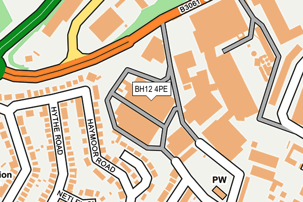
BH12 4PE is located in the Newtown & Heatherlands electoral ward, within the unitary authority of Bournemouth, Christchurch and Poole and the English Parliamentary constituency of Poole. The Sub Integrated Care Board (ICB) Location is NHS Dorset ICB - 11J and the police force is Dorset. This postcode has been in use since July 1995.


GetTheData
Source: OS OpenMap – Local (Ordnance Survey)
Source: OS VectorMap District (Ordnance Survey)
Licence: Open Government Licence (requires attribution)
| Easting | 403263 |
| Northing | 93285 |
| Latitude | 50.739167 |
| Longitude | -1.955124 |
GetTheData
Source: Open Postcode Geo
Licence: Open Government Licence
| Country | England |
| Postcode District | BH12 |
➜ See where BH12 is on a map ➜ Where is Poole? | |
GetTheData
Source: Land Registry Price Paid Data
Licence: Open Government Licence
Elevation or altitude of BH12 4PE as distance above sea level:
| Metres | Feet | |
|---|---|---|
| Elevation | 60m | 197ft |
Elevation is measured from the approximate centre of the postcode, to the nearest point on an OS contour line from OS Terrain 50, which has contour spacing of ten vertical metres.
➜ How high above sea level am I? Find the elevation of your current position using your device's GPS.
GetTheData
Source: Open Postcode Elevation
Licence: Open Government Licence
| Ward | Newtown & Heatherlands |
| Constituency | Poole |
GetTheData
Source: ONS Postcode Database
Licence: Open Government Licence
| Conservative Club (Ringwood Road) | Newtown | 425m |
| Tesco | Newtown | 451m |
| Conservative Club | Newtown | 451m |
| Tesco (Ringwood Road) | Newtown | 463m |
| Liberal Hall (Ringwood Road) | Newtown | 532m |
| Parkstone (Dorset) Station | 1.9km |
| Branksome Station | 2.8km |
| Poole Station | 3km |
GetTheData
Source: NaPTAN
Licence: Open Government Licence
Estimated total energy consumption in BH12 4PE by fuel type, 2015.
| Consumption (kWh) | 286,532 |
|---|---|
| Meter count | 11 |
| Mean (kWh/meter) | 26,048 |
| Median (kWh/meter) | 31,477 |
GetTheData
Source: Postcode level gas estimates: 2015 (experimental)
Source: Postcode level electricity estimates: 2015 (experimental)
Licence: Open Government Licence
GetTheData
Source: ONS Postcode Database
Licence: Open Government Licence

➜ Get more ratings from the Food Standards Agency
GetTheData
Source: Food Standards Agency
Licence: FSA terms & conditions
| Last Collection | |||
|---|---|---|---|
| Location | Mon-Fri | Sat | Distance |
| Haymoor Orad | 17:30 | 13:00 | 182m |
| St Clements Road | 17:30 | 13:00 | 383m |
| Hamble Road | 17:30 | 13:00 | 394m |
GetTheData
Source: Dracos
Licence: Creative Commons Attribution-ShareAlike
The below table lists the International Territorial Level (ITL) codes (formerly Nomenclature of Territorial Units for Statistics (NUTS) codes) and Local Administrative Units (LAU) codes for BH12 4PE:
| ITL 1 Code | Name |
|---|---|
| TLK | South West (England) |
| ITL 2 Code | Name |
| TLK2 | Dorset and Somerset |
| ITL 3 Code | Name |
| TLK24 | Bournemouth, Christchurch and Poole |
| LAU 1 Code | Name |
| E06000058 | Bournemouth, Christchurch and Poole |
GetTheData
Source: ONS Postcode Directory
Licence: Open Government Licence
The below table lists the Census Output Area (OA), Lower Layer Super Output Area (LSOA), and Middle Layer Super Output Area (MSOA) for BH12 4PE:
| Code | Name | |
|---|---|---|
| OA | E00078087 | |
| LSOA | E01015440 | Poole 011A |
| MSOA | E02003204 | Poole 011 |
GetTheData
Source: ONS Postcode Directory
Licence: Open Government Licence
| BH15 3NR | Haymoor Road | 100m |
| BH15 3NS | Haymoor Road | 175m |
| BH15 3NN | Hythe Road | 237m |
| BH15 3PH | Kinson Avenue | 251m |
| BH15 3NW | Netley Close | 260m |
| BH15 3NP | Haymoor Road | 268m |
| BH15 3PQ | White Close | 272m |
| BH15 3NE | Foxholes Road | 309m |
| BH15 3PD | St Clements Road | 320m |
| BH12 3LT | Ringwood Road | 353m |
GetTheData
Source: Open Postcode Geo; Land Registry Price Paid Data
Licence: Open Government Licence