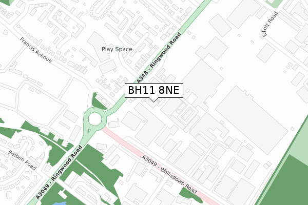
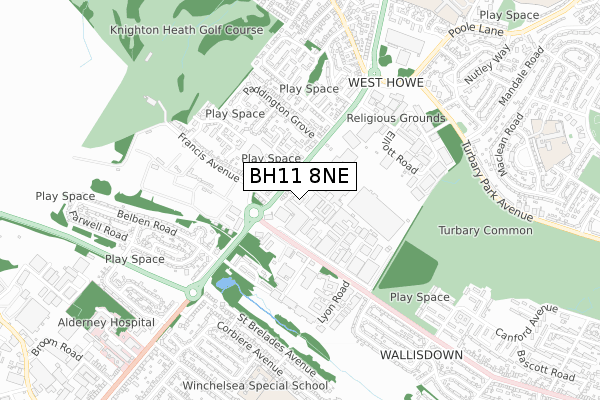
BH11 8NE is located in the Kinson electoral ward, within the unitary authority of Bournemouth, Christchurch and Poole and the English Parliamentary constituency of Bournemouth West. The Sub Integrated Care Board (ICB) Location is NHS Dorset ICB - 11J and the police force is Dorset. This postcode has been in use since January 1980.


GetTheData
Source: OS Open Zoomstack (Ordnance Survey)
Licence: Open Government Licence (requires attribution)
Attribution: Contains OS data © Crown copyright and database right 2025
Source: Open Postcode Geo
Licence: Open Government Licence (requires attribution)
Attribution: Contains OS data © Crown copyright and database right 2025; Contains Royal Mail data © Royal Mail copyright and database right 2025; Source: Office for National Statistics licensed under the Open Government Licence v.3.0
| Easting | 405050 |
| Northing | 94999 |
| Latitude | 50.754557 |
| Longitude | -1.929768 |
GetTheData
Source: Open Postcode Geo
Licence: Open Government Licence
| Country | England |
| Postcode District | BH11 |
➜ See where BH11 is on a map ➜ Where is Bournemouth? | |
GetTheData
Source: Land Registry Price Paid Data
Licence: Open Government Licence
Elevation or altitude of BH11 8NE as distance above sea level:
| Metres | Feet | |
|---|---|---|
| Elevation | 60m | 197ft |
Elevation is measured from the approximate centre of the postcode, to the nearest point on an OS contour line from OS Terrain 50, which has contour spacing of ten vertical metres.
➜ How high above sea level am I? Find the elevation of your current position using your device's GPS.
GetTheData
Source: Open Postcode Elevation
Licence: Open Government Licence
| Ward | Kinson |
| Constituency | Bournemouth West |
GetTheData
Source: ONS Postcode Database
Licence: Open Government Licence
| Francis Avenue (Ringwood Road) | West Howe | 98m |
| Francis Avenue (Ringwood Road) | West Howe | 103m |
| Mountbatten Arms (Wallisdown Road) | Wallisdown | 167m |
| Mountbatten Arms (Wallisdown Road) | Wallisdown | 174m |
| Paddington Grove (Ringwood Road) | West Howe | 209m |
| Branksome Station | 3.2km |
| Parkstone (Dorset) Station | 3.7km |
| Poole Station | 5.4km |
GetTheData
Source: NaPTAN
Licence: Open Government Licence
GetTheData
Source: ONS Postcode Database
Licence: Open Government Licence


➜ Get more ratings from the Food Standards Agency
GetTheData
Source: Food Standards Agency
Licence: FSA terms & conditions
| Last Collection | |||
|---|---|---|---|
| Location | Mon-Fri | Sat | Distance |
| 875 Ringwood Road | 17:45 | 13:00 | 75m |
| Wallisdown Road | 17:30 | 12:30 | 304m |
| Littlemoor Ave | 17:30 | 13:00 | 364m |
GetTheData
Source: Dracos
Licence: Creative Commons Attribution-ShareAlike
The below table lists the International Territorial Level (ITL) codes (formerly Nomenclature of Territorial Units for Statistics (NUTS) codes) and Local Administrative Units (LAU) codes for BH11 8NE:
| ITL 1 Code | Name |
|---|---|
| TLK | South West (England) |
| ITL 2 Code | Name |
| TLK2 | Dorset and Somerset |
| ITL 3 Code | Name |
| TLK24 | Bournemouth, Christchurch and Poole |
| LAU 1 Code | Name |
| E06000058 | Bournemouth, Christchurch and Poole |
GetTheData
Source: ONS Postcode Directory
Licence: Open Government Licence
The below table lists the Census Output Area (OA), Lower Layer Super Output Area (LSOA), and Middle Layer Super Output Area (MSOA) for BH11 8NE:
| Code | Name | |
|---|---|---|
| OA | E00077405 | |
| LSOA | E01015308 | Bournemouth 002C |
| MSOA | E02003173 | Bournemouth 002 |
GetTheData
Source: ONS Postcode Directory
Licence: Open Government Licence
| BH11 8LJ | Ringwood Road | 64m |
| BH11 8LW | Ringwood Road | 99m |
| BH11 8NF | Ringwood Road | 133m |
| BH11 8NU | Francis Avenue | 160m |
| BH11 8LL | 164m | |
| BH11 8NZ | St Georges Drive | 218m |
| BH11 8NY | St Georges Drive | 274m |
| BH11 8NT | Stillmore Road | 340m |
| BH11 8NX | Francis Avenue | 349m |
| BH12 4PQ | Loewy Crescent | 365m |
GetTheData
Source: Open Postcode Geo; Land Registry Price Paid Data
Licence: Open Government Licence