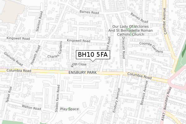
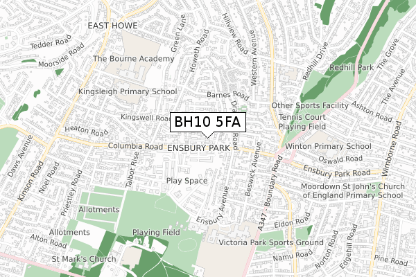
BH10 5FA is located in the Redhill & Northbourne electoral ward, within the unitary authority of Bournemouth, Christchurch and Poole and the English Parliamentary constituency of Bournemouth West. The Sub Integrated Care Board (ICB) Location is NHS Dorset ICB - 11J and the police force is Dorset. This postcode has been in use since August 2019.


GetTheData
Source: OS Open Zoomstack (Ordnance Survey)
Licence: Open Government Licence (requires attribution)
Attribution: Contains OS data © Crown copyright and database right 2024
Source: Open Postcode Geo
Licence: Open Government Licence (requires attribution)
Attribution: Contains OS data © Crown copyright and database right 2024; Contains Royal Mail data © Royal Mail copyright and database right 2024; Source: Office for National Statistics licensed under the Open Government Licence v.3.0
| Easting | 407707 |
| Northing | 94779 |
| Latitude | 50.752550 |
| Longitude | -1.892106 |
GetTheData
Source: Open Postcode Geo
Licence: Open Government Licence
| Country | England |
| Postcode District | BH10 |
| ➜ BH10 open data dashboard ➜ See where BH10 is on a map ➜ Where is Bournemouth? | |
GetTheData
Source: Land Registry Price Paid Data
Licence: Open Government Licence
| Ward | Redhill & Northbourne |
| Constituency | Bournemouth West |
GetTheData
Source: ONS Postcode Database
Licence: Open Government Licence
| January 2024 | Violence and sexual offences | On or near Ashleigh Rise | 269m |
| January 2024 | Violence and sexual offences | On or near Parking Area | 491m |
| December 2023 | Anti-social behaviour | On or near Ashleigh Rise | 269m |
| ➜ Get more crime data in our Crime section | |||
GetTheData
Source: data.police.uk
Licence: Open Government Licence
| Hendford Road (Columbia Road) | Ensbury Park | 55m |
| Hendford Road (Columbia Road) | Ensbury Park | 66m |
| Jubilee Gardens (Slades Farm Road) | Ensbury Park | 256m |
| Howeth Road (Columbia Road) | Ensbury Park | 264m |
| Gorsecliffe Road (Ensbury Avenue) | Ensbury Park | 287m |
| Bournemouth Station | 3.4km |
| Branksome Station | 3.5km |
| Parkstone (Dorset) Station | 5.1km |
GetTheData
Source: NaPTAN
Licence: Open Government Licence
GetTheData
Source: ONS Postcode Database
Licence: Open Government Licence


➜ Get more ratings from the Food Standards Agency
GetTheData
Source: Food Standards Agency
Licence: FSA terms & conditions
| Last Collection | |||
|---|---|---|---|
| Location | Mon-Fri | Sat | Distance |
| Ensbury Park P.o. | 17:30 | 11:30 | 80m |
| 43 Draycott Road | 17:45 | 11:45 | 231m |
| Howeth Road | 17:45 | 11:45 | 337m |
GetTheData
Source: Dracos
Licence: Creative Commons Attribution-ShareAlike
| Facility | Distance |
|---|---|
| Slades Park Ensbury Avenue, Bournemouth Grass Pitches, Artificial Grass Pitch | 541m |
| Glenmoor And Winton Academies Beswick Avenue, Bournemouth Health and Fitness Gym, Grass Pitches, Sports Hall, Outdoor Tennis Courts, Studio | 579m |
| Redhill Park Tennis Courts Redhill Avenue, Bournemouth Outdoor Tennis Courts | 581m |
GetTheData
Source: Active Places
Licence: Open Government Licence
| School | Phase of Education | Distance |
|---|---|---|
| Glenmoor Academy Beswick Avenue, Ensbury Park, Bournemouth, BH10 4EX | Secondary | 578m |
| Hill View Primary School Hill View Road, Ensbury Park, Bournemouth, BH10 5BD | Primary | 583m |
| Winton Academy Winton Way, Bournemouth, BH10 4HT | Secondary | 604m |
GetTheData
Source: Edubase
Licence: Open Government Licence
The below table lists the International Territorial Level (ITL) codes (formerly Nomenclature of Territorial Units for Statistics (NUTS) codes) and Local Administrative Units (LAU) codes for BH10 5FA:
| ITL 1 Code | Name |
|---|---|
| TLK | South West (England) |
| ITL 2 Code | Name |
| TLK2 | Dorset and Somerset |
| ITL 3 Code | Name |
| TLK24 | Bournemouth, Christchurch and Poole |
| LAU 1 Code | Name |
| E06000058 | Bournemouth, Christchurch and Poole |
GetTheData
Source: ONS Postcode Directory
Licence: Open Government Licence
The below table lists the Census Output Area (OA), Lower Layer Super Output Area (LSOA), and Middle Layer Super Output Area (MSOA) for BH10 5FA:
| Code | Name | |
|---|---|---|
| OA | E00077536 | |
| LSOA | E01015337 | Bournemouth 003E |
| MSOA | E02003174 | Bournemouth 003 |
GetTheData
Source: ONS Postcode Directory
Licence: Open Government Licence
| BH10 4FP | Orchard Close | 18m |
| BH10 5DR | Kingswell Close | 49m |
| BH10 5BA | Hendford Gardens | 53m |
| BH10 4ED | Columbia Road | 54m |
| BH10 4GB | Kings Close | 62m |
| BH10 4DX | Columbia Road | 86m |
| BH10 5AT | Hendford Road | 87m |
| BH10 5DT | Mabey Avenue | 117m |
| BH10 5DF | Kingswell Road | 130m |
| BH10 4EB | Columbia Road | 130m |
GetTheData
Source: Open Postcode Geo; Land Registry Price Paid Data
Licence: Open Government Licence