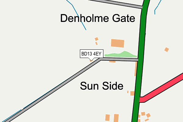
BD13 4EY lies on Foreside Lane in Denholme, Bradford. BD13 4EY is located in the Bingley Rural electoral ward, within the metropolitan district of Bradford and the English Parliamentary constituency of Shipley. The Sub Integrated Care Board (ICB) Location is NHS West Yorkshire ICB - 36J and the police force is West Yorkshire. This postcode has been in use since January 1980.


GetTheData
Source: OS OpenMap – Local (Ordnance Survey)
Source: OS VectorMap District (Ordnance Survey)
Licence: Open Government Licence (requires attribution)
| Easting | 406865 |
| Northing | 432118 |
| Latitude | 53.785341 |
| Longitude | -1.897289 |
GetTheData
Source: Open Postcode Geo
Licence: Open Government Licence
| Street | Foreside Lane |
| Locality | Denholme |
| Town/City | Bradford |
| Country | England |
| Postcode District | BD13 |
➜ See where BD13 is on a map ➜ Where is Denholme? | |
GetTheData
Source: Land Registry Price Paid Data
Licence: Open Government Licence
Elevation or altitude of BD13 4EY as distance above sea level:
| Metres | Feet | |
|---|---|---|
| Elevation | 330m | 1,083ft |
Elevation is measured from the approximate centre of the postcode, to the nearest point on an OS contour line from OS Terrain 50, which has contour spacing of ten vertical metres.
➜ How high above sea level am I? Find the elevation of your current position using your device's GPS.
GetTheData
Source: Open Postcode Elevation
Licence: Open Government Licence
| Ward | Bingley Rural |
| Constituency | Shipley |
GetTheData
Source: ONS Postcode Database
Licence: Open Government Licence
FERNBANK, FORESIDE LANE, DENHOLME, BRADFORD, BD13 4EY 2006 2 JUN £280,000 |
GetTheData
Source: HM Land Registry Price Paid Data
Licence: Contains HM Land Registry data © Crown copyright and database right 2025. This data is licensed under the Open Government Licence v3.0.
| Halifax Rd Thornton Road (Halifax Road) | Denholme | 162m |
| Halifax Road Foreside Mill (Halifax Road) | Denholme | 163m |
| Halifax Road Thornton Rd (Halifax Road) | Denholme | 164m |
| Halifax Road Cragg Lane (Halifax Road) | Denholme | 409m |
| Halifax Rd Cragg Lane (Halifax Road) | Denholme | 425m |
GetTheData
Source: NaPTAN
Licence: Open Government Licence
| Percentage of properties with Next Generation Access | 100.0% |
| Percentage of properties with Superfast Broadband | 100.0% |
| Percentage of properties with Ultrafast Broadband | 0.0% |
| Percentage of properties with Full Fibre Broadband | 0.0% |
Superfast Broadband is between 30Mbps and 300Mbps
Ultrafast Broadband is > 300Mbps
| Percentage of properties unable to receive 2Mbps | 0.0% |
| Percentage of properties unable to receive 5Mbps | 0.0% |
| Percentage of properties unable to receive 10Mbps | 0.0% |
| Percentage of properties unable to receive 30Mbps | 0.0% |
GetTheData
Source: Ofcom
Licence: Ofcom Terms of Use (requires attribution)
GetTheData
Source: ONS Postcode Database
Licence: Open Government Licence


➜ Get more ratings from the Food Standards Agency
GetTheData
Source: Food Standards Agency
Licence: FSA terms & conditions
| Last Collection | |||
|---|---|---|---|
| Location | Mon-Fri | Sat | Distance |
| Fieldhead Estate | 17:00 | 12:00 | 2,704m |
| 2 Park Lane Queensbury | 17:45 | 12:00 | 4,471m |
| Baldwin Lane | 17:15 | 12:00 | 4,622m |
GetTheData
Source: Dracos
Licence: Creative Commons Attribution-ShareAlike
The below table lists the International Territorial Level (ITL) codes (formerly Nomenclature of Territorial Units for Statistics (NUTS) codes) and Local Administrative Units (LAU) codes for BD13 4EY:
| ITL 1 Code | Name |
|---|---|
| TLE | Yorkshire and The Humber |
| ITL 2 Code | Name |
| TLE4 | West Yorkshire |
| ITL 3 Code | Name |
| TLE41 | Bradford |
| LAU 1 Code | Name |
| E08000032 | Bradford |
GetTheData
Source: ONS Postcode Directory
Licence: Open Government Licence
The below table lists the Census Output Area (OA), Lower Layer Super Output Area (LSOA), and Middle Layer Super Output Area (MSOA) for BD13 4EY:
| Code | Name | |
|---|---|---|
| OA | E00053498 | |
| LSOA | E01010595 | Bradford 031D |
| MSOA | E02002213 | Bradford 031 |
GetTheData
Source: ONS Postcode Directory
Licence: Open Government Licence
| BD13 4HA | County Bridge | 148m |
| BD13 4HB | Halifax Road | 239m |
| BD13 4EU | Halifax Road | 422m |
| BD13 4HP | Cragg Lane | 517m |
| BD13 4ET | Black Edge Lane | 552m |
| BD13 4HR | Old Fort | 624m |
| HX2 8YD | 661m | |
| BD13 4EG | John Hanson Court | 668m |
| BD13 4EJ | Monarch Gate | 733m |
| BD13 4HN | Brighouse Road | 734m |
GetTheData
Source: Open Postcode Geo; Land Registry Price Paid Data
Licence: Open Government Licence