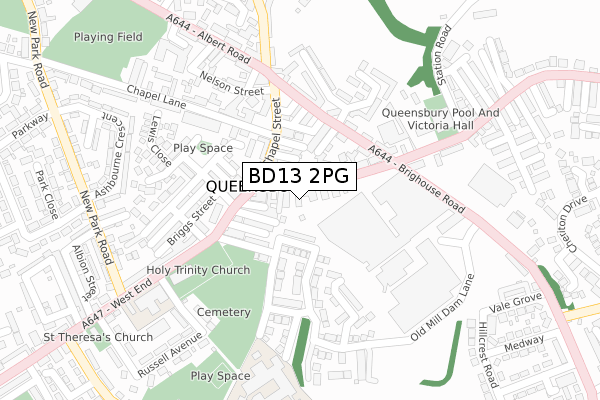
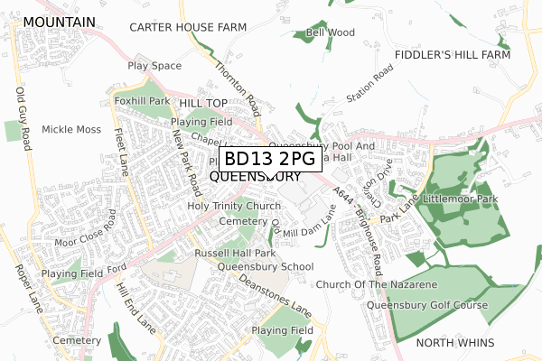
BD13 2PG lies on Olive Place in Queensbury, Bradford. BD13 2PG is located in the Queensbury electoral ward, within the metropolitan district of Bradford and the English Parliamentary constituency of Bradford South. The Sub Integrated Care Board (ICB) Location is NHS West Yorkshire ICB - 36J and the police force is West Yorkshire. This postcode has been in use since January 1980.


GetTheData
Source: OS Open Zoomstack (Ordnance Survey)
Licence: Open Government Licence (requires attribution)
Attribution: Contains OS data © Crown copyright and database right 2025
Source: Open Postcode Geo
Licence: Open Government Licence (requires attribution)
Attribution: Contains OS data © Crown copyright and database right 2025; Contains Royal Mail data © Royal Mail copyright and database right 2025; Source: Office for National Statistics licensed under the Open Government Licence v.3.0
| Easting | 410240 |
| Northing | 430191 |
| Latitude | 53.767966 |
| Longitude | -1.846129 |
GetTheData
Source: Open Postcode Geo
Licence: Open Government Licence
| Street | Olive Place |
| Locality | Queensbury |
| Town/City | Bradford |
| Country | England |
| Postcode District | BD13 |
➜ See where BD13 is on a map ➜ Where is Queensbury? | |
GetTheData
Source: Land Registry Price Paid Data
Licence: Open Government Licence
Elevation or altitude of BD13 2PG as distance above sea level:
| Metres | Feet | |
|---|---|---|
| Elevation | 340m | 1,115ft |
Elevation is measured from the approximate centre of the postcode, to the nearest point on an OS contour line from OS Terrain 50, which has contour spacing of ten vertical metres.
➜ How high above sea level am I? Find the elevation of your current position using your device's GPS.
GetTheData
Source: Open Postcode Elevation
Licence: Open Government Licence
| Ward | Queensbury |
| Constituency | Bradford South |
GetTheData
Source: ONS Postcode Database
Licence: Open Government Licence
| High Street Brighouse Rd (High Street) | Queensbury | 108m |
| High Street Brighouse Rd (High Street) | Queensbury | 114m |
| Chapel Street Cenotaph (Chapel Street) | Queensbury | 115m |
| Chapel Street Cenotaph (Chapel Street) | Queensbury | 126m |
| Brighouse Road Sandbeds (Brighouse Road) | Queensbury | 238m |
GetTheData
Source: NaPTAN
Licence: Open Government Licence
| Percentage of properties with Next Generation Access | 100.0% |
| Percentage of properties with Superfast Broadband | 100.0% |
| Percentage of properties with Ultrafast Broadband | 66.7% |
| Percentage of properties with Full Fibre Broadband | 0.0% |
Superfast Broadband is between 30Mbps and 300Mbps
Ultrafast Broadband is > 300Mbps
| Percentage of properties unable to receive 2Mbps | 0.0% |
| Percentage of properties unable to receive 5Mbps | 0.0% |
| Percentage of properties unable to receive 10Mbps | 0.0% |
| Percentage of properties unable to receive 30Mbps | 0.0% |
GetTheData
Source: Ofcom
Licence: Ofcom Terms of Use (requires attribution)
GetTheData
Source: ONS Postcode Database
Licence: Open Government Licence


➜ Get more ratings from the Food Standards Agency
GetTheData
Source: Food Standards Agency
Licence: FSA terms & conditions
| Last Collection | |||
|---|---|---|---|
| Location | Mon-Fri | Sat | Distance |
| 2 Park Lane Queensbury | 17:45 | 12:00 | 758m |
| Baldwin Lane | 17:15 | 12:00 | 1,699m |
| 61 The Avenue Clayton | 17:45 | 12:00 | 2,307m |
GetTheData
Source: Dracos
Licence: Creative Commons Attribution-ShareAlike
The below table lists the International Territorial Level (ITL) codes (formerly Nomenclature of Territorial Units for Statistics (NUTS) codes) and Local Administrative Units (LAU) codes for BD13 2PG:
| ITL 1 Code | Name |
|---|---|
| TLE | Yorkshire and The Humber |
| ITL 2 Code | Name |
| TLE4 | West Yorkshire |
| ITL 3 Code | Name |
| TLE41 | Bradford |
| LAU 1 Code | Name |
| E08000032 | Bradford |
GetTheData
Source: ONS Postcode Directory
Licence: Open Government Licence
The below table lists the Census Output Area (OA), Lower Layer Super Output Area (LSOA), and Middle Layer Super Output Area (MSOA) for BD13 2PG:
| Code | Name | |
|---|---|---|
| OA | E00054254 | |
| LSOA | E01010752 | Bradford 058A |
| MSOA | E02002240 | Bradford 058 |
GetTheData
Source: ONS Postcode Directory
Licence: Open Government Licence
| BD13 2PE | High Street | 16m |
| BD13 2PQ | Morpeth Street | 24m |
| BD13 2PF | High Street Place | 45m |
| BD13 2PH | Russell Street | 45m |
| BD13 2AB | High Croft | 66m |
| BD13 2PJ | Gothic Street | 66m |
| BD13 2AE | Spring Garden Street | 69m |
| BD13 2PA | High Street | 71m |
| BD13 2AA | High Street | 79m |
| BD13 2QJ | Cambridge Place | 79m |
GetTheData
Source: Open Postcode Geo; Land Registry Price Paid Data
Licence: Open Government Licence