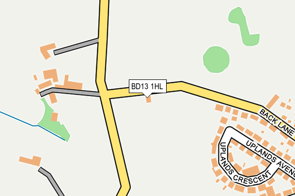
BD13 1HL lies on Back Lane in Queensbury, Bradford. BD13 1HL is located in the Queensbury electoral ward, within the metropolitan district of Bradford and the English Parliamentary constituency of Bradford South. The Sub Integrated Care Board (ICB) Location is NHS West Yorkshire ICB - 36J and the police force is West Yorkshire. This postcode has been in use since March 1988.


GetTheData
Source: OS OpenMap – Local (Ordnance Survey)
Source: OS VectorMap District (Ordnance Survey)
Licence: Open Government Licence (requires attribution)
| Easting | 411507 |
| Northing | 430870 |
| Latitude | 53.774043 |
| Longitude | -1.826883 |
GetTheData
Source: Open Postcode Geo
Licence: Open Government Licence
| Street | Back Lane |
| Locality | Queensbury |
| Town/City | Bradford |
| Country | England |
| Postcode District | BD13 |
➜ See where BD13 is on a map | |
GetTheData
Source: Land Registry Price Paid Data
Licence: Open Government Licence
Elevation or altitude of BD13 1HL as distance above sea level:
| Metres | Feet | |
|---|---|---|
| Elevation | 290m | 951ft |
Elevation is measured from the approximate centre of the postcode, to the nearest point on an OS contour line from OS Terrain 50, which has contour spacing of ten vertical metres.
➜ How high above sea level am I? Find the elevation of your current position using your device's GPS.
GetTheData
Source: Open Postcode Elevation
Licence: Open Government Licence
| Ward | Queensbury |
| Constituency | Bradford South |
GetTheData
Source: ONS Postcode Database
Licence: Open Government Licence
| Highgate Rd Stocks Lane (Highgate Road) | Clayton Heights | 382m |
| Highgate Road Woodlands Rd (Highgate Road) | Clayton Heights | 393m |
| Highgate Road Woodlands Rd (Highgate Road) | Clayton Heights | 398m |
| Highgate Road Uplands Ave (Highgate Road) | Clayton Heights | 408m |
| Scarlett Heights Littlemoor (Scarlet Heights) | Queensbury | 541m |
| Bradford Forster Square Station | 5.5km |
| Low Moor Station | 5.5km |
GetTheData
Source: NaPTAN
Licence: Open Government Licence
| Percentage of properties with Next Generation Access | 100.0% |
| Percentage of properties with Superfast Broadband | 100.0% |
| Percentage of properties with Ultrafast Broadband | 0.0% |
| Percentage of properties with Full Fibre Broadband | 0.0% |
Superfast Broadband is between 30Mbps and 300Mbps
Ultrafast Broadband is > 300Mbps
| Percentage of properties unable to receive 2Mbps | 0.0% |
| Percentage of properties unable to receive 5Mbps | 0.0% |
| Percentage of properties unable to receive 10Mbps | 0.0% |
| Percentage of properties unable to receive 30Mbps | 0.0% |
GetTheData
Source: Ofcom
Licence: Ofcom Terms of Use (requires attribution)
GetTheData
Source: ONS Postcode Database
Licence: Open Government Licence


➜ Get more ratings from the Food Standards Agency
GetTheData
Source: Food Standards Agency
Licence: FSA terms & conditions
| Last Collection | |||
|---|---|---|---|
| Location | Mon-Fri | Sat | Distance |
| Baldwin Lane | 17:15 | 12:00 | 537m |
| 2 Park Lane Queensbury | 17:45 | 12:00 | 732m |
| 3 Glenholme Park | 17:30 | 11:45 | 1,017m |
GetTheData
Source: Dracos
Licence: Creative Commons Attribution-ShareAlike
The below table lists the International Territorial Level (ITL) codes (formerly Nomenclature of Territorial Units for Statistics (NUTS) codes) and Local Administrative Units (LAU) codes for BD13 1HL:
| ITL 1 Code | Name |
|---|---|
| TLE | Yorkshire and The Humber |
| ITL 2 Code | Name |
| TLE4 | West Yorkshire |
| ITL 3 Code | Name |
| TLE41 | Bradford |
| LAU 1 Code | Name |
| E08000032 | Bradford |
GetTheData
Source: ONS Postcode Directory
Licence: Open Government Licence
The below table lists the Census Output Area (OA), Lower Layer Super Output Area (LSOA), and Middle Layer Super Output Area (MSOA) for BD13 1HL:
| Code | Name | |
|---|---|---|
| OA | E00054249 | |
| LSOA | E01010752 | Bradford 058A |
| MSOA | E02002240 | Bradford 058 |
GetTheData
Source: ONS Postcode Directory
Licence: Open Government Licence
| BD14 6PS | Brow Top | 193m |
| BD13 1EP | Uplands Crescent | 225m |
| BD13 1ER | Uplands Avenue | 241m |
| BD13 1HJ | Roundhill Place | 254m |
| BD13 1HN | Baldwin Lane | 277m |
| BD13 1HG | Roundhill Close | 307m |
| BD13 1EW | Uplands Grove | 314m |
| BD13 1HB | Back Lane | 338m |
| BD13 1DR | Highgate Road | 343m |
| BD13 1EQ | Prince Albert Square | 346m |
GetTheData
Source: Open Postcode Geo; Land Registry Price Paid Data
Licence: Open Government Licence