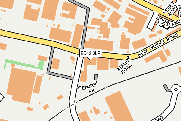
BD12 0LP is located in the Wyke electoral ward, within the metropolitan district of Bradford and the English Parliamentary constituency of Bradford South. The Sub Integrated Care Board (ICB) Location is NHS West Yorkshire ICB - 36J and the police force is West Yorkshire. This postcode has been in use since July 1990.


GetTheData
Source: OS OpenMap – Local (Ordnance Survey)
Source: OS VectorMap District (Ordnance Survey)
Licence: Open Government Licence (requires attribution)
| Easting | 416052 |
| Northing | 428187 |
| Latitude | 53.749824 |
| Longitude | -1.758063 |
GetTheData
Source: Open Postcode Geo
Licence: Open Government Licence
| Country | England |
| Postcode District | BD12 |
➜ See where BD12 is on a map ➜ Where is Bradford? | |
GetTheData
Source: Land Registry Price Paid Data
Licence: Open Government Licence
Elevation or altitude of BD12 0LP as distance above sea level:
| Metres | Feet | |
|---|---|---|
| Elevation | 140m | 459ft |
Elevation is measured from the approximate centre of the postcode, to the nearest point on an OS contour line from OS Terrain 50, which has contour spacing of ten vertical metres.
➜ How high above sea level am I? Find the elevation of your current position using your device's GPS.
GetTheData
Source: Open Postcode Elevation
Licence: Open Government Licence
| Ward | Wyke |
| Constituency | Bradford South |
GetTheData
Source: ONS Postcode Database
Licence: Open Government Licence
| Cleckheaton Road Terry Rd (Cleckheaton Road) | Low Moor | 293m |
| Cleckheaton Road New Works Rd (Cleckheaton Road) | Low Moor | 325m |
| Cleckheaton Road Chapel Rd (Cleckheaton Road) | Low Moor | 350m |
| Cleckheaton Road Chapel Rd (Cleckheaton Road) | Low Moor | 388m |
| Cleckheaton Rd Furnace Road (Cleckheaton Road) | Oakenshaw | 495m |
| Low Moor Station | 0.3km |
| Bradford Interchange Station | 4.6km |
GetTheData
Source: NaPTAN
Licence: Open Government Licence
GetTheData
Source: ONS Postcode Database
Licence: Open Government Licence


➜ Get more ratings from the Food Standards Agency
GetTheData
Source: Food Standards Agency
Licence: FSA terms & conditions
| Last Collection | |||
|---|---|---|---|
| Location | Mon-Fri | Sat | Distance |
| Carr Lane | 17:00 | 12:00 | 301m |
| Low Moor Business Box | 18:30 | 11:45 | 381m |
| 451 Cleckheaton Road | 17:45 | 11:45 | 874m |
GetTheData
Source: Dracos
Licence: Creative Commons Attribution-ShareAlike
The below table lists the International Territorial Level (ITL) codes (formerly Nomenclature of Territorial Units for Statistics (NUTS) codes) and Local Administrative Units (LAU) codes for BD12 0LP:
| ITL 1 Code | Name |
|---|---|
| TLE | Yorkshire and The Humber |
| ITL 2 Code | Name |
| TLE4 | West Yorkshire |
| ITL 3 Code | Name |
| TLE41 | Bradford |
| LAU 1 Code | Name |
| E08000032 | Bradford |
GetTheData
Source: ONS Postcode Directory
Licence: Open Government Licence
The below table lists the Census Output Area (OA), Lower Layer Super Output Area (LSOA), and Middle Layer Super Output Area (MSOA) for BD12 0LP:
| Code | Name | |
|---|---|---|
| OA | E00054793 | |
| LSOA | E01010866 | Bradford 060E |
| MSOA | E02002242 | Bradford 060 |
GetTheData
Source: ONS Postcode Directory
Licence: Open Government Licence
| BD12 0LA | Moorland View | 247m |
| BD12 0LB | New Works Road | 269m |
| BD12 0LE | Moorland Place | 271m |
| BD12 0JY | Cleckheaton Road | 280m |
| BD12 0JL | Cleckheaton Road | 287m |
| BD12 0LQ | Cleckheaton Road | 295m |
| BD12 0LG | Potter Close | 316m |
| BD12 0JH | Chapel Road | 323m |
| BD12 0LJ | Cleckheaton Road | 327m |
| BD12 0LL | Terry Road | 341m |
GetTheData
Source: Open Postcode Geo; Land Registry Price Paid Data
Licence: Open Government Licence