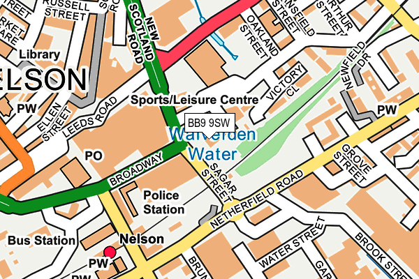
BB9 9SW is located in the Bradley electoral ward, within the local authority district of Pendle and the English Parliamentary constituency of Pendle. The Sub Integrated Care Board (ICB) Location is NHS Lancashire and South Cumbria ICB - 01A and the police force is Lancashire. This postcode has been in use since January 1980.


GetTheData
Source: OS OpenMap – Local (Ordnance Survey)
Source: OS VectorMap District (Ordnance Survey)
Licence: Open Government Licence (requires attribution)
| Easting | 386155 |
| Northing | 437802 |
| Latitude | 53.836284 |
| Longitude | -2.211866 |
GetTheData
Source: Open Postcode Geo
Licence: Open Government Licence
| Country | England |
| Postcode District | BB9 |
➜ See where BB9 is on a map ➜ Where is Nelson? | |
GetTheData
Source: Land Registry Price Paid Data
Licence: Open Government Licence
Elevation or altitude of BB9 9SW as distance above sea level:
| Metres | Feet | |
|---|---|---|
| Elevation | 140m | 459ft |
Elevation is measured from the approximate centre of the postcode, to the nearest point on an OS contour line from OS Terrain 50, which has contour spacing of ten vertical metres.
➜ How high above sea level am I? Find the elevation of your current position using your device's GPS.
GetTheData
Source: Open Postcode Elevation
Licence: Open Government Licence
| Ward | Bradley |
| Constituency | Pendle |
GetTheData
Source: ONS Postcode Database
Licence: Open Government Licence
| Broadway | Nelson | 51m |
| Wavelengths (Leeds Road) | Nelson | 143m |
| Wavelengths (Leeds Road) | Nelson | 179m |
| New Scotland Road | Nelson | 200m |
| New Scotland Road | Nelson | 211m |
| Nelson Station | 0.2km |
| Brierfield Station | 2.1km |
| Colne Station | 2.8km |
GetTheData
Source: NaPTAN
Licence: Open Government Licence
GetTheData
Source: ONS Postcode Database
Licence: Open Government Licence


➜ Get more ratings from the Food Standards Agency
GetTheData
Source: Food Standards Agency
Licence: FSA terms & conditions
| Last Collection | |||
|---|---|---|---|
| Location | Mon-Fri | Sat | Distance |
| Hill Place | 17:30 | 12:00 | 937m |
| St Johns | 17:30 | 11:00 | 1,455m |
| 46 Carr Road | 16:00 | 11:00 | 1,936m |
GetTheData
Source: Dracos
Licence: Creative Commons Attribution-ShareAlike
The below table lists the International Territorial Level (ITL) codes (formerly Nomenclature of Territorial Units for Statistics (NUTS) codes) and Local Administrative Units (LAU) codes for BB9 9SW:
| ITL 1 Code | Name |
|---|---|
| TLD | North West (England) |
| ITL 2 Code | Name |
| TLD4 | Lancashire |
| ITL 3 Code | Name |
| TLD46 | East Lancashire |
| LAU 1 Code | Name |
| E07000122 | Pendle |
GetTheData
Source: ONS Postcode Directory
Licence: Open Government Licence
The below table lists the Census Output Area (OA), Lower Layer Super Output Area (LSOA), and Middle Layer Super Output Area (MSOA) for BB9 9SW:
| Code | Name | |
|---|---|---|
| OA | E00127814 | |
| LSOA | E01025182 | Pendle 009B |
| MSOA | E02005248 | Pendle 009 |
GetTheData
Source: ONS Postcode Directory
Licence: Open Government Licence
| BB9 9ED | Victory Close | 135m |
| BB9 9SJ | Broadway | 145m |
| BB9 9SG | Railway Street | 162m |
| BB9 9TD | Leeds Road | 165m |
| BB9 9XX | Chapel Street | 176m |
| BB9 9AN | Place De Criel | 198m |
| BB9 9YD | Stansfield Street | 207m |
| BB9 7UU | Scotland Road | 211m |
| BB9 9XT | Chapel Street | 217m |
| BB9 7UT | Scotland Road | 218m |
GetTheData
Source: Open Postcode Geo; Land Registry Price Paid Data
Licence: Open Government Licence