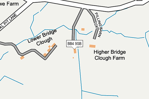
BB4 9SB lies on Coal Pit Lane in Whitewell Bottom, Rossendale. BB4 9SB is located in the Whitewell electoral ward, within the local authority district of Rossendale and the English Parliamentary constituency of Rossendale and Darwen. The Sub Integrated Care Board (ICB) Location is NHS Lancashire and South Cumbria ICB - 01A and the police force is Lancashire. This postcode has been in use since January 1980.


GetTheData
Source: OS OpenMap – Local (Ordnance Survey)
Source: OS VectorMap District (Ordnance Survey)
Licence: Open Government Licence (requires attribution)
| Easting | 384681 |
| Northing | 423549 |
| Latitude | 53.708138 |
| Longitude | -2.233552 |
GetTheData
Source: Open Postcode Geo
Licence: Open Government Licence
| Street | Coal Pit Lane |
| Locality | Whitewell Bottom |
| Town/City | Rossendale |
| Country | England |
| Postcode District | BB4 |
➜ See where BB4 is on a map | |
GetTheData
Source: Land Registry Price Paid Data
Licence: Open Government Licence
Elevation or altitude of BB4 9SB as distance above sea level:
| Metres | Feet | |
|---|---|---|
| Elevation | 290m | 951ft |
Elevation is measured from the approximate centre of the postcode, to the nearest point on an OS contour line from OS Terrain 50, which has contour spacing of ten vertical metres.
➜ How high above sea level am I? Find the elevation of your current position using your device's GPS.
GetTheData
Source: Open Postcode Elevation
Licence: Open Government Licence
| Ward | Whitewell |
| Constituency | Rossendale And Darwen |
GetTheData
Source: ONS Postcode Database
Licence: Open Government Licence
| Foxhill Drive | Whitewell Bottom | 901m |
| Foxhill Drive | Whitewell Bottom | 985m |
| Baptist Church (Edgeside Lane) | Edgeside | 1,017m |
| Baptist Church (Edgeside Lane) | Edgeside | 1,030m |
| Ashworth Lane | Edgeside | 1,030m |
GetTheData
Source: NaPTAN
Licence: Open Government Licence
| Percentage of properties with Next Generation Access | 100.0% |
| Percentage of properties with Superfast Broadband | 42.9% |
| Percentage of properties with Ultrafast Broadband | 0.0% |
| Percentage of properties with Full Fibre Broadband | 0.0% |
Superfast Broadband is between 30Mbps and 300Mbps
Ultrafast Broadband is > 300Mbps
| Percentage of properties unable to receive 2Mbps | 0.0% |
| Percentage of properties unable to receive 5Mbps | 0.0% |
| Percentage of properties unable to receive 10Mbps | 0.0% |
| Percentage of properties unable to receive 30Mbps | 57.1% |
GetTheData
Source: Ofcom
Licence: Ofcom Terms of Use (requires attribution)
GetTheData
Source: ONS Postcode Database
Licence: Open Government Licence


➜ Get more ratings from the Food Standards Agency
GetTheData
Source: Food Standards Agency
Licence: FSA terms & conditions
| Last Collection | |||
|---|---|---|---|
| Location | Mon-Fri | Sat | Distance |
| Stacksteads P.o. | 17:00 | 11:30 | 1,827m |
| Bacup Bo | 17:45 | 12:00 | 2,168m |
| 37 Market Street | 17:15 | 11:30 | 2,237m |
GetTheData
Source: Dracos
Licence: Creative Commons Attribution-ShareAlike
The below table lists the International Territorial Level (ITL) codes (formerly Nomenclature of Territorial Units for Statistics (NUTS) codes) and Local Administrative Units (LAU) codes for BB4 9SB:
| ITL 1 Code | Name |
|---|---|
| TLD | North West (England) |
| ITL 2 Code | Name |
| TLD4 | Lancashire |
| ITL 3 Code | Name |
| TLD46 | East Lancashire |
| LAU 1 Code | Name |
| E07000125 | Rossendale |
GetTheData
Source: ONS Postcode Directory
Licence: Open Government Licence
The below table lists the Census Output Area (OA), Lower Layer Super Output Area (LSOA), and Middle Layer Super Output Area (MSOA) for BB4 9SB:
| Code | Name | |
|---|---|---|
| OA | E00128863 | |
| LSOA | E01025393 | Rossendale 001D |
| MSOA | E02005278 | Rossendale 001 |
GetTheData
Source: ONS Postcode Directory
Licence: Open Government Licence
| BB4 9SA | Coal Pit Lane | 476m |
| OL13 8NN | Brex | 646m |
| BB4 9SD | Edgeside Lane | 776m |
| BB4 9RW | Lumb Lane | 803m |
| BB4 9JZ | Shawclough Road | 831m |
| BB4 9TW | Edgeside Lane | 930m |
| BB4 9LF | Hollin Close | 931m |
| BB4 9LD | Foxhill Drive | 944m |
| BB4 9TR | Edgeside Lane | 1001m |
| BB4 9TL | St Annes Crescent | 1011m |
GetTheData
Source: Open Postcode Geo; Land Registry Price Paid Data
Licence: Open Government Licence